Featured: How and why the ancients enchanted Great Britain and Brittany

How and why the ancients enchanted Great Britain and Brittany

Random Image


Nunwell Down

From Carnac to Callanish: Prehistoric Stone Rows, Aubrey Burl

From Carnac to Callanish: Prehistoric Stone Rows, Aubrey Burl

Who's Online

There are currently, 207 guests and 1 members online.

You are a guest. To join in, please register for free by clicking here

Sponsors

<< Our Photo Pages >> The Harp Stone - Standing Stone (Menhir) in England in Dorset

Submitted by enkidu41 on Monday, 20 September 2004  Page Views: 16867

Neolithic and Bronze AgeSite Name: The Harp Stone Alternative Name: Hurpstone
Country: England County: Dorset Type: Standing Stone (Menhir)
Nearest Town: Wareham  Nearest Village: Steeple
Map Ref: SY92168058  Landranger Map Number: 195
Latitude: 50.624868N  Longitude: 2.112196W
Condition:
5Perfect
4Almost Perfect
3Reasonable but with some damage
2Ruined but still recognisable as an ancient site
1Pretty much destroyed, possibly visible as crop marks
0No data.
-1Completely destroyed
3 Ambience:
5Superb
4Good
3Ordinary
2Not Good
1Awful
0No data.
3 Access:
5Can be driven to, probably with disabled access
4Short walk on a footpath
3Requiring a bit more of a walk
2A long walk
1In the middle of nowhere, a nightmare to find
0No data.
3 Accuracy:
5co-ordinates taken by GPS or official recorded co-ordinates
4co-ordinates scaled from a detailed map
3co-ordinates scaled from a bad map
2co-ordinates of the nearest village
1co-ordinates of the nearest town
0no data
5

Internal Links:
External Links:

I have visited· I would like to visit

SolarMegalith would like to visit

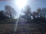
TheCaptain visited on 17th Oct 2021 - their rating: Cond: 3 Amb: 3 Access: 3 Walking with friends from Swyre head to Kimmeridge. Up to the ridge again after lunch, where I went down the other side to look for the Harp Stone before returning to the ridge to join with the others who had waited. I was expecting to see the stone in the hedge at the far side of the field like the pictures on the portal, but no such luck, as the hedge was very overgrown. At first I found a tree stump, then a shiny pile of bracken but no sign of the stone. Up and down the hedge a couple of times, but before I gave up I got the gps out and the detailed OS map, giving me the best info I could have to find the stone. Eventually I saw it in the hedge, all overgrown and hiding behing a couple of vicious blackthorn bushes, which made me bleed as I was trying to get a picture of the stone between them. Only the top few feet of it could be seen, but it was still there. I had a very satisfied walk back across the field and up to the ridge to meet the others I was out walking with before returning to Swyre Head.

JimChampion have visited here

The Harp Stone
The Harp Stone submitted by JimChampion : The Harp Stone stands on a bank that divided the medieval manorial estates of Herpston and Hyde. On the far side of the stone is a hollow way, an old route down the hill from Kimmeridge that eventually led to Creech on the far side of the chalk ridge. (Vote or comment on this photo)
This Scheduled Monument stands at the eastern edge of a field to the north of Kimmeridge in Dorset. There is a public footpath through this field, but the stone is in the hedge at the opposite side.

The stone is over 7' high with a maximum width of about 3' and cut by long vertical grooves. The tip of the stone has been lost and the appearance indicates this was relatively recently. A photograph taken early last century shows the stone intact.

The stone is situated on a natural river bank which formed the boundary between the medieval manorial estates of Herpston and Hyde. The stone is also next to the course of a former road linking the settlements of Creech and Kimmeridge.
You may be viewing yesterday's version of this page. To see the most up to date information please register for a free account.


The Harp Stone
The Harp Stone submitted by JimChampion : The Harp Stone is in the hedge in the foreground, on the far side of the field. In the distance the keep of Corfe Castle dominates the gap in the chalk ridge of the Purbeck Hills. (2 comments - Vote or comment on this photo)

The Harp Stone
The Harp Stone submitted by enkidu41 : SY 922805 A 7' high x 3' wide standing stone. This shot shows the damage to the top of the stone which has occurred relatively recently. (Vote or comment on this photo)

The Harp Stone
The Harp Stone submitted by JimChampion : A low angle view of the west side of the Harp Stone. (Vote or comment on this photo)

The Harp Stone
The Harp Stone submitted by Bladup : The Harp Stone in dappled sunlight (Vote or comment on this photo)

The Harp Stone
The Harp Stone submitted by Bladup : The Harp Stone, Looking rather phallic from the side (Vote or comment on this photo)

The Harp Stone
The Harp Stone submitted by Bladup : The Harp Stone, Crevice

The Harp Stone
The Harp Stone submitted by Bladup : The Harp Stone, The top of this sadly very overgrown wonderful Standing Stone

The Harp Stone
The Harp Stone submitted by Bladup : The Harp Stone, Like TheCaptain says in his photo the site is now totally overgrown and the stone not visible, This is what it looked like after i found the stone and we'd cleared the way to it (a bit)

The Harp Stone
The Harp Stone submitted by Bladup : The Harp Stone, Someone had tied a bit of green cloth on a eroded cave like bit on the backside of the stone, It must have been there awhile because the stone was totally overgrown when we got there

The Harp Stone
The Harp Stone submitted by Bladup : The Harp Stone, I got here at last, 22 years after first intending to, Life's a funny old thing!

The Harp Stone
The Harp Stone submitted by ArchieRob : Another front view of the Harp Stone, facing west.

The Harp Stone
The Harp Stone submitted by ArchieRob : Front view of the Harp Stone, facing west.

The Harp Stone
The Harp Stone submitted by TheCaptain : The Harp stone in October 2021. I had hoped it was going to be easy to see in the hedge at the far side of the field like the pictures on the portal, but no such luck, as the hedge was very overgrown. At first I found a tree stump, then a shiny pile of bracken but no sign of the stone. Up and down the hedge a couple of times, but before I gave up I got the gps out and the detailed OS map, gi... (3 comments)

The Harp Stone
The Harp Stone submitted by JimChampion : The Harp Stone, without the three strands of barbed wire getting in the way. This is a composite image from two photographs, taken from very close up (so there's a little distortion). That's my shadow at the bottom left. (2 comments)

The Harp Stone
The Harp Stone submitted by JimChampion : The west side of the Harp Stone, now living in a hedge on the eastern side of a field and behind barbed wire.

The Harp Stone
The Harp Stone submitted by JimChampion : The western side of the Harp Stone. The top of the stone has been damaged - in the 18th century it was recorded as being 9 feet tall, now it is just over 7 feet tall.

The Harp Stone
The Harp Stone submitted by JimChampion : The Harp Stone in its modern context. The Corfe River (or Steeple Brook) winds its way along in the valley bottom to the left of the hedge on the left. A hollow way runs down the hillside, behind the Harp Stone; part of an old track from Steeple to Kimmeridge.

The Harp Stone
The Harp Stone submitted by enkidu41 : SY 922805 A 7' high x 3' wide standing stone.

Do not use the above information on other web sites or publications without permission of the contributor.
Click here to see more info for this site

Nearby sites

Click here to view sites on an interactive OS map

Key: Red: member's photo, Blue: 3rd party photo, Yellow: other image, Green: no photo - please go there and take one, Grey: site destroyed

Download sites to:
KML (Google Earth)
GPX (GPS waypoints)
CSV (Garmin/Navman)
CSV (Excel)

To unlock full downloads you need to sign up as a Contributory Member. Otherwise downloads are limited to 50 sites.


Turn off the page maps and other distractions

Nearby sites listing. In the following links * = Image available
 2.5km SSE 150° Swyre Head* Round Barrow(s) (SY93417845)
 2.9km NE 51° Knowle Hill Cross Dyke* Misc. Earthwork (SY94398237)
 3.0km NE 54° Knowle Hill Barrows* Round Barrow(s) (SY94578233)
 3.5km NNW 334° Grange Heath Bell Barrow Round Barrow(s) (SY90658374)
 3.8km ENE 61° Corfe Castle West Hill barrows* Round Barrow(s) (SY95478237)
 3.9km E 85° Corfe Common* Barrow Cemetery (SY961809)
 4.0km N 355° Creech Bottom Standing Stones (SY918846)
 4.2km ENE 65° Corfe Castle & St. Edward the Martyr's Well* Holy Well or Sacred Spring (SY9595082317)
 4.2km N 349° Three Lord's Round Barrow(s) (SY914847)
 4.2km NNE 24° Three Barrows (Furzebrook)* Barrow Cemetery (SY939844)
 4.6km ENE 67° Corfe Castle East Hill barrows* Round Barrow(s) (SY96388237)
 5.0km ESE 111° Afflington Barrow* Round Barrow(s) (SY96867880)
 5.2km W 275° Lulworth stone circle Stone Circle (SY870810)
 5.4km NW 310° Povington Heath Barrows Barrow Cemetery (SY880841)
 5.5km W 277° Boat Knoll* Round Barrow(s) (SY867813)
 5.7km WNW 281° Ferny Barrows* Round Barrow(s) (SY866817)
 5.8km W 270° Flower's Barrow* Hillfort (SY86388056)
 5.8km WNW 282° Water Barrows Round Barrow(s) (SY865818)
 5.9km W 278° East Lulworth* Barrow Cemetery (SY863814)
 6.6km N 3° Lady St Mary (Wareham)* Ancient Cross (SY92498719)
 7.1km NNW 343° Wareham Barrows Barrow Cemetery (SY90128737)
 7.1km N 0° Wareham Walls* Misc. Earthwork (SY92218771)
 7.2km WNW 302° Coombe Beacon Barrow Cemetery (SY860844)
 7.4km E 82° Nine Barrow Down* Barrow Cemetery (SY995816)
 7.4km ENE 78° Rempstone* Stone Circle (SY99468208)
View more nearby sites and additional images

<< Woolsbarrow

Aber Rhaeadr >>

Please add your thoughts on this site

Prehistoric Dorset

Prehistoric Dorset

Sponsors

Auto-Translation (Google)

Translate from English into:

"The Harp Stone" | Login/Create an Account | 4 News and Comments
  
Go back to top of page    Comments are owned by the poster. We aren't responsible for their content.
Re: The Harp Stone by Anonymous on Monday, 04 January 2021
is there any public access to the Harp Stone? The OS map shows no right of way nearby
[ Reply to This ]

Re: Harpstone by Anonymous on Monday, 07 January 2008
I visited this stone on 5 January 2008. does anyone know why it is called 'harp' stone
[ Reply to This ]
    Re: Harpstone by JimChampion on Tuesday, 15 April 2008
    (User Info | Send a Message)
    The area was a manor called 'Herpere' when it was recorded in the Domesday Book. The modern name for the area (the coppice to the south and a dwelling to the east) is Hurpston, perhaps the name is descended from the 'Herpere Stone'. The stone stands on the bank which divides Harpstone from Hide.

    The following is an extract from the third edition of “The History and Antiquities of the County of Dorset” by John HUTCHINS, edited by W. SHIPP & J. W. HODSON, published by J. B. Nichols & Sons, Westminster, 1860-74, transcribed and donated to the Dorset OPC Project by Kim Parker [link to source]:

    In the bank which divides Harpstone from Hide is a remarkable stone placed at right angles to its natural bed, and rising 9 ft. above the ground. Its greatest width is 2 ft. 6 in. It retains its natural form, except that it is much honeycombed by the weather, and is probably of great antiquity, though with what object it was placed on this spot it is now impossible to determine. Large stones as well as barrows and springs were often objects of special notice in very early times, and this stone may perhaps have derived its distinctive appellation from its locality. Thus the Herpere stone or Harpine stone may easily, in common parlance, have become Herpestone or Harpestone, and then the name, when once established, may in time have modified the original denomination of the adjacent lands. It seems pretty certain, however, that Harpstone is the Herpere of Domesday.
    [ Reply to This ]

Re: Harpstone by enkidu41 on Monday, 19 July 2004
(User Info | Send a Message)
Condition:4
Ambience:3
Access:5
This Scheduled Monument stands at the edge of a field through which passes a public footpath. It is cut by long vertical grooves and is over 7' high with a maximum width of about 3'. The tip of the stone has been lost and the appearance indicates this was relatively recently. A photograph taken early last century shows the stone intact.
[ Reply to This ]

Your Name: Anonymous [ Register Now ]
Subject:


Add your comment or contribution to this page. Spam or offensive posts are deleted immediately, don't even bother

<<< What is five plus one as a number? (Please type the answer to this question in the little box on the left)
You can also embed videos and other things. For Youtube please copy and paste the 'embed code'.
For Google Street View please include Street View in the text.
Create a web link like this: <a href="https://www.megalithic.co.uk">This is a link</a>  

Allowed HTML is:
<p> <b> <i> <a> <img> <em> <br> <strong> <blockquote> <tt> <li> <ol> <ul> <object> <param> <embed> <iframe>

We would like to know more about this location. Please feel free to add a brief description and any relevant information in your own language.
Wir möchten mehr über diese Stätte erfahren. Bitte zögern Sie nicht, eine kurze Beschreibung und relevante Informationen in Deutsch hinzuzufügen.
Nous aimerions en savoir encore un peu sur les lieux. S'il vous plaît n'hesitez pas à ajouter une courte description et tous les renseignements pertinents dans votre propre langue.
Quisieramos informarnos un poco más de las lugares. No dude en añadir una breve descripción y otros datos relevantes en su propio idioma.