


<< Our Photo Pages >> Lower Colgarth Hill Tumulus - Round Barrow(s) in England in Yorkshire (North)
Submitted by Sunny100 on Thursday, 29 September 2016 Page Views: 2789
Neolithic and Bronze AgeSite Name: Lower Colgarth Hill Tumulus Alternative Name: Lower Colgarth Hill Burial MoundCountry: England
NOTE: This site is 1.6 km away from the location you searched for.
County: Yorkshire (North) Type: Round Barrow(s)
Nearest Town: Skipton Nearest Village: Bell Busk
Map Ref: SD9048157360
Latitude: 54.012165N Longitude: 2.146747W
Condition:
| 5 | Perfect |
| 4 | Almost Perfect |
| 3 | Reasonable but with some damage |
| 2 | Ruined but still recognisable as an ancient site |
| 1 | Pretty much destroyed, possibly visible as crop marks |
| 0 | No data. |
| -1 | Completely destroyed |
| 5 | Superb |
| 4 | Good |
| 3 | Ordinary |
| 2 | Not Good |
| 1 | Awful |
| 0 | No data. |
| 5 | Can be driven to, probably with disabled access |
| 4 | Short walk on a footpath |
| 3 | Requiring a bit more of a walk |
| 2 | A long walk |
| 1 | In the middle of nowhere, a nightmare to find |
| 0 | No data. |
| 5 | co-ordinates taken by GPS or official recorded co-ordinates |
| 4 | co-ordinates scaled from a detailed map |
| 3 | co-ordinates scaled from a bad map |
| 2 | co-ordinates of the nearest village |
| 1 | co-ordinates of the nearest town |
| 0 | no data |
Internal Links:
External Links:
")
The burial mound (tumulus) here at the foot of Lower Colgarth Hill is rather oddly-shaped, especially at its SW side, where it may have been dug into at some point in the past, although originally it was almost certainly bowl-shaped or bowl barrow-shaped; at a distance it has the look of a long barrow because of this. It measures roughly 11m (36 ft) long and 5.6m (18 ft) wide and is about 5 feet high. This was probably the place where a chieftain or a high-ranking individual of a local tribe was buried – either in the late Neolithic or the Bronze Age. Maybe more than one individual was buried in the mound and, or, quite possibly other members of the chieftain’s family.
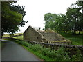
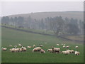
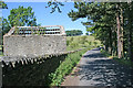
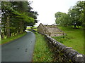
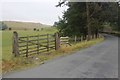
The grassy tumulus is in a field close to a footpath which runs up from the country lane (Carseylands Hill Road), close to a ruined barn called Allamire Laithe. The village of Bell Busk is about half a mile to the south. The river Aire can be seen over to the east. Just opposite the mound, in the wall opening, there is an odd-looking boulder. You will also notice that there are ancient cultivation terraces in this field, and in others close by.
This monument is scheduled as Historic England List ID 1010541 and recorded as Pastscape Monument No. 46432.
The Journal of Antiquities also includes an entry for the Lower Colgarth Hill Burial Mound, Near Bell Busk, North Yorkshire, which includes photographs, directions for finding this site, a description and a list of reference sources for more information.
You may be viewing yesterday's version of this page. To see the most up to date information please register for a free account.
")
")
Do not use the above information on other web sites or publications without permission of the contributor.
Nearby Images from Geograph Britain and Ireland:
©2012(licence)
©2007(licence)
©2006(licence)
©2010(licence)
©2018(licence)
The above images may not be of the site on this page, they are loaded from Geograph.
Please Submit an Image of this site or go out and take one for us!
Click here to see more info for this site
Nearby sites
Key: Red: member's photo, Blue: 3rd party photo, Yellow: other image, Green: no photo - please go there and take one, Grey: site destroyed
Download sites to:
KML (Google Earth)
GPX (GPS waypoints)
CSV (Garmin/Navman)
CSV (Excel)
To unlock full downloads you need to sign up as a Contributory Member. Otherwise downloads are limited to 50 sites.
Turn off the page maps and other distractions
Nearby sites listing. In the following links * = Image available
2.6km E 98° St Helen's Well (Eshton)* Holy Well or Sacred Spring (SD9309656992)
2.9km SW 220° Steeling Hill Enclosure Ancient Village or Settlement (SD8859255148)
4.2km SE 141° Roman Ford (Gargrave)* Ancient Trackway (SD9316354086)
4.4km SE 142° St Andrew (Gargrave)* Ancient Cross (SD93205391)
4.4km SE 144° The Garris* Ancient Village or Settlement (SD9306153776)
5.2km SE 138° Kirk Sink (Gargrave) Ancient Village or Settlement (SD9396753517)
5.5km SW 224° Cobers Laithe Camp (Nappa)* Misc. Earthwork (SD86695340)
6.0km ESE 105° Rough Haw (Flasby) Hillfort (SD963558)
6.1km N 0° Malham settlements and field systems* Ancient Village or Settlement (SD905635)
6.6km E 94° Scale House (Rylstone) Cairn (SD9708856870)
6.7km S 177° St Peter (East Marton)* Ancient Cross (SD9080750694)
6.7km ESE 116° Skyrakes West (Stirton) Rock Art (SD965544)
6.9km ENE 78° St Peter's Church (Rylstone) Ancient Cross (SD972588)
7.0km NNW 346° Jorden Scar* Ancient Village or Settlement (SD88776419)
7.1km ENE 74° Rylstone and Cracoe Plague Stone* Ancient Cross (SD973593)
7.2km NW 326° Rye Loaf Hill (Settle) Cairn (SD8641963309)
7.4km N 351° Ing Scar* Ancient Village or Settlement (SD8931964626)
7.4km NNW 343° Ewe Moor* Ring Cairn (SD88326445)
7.4km SE 143° Broughton Circle Stone Circle (SD9490551404)
7.5km E 98° Nettlehole Ridge* Stone Circle (SD97945634)
7.6km N 351° Comb Scar* Ancient Village or Settlement (SD89366485)
8.0km N 355° Torlery Edge (Malham Moor) Ancient Village or Settlement (SD8978465292)
8.0km N 1° Seaty Hill (Malham Moor) Cairn (SD9069265390)
8.3km E 99° Fairies Chest (Embsay Moor)* Natural Stone / Erratic / Other Natural Feature (SD9869656105)
8.9km SE 131° Niffany stone* Standing Stone (Menhir) (SD97155145)
View more nearby sites and additional images


 We would like to know more about this location. Please feel free to add a brief description and any relevant information in your own language.
 Wir möchten mehr über diese Stätte erfahren. Bitte zögern Sie nicht, eine kurze Beschreibung und relevante Informationen in Deutsch hinzuzufügen.
 Nous aimerions en savoir encore un peu sur les lieux. S'il vous plaît n'hesitez pas à ajouter une courte description et tous les renseignements pertinents dans votre propre langue.
 Quisieramos informarnos un poco más de las lugares. No dude en añadir una breve descripción y otros datos relevantes en su propio idioma.