<< Our Photo Pages >> Wool Road Sarsen Stone - Standing Stone (Menhir) in England in Dorset
Submitted by traveller on Monday, 20 September 2004 Page Views: 9443
Neolithic and Bronze AgeSite Name: Wool Road Sarsen StoneCountry: England
NOTE: This site is 1.2 km away from the location you searched for.
County: Dorset Type: Standing Stone (Menhir)
Nearest Town: Wareham Nearest Village: Bere Regis
Map Ref: SY8467394244 Landranger Map Number: 194
Latitude: 50.747594N Longitude: 2.21861W
Condition:
| 5 | Perfect |
| 4 | Almost Perfect |
| 3 | Reasonable but with some damage |
| 2 | Ruined but still recognisable as an ancient site |
| 1 | Pretty much destroyed, possibly visible as crop marks |
| 0 | No data. |
| -1 | Completely destroyed |
| 5 | Superb |
| 4 | Good |
| 3 | Ordinary |
| 2 | Not Good |
| 1 | Awful |
| 0 | No data. |
| 5 | Can be driven to, probably with disabled access |
| 4 | Short walk on a footpath |
| 3 | Requiring a bit more of a walk |
| 2 | A long walk |
| 1 | In the middle of nowhere, a nightmare to find |
| 0 | No data. |
| 5 | co-ordinates taken by GPS or official recorded co-ordinates |
| 4 | co-ordinates scaled from a detailed map |
| 3 | co-ordinates scaled from a bad map |
| 2 | co-ordinates of the nearest village |
| 1 | co-ordinates of the nearest town |
| 0 | no data |
Internal Links:
External Links:
")
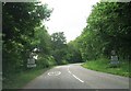
Bere Regis Sarsen is situated just by Wool Rd, at SY847943, lying on a small bank outside Bere Regis County School. It is triangular in shape, and approx 4.5ft x 5ft appearing to be limestone/quartzite. It is possibly a marker.
You may be viewing yesterday's version of this page. To see the most up to date information please register for a free account.
Do not use the above information on other web sites or publications without permission of the contributor.
coldrum has found this location on Google Street View:
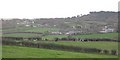
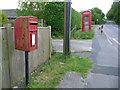
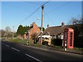
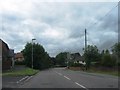
Nearby Images from Geograph Britain and Ireland:
©2009(licence)
©2013(licence)
©2008(licence)
©2012(licence)
©2012(licence)
The above images may not be of the site on this page, they are loaded from Geograph.
Please Submit an Image of this site or go out and take one for us!
Click here to see more info for this site
Nearby sites
Key: Red: member's photo, Blue: 3rd party photo, Yellow: other image, Green: no photo - please go there and take one, Grey: site destroyed
Download sites to:
KML (Google Earth)
GPX (GPS waypoints)
CSV (Garmin/Navman)
CSV (Excel)
To unlock full downloads you need to sign up as a Contributory Member. Otherwise downloads are limited to 50 sites.
Turn off the page maps and other distractions
Nearby sites listing. In the following links * = Image available
981m W 261° Devil's Stone (Dorset)* Standing Stone (Menhir) (SY837941)
1.1km ENE 59° Woodbury Hill (Dorset)* Hillfort (SY856948)
3.2km NW 322° Milborne St Andrew 1 Round Barrow(s) (SY827968)
3.5km NNW 331° Milborne St Andrew 2 Round Barrow(s) (SY830973)
3.8km NNE 25° Winterborne Kingston Standing Stone (Menhir) (SY863977)
4.4km WNW 296° Weatherby Castle* Hillfort (SY807962)
4.9km ESE 111° Woolsbarrow* Hillfort (SY893925)
5.5km NNW 331° Deverel Barrow* Round Barrow(s) (SY820990)
7.9km N 3° Combs Ditch Ancient Village or Settlement (ST851021)
8.5km S 179° Woodman's Cross* Barrow Cemetery (SY84838573)
8.8km SE 142° Wareham Barrows Barrow Cemetery (SY90128737)
8.9km SSW 207° Blacknoll Hill* Barrow Cemetery (SY80638630)
9.9km S 172° Coombe Beacon Barrow Cemetery (SY860844)
10.0km SE 131° Wareham Walls* Misc. Earthwork (SY92218771)
10.3km NE 41° Spettisbury Rings* Hillfort (ST914020)
10.5km SE 132° Lady St Mary (Wareham)* Ancient Cross (SY92498719)
10.7km SSE 162° Povington Heath Barrows Barrow Cemetery (SY880841)
11.4km WSW 258° Rainbarrows* Round Barrow(s) (SY735920)
11.4km NE 49° Shapwick Round Barrow(s) (ST9336301635)
11.5km SSW 209° Five Marys* Barrow Cemetery (SY790842)
11.6km NW 310° Giant's Grave Sarsen Stone* Standing Stone (Menhir) (ST757017)
11.7km SE 145° Three Lord's Round Barrow(s) (SY914847)
11.8km WSW 255° Heedless William's Stone* Standing Stone (Menhir) (SY732913)
12.0km WNW 296° Cheselbourne Round Barrow(s) (SY739995)
12.0km SE 143° Creech Bottom Standing Stones (SY918846)
View more nearby sites and additional images


 We would like to know more about this location. Please feel free to add a brief description and any relevant information in your own language.
 Wir möchten mehr über diese Stätte erfahren. Bitte zögern Sie nicht, eine kurze Beschreibung und relevante Informationen in Deutsch hinzuzufügen.
 Nous aimerions en savoir encore un peu sur les lieux. S'il vous plaît n'hesitez pas à ajouter une courte description et tous les renseignements pertinents dans votre propre langue.
 Quisieramos informarnos un poco más de las lugares. No dude en añadir una breve descripción y otros datos relevantes en su propio idioma.