

<< Our Photo Pages >> Parkwood Farm - Round Barrow(s) in England in Gloucestershire
Submitted by 4clydesdale7 on Friday, 01 July 2011 Page Views: 4433
Neolithic and Bronze AgeSite Name: Parkwood FarmCountry: England County: Gloucestershire Type: Round Barrow(s)
Nearest Village: Leighterton
Map Ref: ST822897
Latitude: 51.605851N Longitude: 2.258421W
Condition:
| 5 | Perfect |
| 4 | Almost Perfect |
| 3 | Reasonable but with some damage |
| 2 | Ruined but still recognisable as an ancient site |
| 1 | Pretty much destroyed, possibly visible as crop marks |
| 0 | No data. |
| -1 | Completely destroyed |
| 5 | Superb |
| 4 | Good |
| 3 | Ordinary |
| 2 | Not Good |
| 1 | Awful |
| 0 | No data. |
| 5 | Can be driven to, probably with disabled access |
| 4 | Short walk on a footpath |
| 3 | Requiring a bit more of a walk |
| 2 | A long walk |
| 1 | In the middle of nowhere, a nightmare to find |
| 0 | No data. |
| 5 | co-ordinates taken by GPS or official recorded co-ordinates |
| 4 | co-ordinates scaled from a detailed map |
| 3 | co-ordinates scaled from a bad map |
| 2 | co-ordinates of the nearest village |
| 1 | co-ordinates of the nearest town |
| 0 | no data |
Internal Links:
External Links:
I have visited· I would like to visit
MegalithicChaton would like to visit
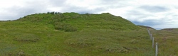
4clydesdale7 visited on 30th Jun 2011 - their rating: Cond: 2 Amb: 4 Access: 4 This came as a surprise when approaching Leighterton from the S late on a sunny summer's evening
")
Access may be difficult due to the fact the site is on land forming part of the Whitley Stud.
You may be viewing yesterday's version of this page. To see the most up to date information please register for a free account.
Do not use the above information on other web sites or publications without permission of the contributor.
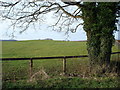
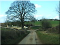
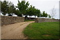
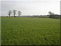
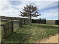
Nearby Images from Geograph Britain and Ireland:
©2006(licence)
©2012(licence)
©2016(licence)
©2006(licence)
©2021(licence)
The above images may not be of the site on this page, they are loaded from Geograph.
Please Submit an Image of this site or go out and take one for us!
Click here to see more info for this site
Nearby sites
Key: Red: member's photo, Blue: 3rd party photo, Yellow: other image, Green: no photo - please go there and take one, Grey: site destroyed
Download sites to:
KML (Google Earth)
GPX (GPS waypoints)
CSV (Garmin/Navman)
CSV (Excel)
To unlock full downloads you need to sign up as a Contributory Member. Otherwise downloads are limited to 50 sites.
Turn off the page maps and other distractions
Nearby sites listing. In the following links * = Image available
1.6km N 350° Leighterton Long Barrow* Long Barrow (ST81929131)
2.0km WSW 259° Nan Tow's Tump* Round Barrow(s) (ST80288932)
2.2km S 179° St Lawrences Well* Holy Well or Sacred Spring (ST82258749)
2.2km S 179° Didmarton Cross* Ancient Cross (ST8223887460)
2.5km SW 216° Tump Barn Round Barrow* Round Barrow(s) (ST80758770)
2.7km N 353° Boxwell Lodge* Chambered Tomb (ST819924)
3.0km NNW 348° St. Mary's Well (Boxwell)* Holy Well or Sacred Spring (ST816926)
3.0km WSW 239° Upper Kilcott Round Barrow* Round Barrow(s) (ST79638819)
3.3km WSW 237° Starveall* Chambered Tomb (ST79408792)
3.3km NE 45° Bowldownwood Round Barrows* Round Barrow(s) (ST84569205)
4.1km NNW 346° Brock Hill* Round Barrow(s) (ST8121093630)
4.1km NNE 25° Beverston Barrow 1* Round Barrow(s) (ST83949344)
5.1km NNW 348° Kingscote Standing Stones* Standing Stones (ST81189467)
5.3km SSE 160° Hancock's Well Holy Well or Sacred Spring (ST8403684687)
5.7km E 80° Tetbury Upton 3* Round Barrow(s) (ST87809070)
5.9km NW 307° Blackquarries Hill* Chambered Tomb (ST77529323)
5.9km WSW 245° Hawkesbury Knoll* Long Barrow (ST76838722)
6.1km WSW 243° Hawkesbury Well Holy Well or Sacred Spring (ST7677586931)
6.6km NE 46° Beverston Barrow 2* Round Barrow(s) (ST86969433)
6.7km S 182° Giant's Caves* Chambered Cairn (ST81998297)
6.8km NNW 338° Symonds Hall Farm* Long Barrow (ST79719599)
6.9km S 181° Luckington II* Chambered Tomb (ST82108284)
6.9km NE 44° Beverston Barrow 4* Round Barrow(s) (ST87069460)
7.4km NNW 333° Wotton Under Edge Cursus Cursus (ST789963)
7.5km SSW 211° Grickstone Farm* Chambered Tomb (ST78278327)
View more nearby sites and additional images


 We would like to know more about this location. Please feel free to add a brief description and any relevant information in your own language.
 Wir möchten mehr über diese Stätte erfahren. Bitte zögern Sie nicht, eine kurze Beschreibung und relevante Informationen in Deutsch hinzuzufügen.
 Nous aimerions en savoir encore un peu sur les lieux. S'il vous plaît n'hesitez pas à ajouter une courte description et tous les renseignements pertinents dans votre propre langue.
 Quisieramos informarnos un poco más de las lugares. No dude en añadir una breve descripción y otros datos relevantes en su propio idioma.