<< Our Photo Pages >> Jug's Grave - Round Barrow(s) in England in Wiltshire
Submitted by 4clydesdale7 on Thursday, 16 July 2015 Page Views: 9577
Neolithic and Bronze AgeSite Name: Jug's Grave Alternative Name: Jug's BarrowCountry: England County: Wiltshire Type: Round Barrow(s)
Nearest Town: Bradford-on-Avon Nearest Village: Monkton Farleigh
Map Ref: ST79696305
Latitude: 51.366146N Longitude: 2.293123W
Condition:
| 5 | Perfect |
| 4 | Almost Perfect |
| 3 | Reasonable but with some damage |
| 2 | Ruined but still recognisable as an ancient site |
| 1 | Pretty much destroyed, possibly visible as crop marks |
| 0 | No data. |
| -1 | Completely destroyed |
| 5 | Superb |
| 4 | Good |
| 3 | Ordinary |
| 2 | Not Good |
| 1 | Awful |
| 0 | No data. |
| 5 | Can be driven to, probably with disabled access |
| 4 | Short walk on a footpath |
| 3 | Requiring a bit more of a walk |
| 2 | A long walk |
| 1 | In the middle of nowhere, a nightmare to find |
| 0 | No data. |
| 5 | co-ordinates taken by GPS or official recorded co-ordinates |
| 4 | co-ordinates scaled from a detailed map |
| 3 | co-ordinates scaled from a bad map |
| 2 | co-ordinates of the nearest village |
| 1 | co-ordinates of the nearest town |
| 0 | no data |
Internal Links:
External Links:
I have visited· I would like to visit
4clydesdale7 visited on 15th Jul 2012 - their rating: Cond: 2 Amb: 3 Access: 4 Deep in dark woodland amidst several quarry workings
")
Guy Underwood also discovered the Conkwell Stone Circle upon which there is now very great doubt.
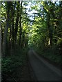
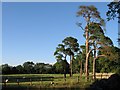
The barrow is not easy to find because it is seriously overgrown, lies deep in a very dark and wet wood (Inwood) and has been very badly mutilated - furthermore it is situated within an old stone quarry - with loads of debris and smaller cairns at hand - (ST79686308)
Mentioned in:- (a) pastscape; Wiltshire: Monkton Farleigh: 204149 (b) Victoria County History; Wiltshire; Vol 1; p184 - Grinsell and (c) Wiltshire Archaeological and Natural History Magazine 1947/8 Vol 51 p447 and Vol 52 p270 - Underwood
Pastscape says: An oval-shaped bowl barrow, known as Jug's Grave. It is 27 by 21 paces and 4 feet high. There are slight indications of a ditch on the south and west. Excavations by G. Underwood, 1946/7, revealed a primary interment of two skeletons in a stone cist accompanied by four EBA flint arrowheads, probable Beaker sherds, a gold 'sun disc' ornament and a fragment of bone ring. Four secondary inhumation-burials were found in the north part of the mound and other finds included a few flint flakes and scrapers and part of an hour-glass perforated stone mace. Three banks of the field system (ST 86 SW 1) impinge on the mound. Source: Pastscape
Note: An early Bronze Age sun-disc discovered in this barrow in Monkton Farleigh, Wiltshire has gone on display for the first time at Wiltshire Museum.
You may be viewing yesterday's version of this page. To see the most up to date information please register for a free account.
")
")
")
")
Do not use the above information on other web sites or publications without permission of the contributor.
Nearby Images from Geograph Britain and Ireland:
©2006(licence)
©2006(licence)

©2014(licence)
![ST7962 : Conkwell hamlet [6] by Michael Dibb](https://s2.geograph.org.uk/geophotos/07/36/69/7366998_2ab6a405_120x120.jpg)
©2022(licence)
![ST7962 : Conkwell hamlet [5] by Michael Dibb](https://s0.geograph.org.uk/geophotos/07/36/69/7366996_b95e5aed_120x120.jpg)
©2022(licence)
The above images may not be of the site on this page, they are loaded from Geograph.
Please Submit an Image of this site or go out and take one for us!
Click here to see more info for this site
Nearby sites
Key: Red: member's photo, Blue: 3rd party photo, Yellow: other image, Green: no photo - please go there and take one, Grey: site destroyed
Download sites to:
KML (Google Earth)
GPX (GPS waypoints)
CSV (Garmin/Navman)
CSV (Excel)
To unlock full downloads you need to sign up as a Contributory Member. Otherwise downloads are limited to 50 sites.
Turn off the page maps and other distractions
Nearby sites listing. In the following links * = Image available
346m SW 224° Conkwell stone circle* Stone Circle (ST79456280)
741m SW 232° Conkwell well* Holy Well or Sacred Spring (ST791626)
2.4km SW 224° Shingle Bell* Holy Well or Sacred Spring (ST780613)
2.4km SSE 162° Turleigh Trows* Holy Well or Sacred Spring (ST8044960725)
2.5km S 173° Winsley Chambered Tomb (ST800606)
2.7km NNE 14° Monk's Conduit (Monkton Farleigh)* Holy Well or Sacred Spring (ST8036265692)
3.0km NW 311° Bathampton Camp* Hillfort (ST77456502)
3.3km NW 311° Bathampton* Standing Stones (ST772652)
3.4km SE 131° Ladywell (Bradford on Avon)* Holy Well or Sacred Spring (ST823608)
3.5km SE 128° St Laurence's Church (Bradford on Avon)* Early Christian Sculptured Stone (ST8241960914)
3.6km WNW 301° Bathampton Round Barrow 2* Round Barrow(s) (ST76616489)
4.4km SW 220° Hill Farm Barrow (Somerset) Round Barrow(s) (ST76855969)
4.6km SSW 214° Beacon Barrow (Somerset) Round Barrow(s) (ST77095920)
4.7km NW 309° Kensington Meadows Holed Megalith Holed Stone
4.9km WNW 290° Sacred Spring, Bath* Holy Well or Sacred Spring (ST7505364726)
5.0km WNW 293° Bath Postal Museum* Museum (ST7504564998)
5.1km SW 224° The Giants Graves Cist (ST761594)
5.7km NNW 330° Solsbury Hill* Hillfort (ST76876797)
5.8km SW 232° Twinhoe* Stone Circle (ST75165949)
6.0km NNE 27° Becket's Well (Box) Holy Well or Sacred Spring (ST825684)
6.2km NNE 25° Box Rock Circus* Modern Stone Circle etc (ST823687)
6.5km NE 35° Hazelbury Manor Menhirs* Modern Stone Circle etc (ST83476830)
6.5km NW 311° St Mary's Well (Charlcombe)* Holy Well or Sacred Spring (ST748673)
7.0km N 359° Three Shires Stones* Modern Stone Circle etc (ST7961070021)
8.4km NNE 16° Colerne Cross.* Ancient Cross (ST820711)
View more nearby sites and additional images


 We would like to know more about this location. Please feel free to add a brief description and any relevant information in your own language.
 Wir möchten mehr über diese Stätte erfahren. Bitte zögern Sie nicht, eine kurze Beschreibung und relevante Informationen in Deutsch hinzuzufügen.
 Nous aimerions en savoir encore un peu sur les lieux. S'il vous plaît n'hesitez pas à ajouter une courte description et tous les renseignements pertinents dans votre propre langue.
 Quisieramos informarnos un poco más de las lugares. No dude en añadir una breve descripción y otros datos relevantes en su propio idioma.