<< Our Photo Pages >> Thirteen Stone Hill - Stone Circle in England in Lancashire
Submitted by aussteiger on Sunday, 23 February 2014 Page Views: 11420
Neolithic and Bronze AgeSite Name: Thirteen Stone HillCountry: England County: Lancashire Type: Stone Circle
Nearest Town: Blackburn Nearest Village: Haslingden
Map Ref: SD7665324273
Latitude: 53.714346N Longitude: 2.355224W
Condition:
| 5 | Perfect |
| 4 | Almost Perfect |
| 3 | Reasonable but with some damage |
| 2 | Ruined but still recognisable as an ancient site |
| 1 | Pretty much destroyed, possibly visible as crop marks |
| 0 | No data. |
| -1 | Completely destroyed |
| 5 | Superb |
| 4 | Good |
| 3 | Ordinary |
| 2 | Not Good |
| 1 | Awful |
| 0 | No data. |
| 5 | Can be driven to, probably with disabled access |
| 4 | Short walk on a footpath |
| 3 | Requiring a bit more of a walk |
| 2 | A long walk |
| 1 | In the middle of nowhere, a nightmare to find |
| 0 | No data. |
| 5 | co-ordinates taken by GPS or official recorded co-ordinates |
| 4 | co-ordinates scaled from a detailed map |
| 3 | co-ordinates scaled from a bad map |
| 2 | co-ordinates of the nearest village |
| 1 | co-ordinates of the nearest town |
| 0 | no data |
Be the first person to rate this site - see the 'Contribute!' box in the right hand menu.
Internal Links:
External Links:
")
Located on Oswaldtwistle Moor, the stone circle location is given by the 1972 survey by M K Eckersall & Alan Ormerod.
Co-ordinates are given from the North, clockwise:
1) 376658.789 424285.374
2) 376663.300 424281.872
3) 376666.268 424270.505
4) 376664.365 424265.294
5) 376653.323 424260.415
6) 376649.422 424260.018
7) 376645.894 424262.455
8) 376641.691 424267.250
9) 376640.415 424272.860
10) 376639.794 424277.069
11) 376641.610 424279.135
12) 376643.203 424281.758
13) 376650.609 424286.756
The circle has a diameter of 88ft./29 yds.
Pastscape monument no. 44453
You may be viewing yesterday's version of this page. To see the most up to date information please register for a free account.
")
")
Do not use the above information on other web sites or publications without permission of the contributor.
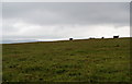
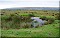
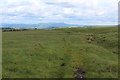
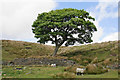
Nearby Images from Geograph Britain and Ireland:
©2010(licence)
©2010(licence)
©2019(licence)
©2020(licence)

©2020(licence)
The above images may not be of the site on this page, they are loaded from Geograph.
Please Submit an Image of this site or go out and take one for us!
Click here to see more info for this site
Nearby sites
Key: Red: member's photo, Blue: 3rd party photo, Yellow: other image, Green: no photo - please go there and take one, Grey: site destroyed
Download sites to:
KML (Google Earth)
GPX (GPS waypoints)
CSV (Garmin/Navman)
CSV (Excel)
To unlock full downloads you need to sign up as a Contributory Member. Otherwise downloads are limited to 50 sites.
Turn off the page maps and other distractions
Nearby sites listing. In the following links * = Image available
3.0km WNW 291° Cocker Cobb* Stone Circle (SD7385225360)
4.9km SSE 165° Robin Hood's Well, Haslingden* Holy Well or Sacred Spring (SD77861954)
4.9km NNE 31° May Hole Well (Hyndburn Moor)* Holy Well or Sacred Spring (SD7923528430)
7.8km SE 127° Waugh's Well (Edenfield) Holy Well or Sacred Spring (SD82871957)
7.8km WSW 243° White Hall* Round Barrow(s) (SD696208)
8.4km S 188° Carve Hill Low* Barrow Cemetery (SD755159)
8.9km SSE 154° Whitelow* Cairn (SD80501626)
9.5km S 178° Whippalow Hill* Barrow Cemetery (SD76921477)
9.5km S 183° Dodd Lee* Barrow Cemetery (SD76121476)
9.7km E 90° Broadclough Dykes, Bacup, Lancashire* Misc. Earthwork (SD864243)
9.8km SSW 210° Cheetham Close* Stone Circle (SD71631586)
10.3km E 96° Bacup Natural History Society Museum* Museum (SD869231)
10.5km WNW 298° Revidge Moor Barrow* Round Barrow(s) (SD674293)
10.6km W 265° Norman Arch over Well Holy Well or Sacred Spring (SD6606023393)
10.6km S 186° Affetside Cross (Lancashire) Ancient Cross (SD7546613689)
10.6km S 186° Affetside Cross (Bury)* Ancient Cross (SD7546613686)
10.7km NE 53° Foldys Cross (Towneley) Ancient Cross (SD85253065)
10.9km W 263° Tocca's Stone* Ancient Cross (SD65842302)
10.9km E 94° Wyrd of Stake Moss* Modern Stone Circle etc (SD876235)
11.1km WSW 247° Hollinshead Holy Well* Holy Well or Sacred Spring (SD66361994)
11.2km ENE 72° Thieveley (Holme Chapel) Cairn (SD873277)
11.2km WNW 299° Beardwood Holed Stone* Holed Stone (SD6684829793)
11.3km ESE 121° Hamer Hill* Stone Circle (SD863184)
11.4km N 349° Portfield* Hillfort (SD7458135499)
11.4km SE 144° Wind Hill Cheesden* Round Barrow(s) (SD8326214945)
View more nearby sites and additional images


 We would like to know more about this location. Please feel free to add a brief description and any relevant information in your own language.
 Wir möchten mehr über diese Stätte erfahren. Bitte zögern Sie nicht, eine kurze Beschreibung und relevante Informationen in Deutsch hinzuzufügen.
 Nous aimerions en savoir encore un peu sur les lieux. S'il vous plaît n'hesitez pas à ajouter une courte description et tous les renseignements pertinents dans votre propre langue.
 Quisieramos informarnos un poco más de las lugares. No dude en añadir una breve descripción y otros datos relevantes en su propio idioma.