<< Our Photo Pages >> Moor Beck Marker Stone - Marker Stone in England in Cumbria
Submitted by PaulUK72 on Tuesday, 30 November 2021 Page Views: 1042
Modern SitesSite Name: Moor Beck Marker StoneCountry: England
NOTE: This site is 6.786 km away from the location you searched for.
County: Cumbria Type: Marker Stone
Nearest Town: Penrith Nearest Village: Warcop
Map Ref: NY7490616292
Latitude: 54.541263N Longitude: 2.389376W
Condition:
| 5 | Perfect |
| 4 | Almost Perfect |
| 3 | Reasonable but with some damage |
| 2 | Ruined but still recognisable as an ancient site |
| 1 | Pretty much destroyed, possibly visible as crop marks |
| 0 | No data. |
| -1 | Completely destroyed |
| 5 | Superb |
| 4 | Good |
| 3 | Ordinary |
| 2 | Not Good |
| 1 | Awful |
| 0 | No data. |
| 5 | Can be driven to, probably with disabled access |
| 4 | Short walk on a footpath |
| 3 | Requiring a bit more of a walk |
| 2 | A long walk |
| 1 | In the middle of nowhere, a nightmare to find |
| 0 | No data. |
| 5 | co-ordinates taken by GPS or official recorded co-ordinates |
| 4 | co-ordinates scaled from a detailed map |
| 3 | co-ordinates scaled from a bad map |
| 2 | co-ordinates of the nearest village |
| 1 | co-ordinates of the nearest town |
| 0 | no data |
Internal Links:
External Links:
")
It has views of Long Fell & Burton Fell to the NE. Another possible small standing stone is located a few meters to the East in bushes next to the stream, Moor Beck. A tumulus is located less than a kilometre to the NW which like the stone is situated on the same side of the road.
You may be viewing yesterday's version of this page. To see the most up to date information please register for a free account.
")
")
Do not use the above information on other web sites or publications without permission of the contributor.
Nearby Images from Geograph Britain and Ireland:

©2025(licence)
©2017(licence)
©2012(licence)
©2018(licence)
©2008(licence)
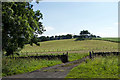
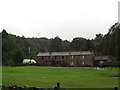
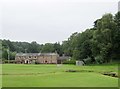
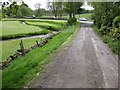
The above images may not be of the site on this page, they are loaded from Geograph.
Please Submit an Image of this site or go out and take one for us!
Click here to see more info for this site
Nearby sites
Key: Red: member's photo, Blue: 3rd party photo, Yellow: other image, Green: no photo - please go there and take one, Grey: site destroyed
Download sites to:
KML (Google Earth)
GPX (GPS waypoints)
CSV (Garmin/Navman)
CSV (Excel)
To unlock full downloads you need to sign up as a Contributory Member. Otherwise downloads are limited to 50 sites.
Turn off the page maps and other distractions
Nearby sites listing. In the following links * = Image available
7.4km WSW 246° St Helen's Well (Great Asby)* Holy Well or Sacred Spring (NY6817813278)
7.7km ESE 106° Leonard's Cragg Rock Art (NY823142)
7.8km WSW 239° Holborn Hill Ancient Village or Settlement (NY682123)
8.8km SSE 167° Croglam Castle Ancient Village or Settlement (NY768077)
8.8km SSE 165° The Loki Stone* Early Christian Sculptured Stone (NY77130774)
9.0km ESE 104° Dyke House Hillfort (NY837141)
9.3km SW 234° Asby Common Ancient Village or Settlement (NY673109)
9.6km SW 216° Little Asby Scar Round Cairn* Round Cairn (NY6920808493)
10.1km WSW 237° Ling Bank South Prehistoric Settlement/Enclosures* Ancient Village or Settlement (NY6639910793)
10.2km SW 230° Muddygill Plain, Great Asby Scar* Cairn (NY6704309747)
10.2km WSW 238° Ling Bank North Settlement/Enclosures* Ancient Village or Settlement (NY6616310906)
10.3km SSW 197° Crosby Garrett Ancient Village or Settlement (NY719064)
10.4km SSW 204° Bent's Hill Round Cairn* Round Cairn (NY7060206780)
10.5km SW 221° Howes Well ring cairn* Ring Cairn (NY6804908373)
10.7km WSW 244° Hollin Stump Cairn* Cairn (NY652117)
10.9km ENE 68° Lune Head* Stone Circle (NY85052039)
11.0km WSW 246° Gaythorne Plain Round Cairns* Cairn (NY64811193)
11.0km S 186° Rasett Hill* Round Cairn (NY73780531)
11.1km SW 229° Little Kinmond Cairn* Cairn (NY66540899)
11.1km SW 215° Raiset Pike* Long Barrow (NY68400725)
11.2km WNW 296° Lady Well (Bewley Castle) Holy Well or Sacred Spring (NY6485021260)
11.4km WSW 243° Gaythorn Plain* Ring Cairn (NY647112)
11.6km WSW 253° Raise Howe Cairn* Cairn (NY63711303)
11.8km SSW 200° St. Helen's Well (Newbiggin-on-Lune)* Holy Well or Sacred Spring (NY7079905268)
12.1km SW 235° Castle Folds* Ancient Village or Settlement (NY64990936)
View more nearby sites and additional images


 We would like to know more about this location. Please feel free to add a brief description and any relevant information in your own language.
 Wir möchten mehr über diese Stätte erfahren. Bitte zögern Sie nicht, eine kurze Beschreibung und relevante Informationen in Deutsch hinzuzufügen.
 Nous aimerions en savoir encore un peu sur les lieux. S'il vous plaît n'hesitez pas à ajouter une courte description et tous les renseignements pertinents dans votre propre langue.
 Quisieramos informarnos un poco más de las lugares. No dude en añadir una breve descripción y otros datos relevantes en su propio idioma.