<< Our Photo Pages >> Midshiels Standing Stone - Standing Stone (Menhir) in Scotland in Scottish Borders
Submitted by vicky on Sunday, 22 December 2002 Page Views: 8690
Neolithic and Bronze AgeSite Name: Midshiels Standing StoneCountry: Scotland County: Scottish Borders Type: Standing Stone (Menhir)
Nearest Town: Hawick Nearest Village: Midshiels
Map Ref: NT53391774 Landranger Map Number: 79
Latitude: 55.451289N Longitude: 2.738473W
Condition:
| 5 | Perfect |
| 4 | Almost Perfect |
| 3 | Reasonable but with some damage |
| 2 | Ruined but still recognisable as an ancient site |
| 1 | Pretty much destroyed, possibly visible as crop marks |
| 0 | No data. |
| -1 | Completely destroyed |
| 5 | Superb |
| 4 | Good |
| 3 | Ordinary |
| 2 | Not Good |
| 1 | Awful |
| 0 | No data. |
| 5 | Can be driven to, probably with disabled access |
| 4 | Short walk on a footpath |
| 3 | Requiring a bit more of a walk |
| 2 | A long walk |
| 1 | In the middle of nowhere, a nightmare to find |
| 0 | No data. |
| 5 | co-ordinates taken by GPS or official recorded co-ordinates |
| 4 | co-ordinates scaled from a detailed map |
| 3 | co-ordinates scaled from a bad map |
| 2 | co-ordinates of the nearest village |
| 1 | co-ordinates of the nearest town |
| 0 | no data |
Be the first person to rate this site - see the 'Contribute!' box in the right hand menu.
Internal Links:
External Links:
I have visited· I would like to visit
Anne T visited on 29th Aug 2018 - their rating: Cond: 3 Amb: 4 Access: 4 Midshiels Standing Stone, near Hawick: At our last visit, we were put off from entering the field because of a very large bull and his ladies. The bull stood guard near the stone, and any approach made him stand tall, with splayed legs, looking menacingly at us – I contented myself with taking photos from near the gate in the field.
At this visit we parked near the entrance to Midshiels farm, at NT 53459 17603, where we made sure we weren’t blocking the entrance into field. Immediately opposite, at NT 53461 17624 is a metal gate into the field, with the top of the stone just visible.
Husband, Andrew, opened the gate and was in the field, and I was just about to follow when a loud voice behind me stopped me going an further. There was a large, but friendly, farmer and his lad in a very large pickup truck. “There are bullocks in that field – if they see you, they’ll go for you. Drive into the next field and go up to the tunnel – you can turn round there. You can see the stone from there.” I thanked him for the ‘heads up’.
Andrew moved the car, but rather than drive the car up to the tunnel, the ground was a bit too uneven to risk the bottom of the car, so we left it at the edge of the field at NT 53518 17745 and walked to the gate near the tunnel at NT 53388 17830. From here, it looked as if all the cattle were at the far end of the field, with many of them lying down, although the hump in the middle of the field made it difficult to really see. We decided to take the chance and walk to the stone, as we could have got back to the gate quickly.
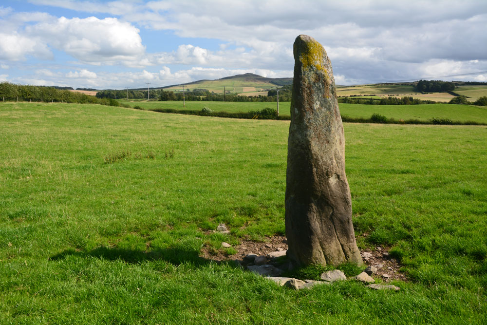
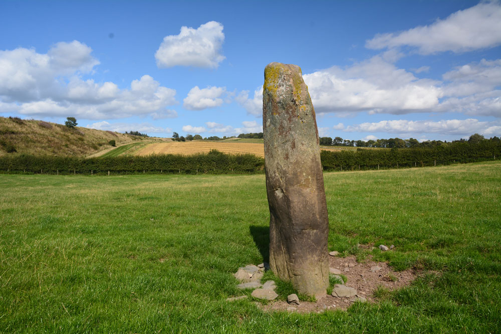
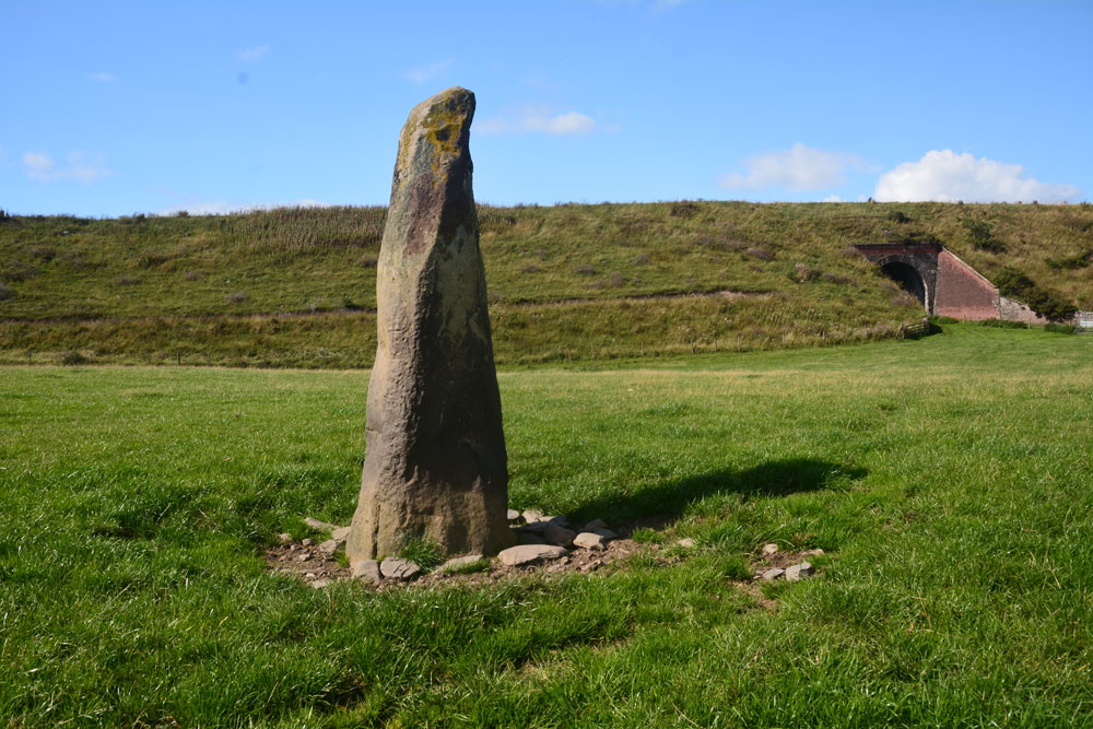
This stone was glorious in the sunshine, with a most peculiar small ‘hook’ to the top. I tried to capture the shadow in the strong sunshine.
Anne T visited on 3rd Jun 2017 - their rating: Cond: 3 Amb: 4 Access: 4 Midshiels Standing Stone, Hawick: We'd arrived (unknowingly) in Hawick on their Riding of the Marches day. The shops were shut and the town was almost deserted. Having visited some other sites on the southern side of Hawick, we decided to stop off to see this standing stone and cairn on the way back home. Following the curious one-way system though Hawick, we ended up on the Borders Abbey Way heading north-east out of the town. At Bucklands, we found where the entire town was - at a community centre at the edge of the town. A marshall stopped us and told us we wouldn't be able to get any further up the road as the procession of horses was coming through. Doubling back through the industrial estate, we took the A698 out of town, turning left over the picturesque Hornshole Bridge, rejoining Borders Abbey Way a few hundred yards before the entrance to Midshiels Farm.
A couple of hundred yards further north-east along the road, there was a large passing place, so we hugged the car into the hedgerow and hopped out. About 50 metres further back, on the other side of the road, a gate let us into the field leading to the dismantled railway embankment to the west. Following the left hand hedge-line along, we came to another gate, just before a tall brick bridge leading under the railway line. This gate gave access to the field with the standing stone and cairn.
However, the field was full of gently grazing sheep and lots of lively, curious bullocks along with what looked like a very large bull. My hand went onto the gate and they were running towards us. I elected to use the zoom lens on the camera, and was really disappointed not to have seen this standing stone closer up. But there is lots to see in this area, so undoubtedly a return visit will be in the offing at some point in the not too distant future.
Average ratings for this site from all visit loggers: Condition: 3 Ambience: 4 Access: 4
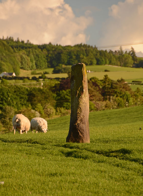
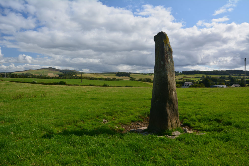
To be found in a field near the old (now dismantled) railway line, this standing stone is 90 yards to the north east of Midshiels Cairn. It stands over 7 feet tall, tapering slightly from the bottom to the top. Further information can be found on Canmore site no. 55254.
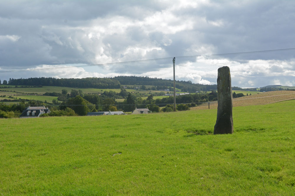
If driving to this stone along the A698 from Hawick, turn left over the picturesque Hornshole Bridge (or follow the Borders Abbey Way north east out of Hawick). Approximately 200 metres past the entrance to Midshiels Farm to your right hand side, there is a large passing place. Almost immediately opposite is the gate to a field at NT 53523 17740 and if you keep to the left hand hedge line, just before the bridge under the railway, is another gate which gives access to the field with the stone and the cairn. The stone is almost immediately underneath the telegraph wires.
You may be viewing yesterday's version of this page. To see the most up to date information please register for a free account.
Do not use the above information on other web sites or publications without permission of the contributor.
Click here to see more info for this site
Nearby sites
Key: Red: member's photo, Blue: 3rd party photo, Yellow: other image, Green: no photo - please go there and take one, Grey: site destroyed
Download sites to:
KML (Google Earth)
GPX (GPS waypoints)
CSV (Garmin/Navman)
CSV (Excel)
To unlock full downloads you need to sign up as a Contributory Member. Otherwise downloads are limited to 50 sites.
Turn off the page maps and other distractions
Nearby sites listing. In the following links * = Image available
89m WSW 243° Midshiels Cairn* Cairn (NT53311770)
2.2km SSE 161° Cavers Cross* Ancient Cross (NT54071564)
5.0km SW 223° Hawick Mote* Misc. Earthwork (NT4994314073)
5.1km ESE 115° Rubers Law* Hillfort (NT58031557)
6.1km E 88° Bedrule Sculptured Stone (NT59501793)
6.1km E 85° Fast Castle (Bedrule)* Misc. Earthwork (NT59531822)
6.5km E 88° Bedrule Parish Church* Sculptured Stone (NT5992217925)
6.6km SSE 148° Hawthornside Farm (Bonchester Bridge)* Holy Well or Sacred Spring (NT5678612089)
9.7km SSW 212° Lord's Tree (Hawick)* Cairn (NT48090957)
10.0km S 178° Stonedge Stone Circle (NT536077)
10.2km SSW 212° Ca Knowe (Hawick)* Cairn (NT4793409075)
10.3km WSW 249° Borthwick Mains Class I Pictish Symbol Stone (NT4372814111)
10.4km E 96° Gilliestongues Promontory Fort / Cliff Castle (NT63721659)
10.7km WSW 240° Whitcastle Hill* Hillfort (NT44101245)
10.9km WSW 238° Whitcastle Sike* Ancient Village or Settlement (NT44011207)
11.3km NE 50° Ancrum Old Church* Sculptured Stone (NT6215024885)
11.5km NE 51° Castle Hill (Ancrum)* Hillfort (NT6239424909)
11.6km NNW 331° Caulks Well (Selkirk)* Holy Well or Sacred Spring (NT4789127983)
11.9km NNW 329° Mungo's Well (Selkirk)* Holy Well or Sacred Spring (NT47342795)
11.9km ENE 77° Jedburgh Ancient Christian Stones* Ancient Cross (NT65052038)
12.0km ENE 77° Jedburgh Rock Art Rock Art (NT651204)
12.3km ENE 59° Harestanes (Ancrum) Stone Circle (NT640240)
12.4km ENE 59° Harestanes (Ancrum) Stone Circle (NT641240)
13.0km NE 50° Harrietsfield Standing Stone (Menhir) (NT63442599)
13.1km SE 129° Southdean Law* Hillfort (NT63500938)
View more nearby sites and additional images


 We would like to know more about this location. Please feel free to add a brief description and any relevant information in your own language.
 Wir möchten mehr über diese Stätte erfahren. Bitte zögern Sie nicht, eine kurze Beschreibung und relevante Informationen in Deutsch hinzuzufügen.
 Nous aimerions en savoir encore un peu sur les lieux. S'il vous plaît n'hesitez pas à ajouter une courte description et tous les renseignements pertinents dans votre propre langue.
 Quisieramos informarnos un poco más de las lugares. No dude en añadir una breve descripción y otros datos relevantes en su propio idioma.