<< Our Photo Pages >> Rotherwas Ribbon - Ancient Trackway in England in Herefordshire
Submitted by Andy B on Friday, 21 November 2008 Page Views: 63439
Neolithic and Bronze AgeSite Name: Rotherwas Ribbon Alternative Name: The Rotherwas SerpentCountry: England
NOTE: This site is 2.115 km away from the location you searched for.
County: Herefordshire Type: Ancient Trackway
Nearest Town: Hereford
Map Ref: SO52053690
Latitude: 52.028427N Longitude: 2.700303W
Condition:
| 5 | Perfect |
| 4 | Almost Perfect |
| 3 | Reasonable but with some damage |
| 2 | Ruined but still recognisable as an ancient site |
| 1 | Pretty much destroyed, possibly visible as crop marks |
| 0 | No data. |
| -1 | Completely destroyed |
| 5 | Superb |
| 4 | Good |
| 3 | Ordinary |
| 2 | Not Good |
| 1 | Awful |
| 0 | No data. |
| 5 | Can be driven to, probably with disabled access |
| 4 | Short walk on a footpath |
| 3 | Requiring a bit more of a walk |
| 2 | A long walk |
| 1 | In the middle of nowhere, a nightmare to find |
| 0 | No data. |
| 5 | co-ordinates taken by GPS or official recorded co-ordinates |
| 4 | co-ordinates scaled from a detailed map |
| 3 | co-ordinates scaled from a bad map |
| 2 | co-ordinates of the nearest village |
| 1 | co-ordinates of the nearest town |
| 0 | no data |
Internal Links:
External Links:
I have visited· I would like to visit
Northernchief would like to visit
")
Dated as being constructed during the Early Bronze Age (2,000BC), it runs broadly at right angles (north to south) to the new Rotherwas access road, being constructed by Alfred McAlpine to the south of Hereford City and which prompted the archaeological dig which uncovered the find.
The “Rotherwas Ribbon” comprises a series of linked opposing curves created by laid surfaces of deliberately fire-cracked stones (stones which have shattered after being heated by fire then dropped into water) unearthed from a ridge half a kilometre away.
The ribbon-shaped feature is not flat, but is three dimensional as it appears to have been deliberately sculpted to undulate throughout the 60 metres of its length which have so far been uncovered.
“While the practice of laying stones in small level ‘pavements’ close to standing stones is known from sites in Pembrokeshire and elsewhere, the closest parallel anywhere we can think of to the long sculpted form of this monument is the ‘Great Serpent Mound’ of the Hopewellian phase – 200BC to 400AD - of the Middle Woodland period in Ohio, USA,” said Herefordshire County Archaeologist Dr Keith Ray.
“This is a very exciting find not just for Herefordshire, and not just for the UK, but, apparently so far unique in Europe - it has international significance,” he added.
"We’re not sure what it was precisely built for – we can only speculate that it may have been used in some kind of ritual or ceremonial activity."
To ensure the “Rotherwas Ribbon” remains intact for future generations to explore, detailed plans have been drawn up to encase the find and preserve it within a protective structure beneath the new road,.
This work will begin early in July.
Source: 24dash
Note: Rotherwas Ribbon is dated to 2100 to 1900 BC, see latest comment.
You may be viewing yesterday's version of this page. To see the most up to date information please register for a free account.
")
")
Do not use the above information on other web sites or publications without permission of the contributor.
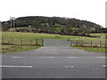
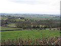
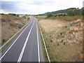
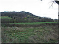
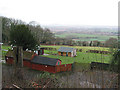
Nearby Images from Geograph Britain and Ireland:
©2009(licence)
©2007(licence)
©2011(licence)
©2007(licence)
©2007(licence)
The above images may not be of the site on this page, they are loaded from Geograph.
Please Submit an Image of this site or go out and take one for us!
Click here to see more info for this site
Nearby sites
Key: Red: member's photo, Blue: 3rd party photo, Yellow: other image, Green: no photo - please go there and take one, Grey: site destroyed
Download sites to:
KML (Google Earth)
GPX (GPS waypoints)
CSV (Garmin/Navman)
CSV (Excel)
To unlock full downloads you need to sign up as a Contributory Member. Otherwise downloads are limited to 50 sites.
Turn off the page maps and other distractions
Nearby sites listing. In the following links * = Image available
610m SE 145° Dinedor Camp* Hillfort (SO524364)
1.9km S 181° Holy Well (Dinedor)* Holy Well or Sacred Spring (SO52013501)
2.9km NNW 341° St Ethelbert's Well (Hereford)* Holy Well or Sacred Spring (SO5112239684)
3.1km NNW 337° The King's Ditch Natural Stone / Erratic / Other Natural Feature (SO50873974)
3.2km NNW 338° Hereford Museum and Art Gallery* Museum (SO5090039851)
3.6km SSW 193° St Ann's Well (Aconbury)* Holy Well or Sacred Spring (SO51173338)
4.1km SSW 203° Aconbury Hill* Hillfort (SO504331)
5.6km S 189° Higgin's Well* Holy Well or Sacred Spring (SO51163141)
5.9km ESE 106° Cherry Hill* Hillfort (SO577352)
6.9km ENE 73° Backbury* Hillfort (SO587389)
7.1km WNW 289° Eaton Camp* Promontory Fort / Cliff Castle (SO454393)
7.1km N 7° The Wergin's Stone* Standing Stone (Menhir) (SO5297543981)
8.3km ESE 118° Capler Camp* Hillfort (SO593329)
8.4km NW 309° Holy Well (Garway)* Holy Well or Sacred Spring (SO45554224)
9.1km ENE 65° St Edith's Well (Herefordshire)* Holy Well or Sacred Spring (SO604406)
9.5km N 2° Sutton Walls* Hillfort (SO525464)
9.6km WNW 300° Holy Well (Swainshill)* Holy Well or Sacred Spring (SO43724177)
9.9km SW 229° Kilpeck church* Early Christian Sculptured Stone (SO44513051)
10.2km N 355° St Ethelbert's Well (Marden)* Holy Well or Sacred Spring (SO512471)
10.3km NW 317° Credenhill Camp* Hillfort (SO451445)
11.0km SSE 159° Picts Cross Stone (Sellack) Standing Stone (Menhir) (SO560266)
11.9km ESE 111° Oldbury Camp (Herefordshire)* Hillfort (SO632326)
12.2km SE 132° Holy Well (Hole in the wall)* Holy Well or Sacred Spring (SO6109028682)
12.9km S 191° St Weonard's Burial Mound Artificial Mound (SO495242)
13.3km WSW 256° Dunseal* Round Barrow(s) (SO391338)
View more nearby sites and additional images


 We would like to know more about this location. Please feel free to add a brief description and any relevant information in your own language.
 Wir möchten mehr über diese Stätte erfahren. Bitte zögern Sie nicht, eine kurze Beschreibung und relevante Informationen in Deutsch hinzuzufügen.
 Nous aimerions en savoir encore un peu sur les lieux. S'il vous plaît n'hesitez pas à ajouter une courte description et tous les renseignements pertinents dans votre propre langue.
 Quisieramos informarnos un poco más de las lugares. No dude en añadir una breve descripción y otros datos relevantes en su propio idioma.