<< Our Photo Pages >> Harolds Stones - Stone Row / Alignment in Wales in Monmouthshire
Submitted by JJ on Wednesday, 03 April 2024 Page Views: 26536
Neolithic and Bronze AgeSite Name: Harolds Stones Alternative Name: Harold's Stones (Trellech); Harold StonesCountry: Wales County: Monmouthshire Type: Stone Row / Alignment
Nearest Town: Monmouth Nearest Village: Trellech
Map Ref: SO49930514 Landranger Map Number: 162
Latitude: 51.742713N Longitude: 2.72658W
Condition:
| 5 | Perfect |
| 4 | Almost Perfect |
| 3 | Reasonable but with some damage |
| 2 | Ruined but still recognisable as an ancient site |
| 1 | Pretty much destroyed, possibly visible as crop marks |
| 0 | No data. |
| -1 | Completely destroyed |
| 5 | Superb |
| 4 | Good |
| 3 | Ordinary |
| 2 | Not Good |
| 1 | Awful |
| 0 | No data. |
| 5 | Can be driven to, probably with disabled access |
| 4 | Short walk on a footpath |
| 3 | Requiring a bit more of a walk |
| 2 | A long walk |
| 1 | In the middle of nowhere, a nightmare to find |
| 0 | No data. |
| 5 | co-ordinates taken by GPS or official recorded co-ordinates |
| 4 | co-ordinates scaled from a detailed map |
| 3 | co-ordinates scaled from a bad map |
| 2 | co-ordinates of the nearest village |
| 1 | co-ordinates of the nearest town |
| 0 | no data |
Internal Links:
External Links:
I have visited· I would like to visit
trystan_hughes PAB jimstone would like to visit
SandyG visited on 19th May 2018 - their rating: Cond: 4 Amb: 3 Access: 5 Parking is available in the village at SO 50081 05283. From here walk carefully south along the road to the stones.
NickyD visited on 1st Sep 2013 - their rating: Cond: 4 Amb: 3 Access: 4
coin visited - their rating: Cond: 5 Amb: 4 Access: 4
Humbucker Bladup cerrig rldixon hamish AngieLake TheCaptain druid Geojazz have visited here
Average ratings for this site from all visit loggers: Condition: 4.33 Ambience: 3.33 Access: 4.33
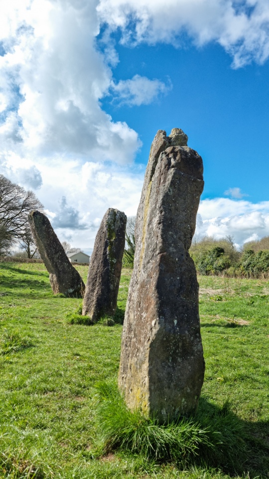
A folklore tradition tells how they were thrown down from the nearby Sugar Loaf mountain by Jack o'Kent, a giant, when he was playing pitch and toss with the Devil (as you do :-).
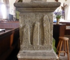
Trelleck was a major medieval settlement, and was named after the stones tre - three, lech - stone. The stones are depicted on a sundial in the church.
Access: Just south of Trellick along the B4293. Signposted between two long hedges, but easily missed. Small lay-by for parking.
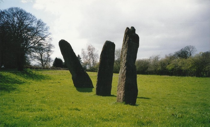
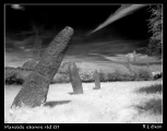
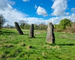
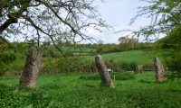
For more information see Coflein NPRN 221159, which describes these stones as "three spectacular uprights (which) are (made) of a local brown conglomerate or 'puddingstone'". The most recent, 2008, entry adds: "The central stone of the three has been dressed to smooth its surface, and bears two large cup marks on its face."
The Journal of Antiquities also features a page for these stones - see their entry for Harold’s Stones, Trellech, Monmouthshire, which includes a photograph, a description of the stones, local folklore and information about the 17th century, four-sided sundial at St Nicholas's Church in the village, which has images of the historical features within the village, including these stones.
Update October 2019: The Harolds Stones are also featured on the Stone Rows of Great Britain website. Their entry includes a description, a plan of the row from a recent survey carried out in May 2018, photographs of the alignment from a number of angles, access information and a list of online resources for more information. The SRoGB entry also includes photographs of the sundial with the carving of the stones, now found in the local church; they note: "This stone depicts other antiquities in the area and was carved for Lady Magdalen Probert in 1689".
You may be viewing yesterday's version of this page. To see the most up to date information please register for a free account.









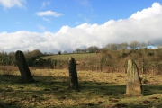


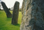

These are just the first 25 photos of Harolds Stones. If you log in with a free user account you will be able to see our entire collection.
Do not use the above information on other web sites or publications without permission of the contributor.
Click here to see more info for this site
Nearby sites
Key: Red: member's photo, Blue: 3rd party photo, Yellow: other image, Green: no photo - please go there and take one, Grey: site destroyed
Download sites to:
KML (Google Earth)
GPX (GPS waypoints)
CSV (Garmin/Navman)
CSV (Excel)
To unlock full downloads you need to sign up as a Contributory Member. Otherwise downloads are limited to 50 sites.
Turn off the page maps and other distractions
Nearby sites listing. In the following links * = Image available
346m NNE 19° Trelleck Churchyard Cross* Ancient Cross (SO5004605466)
372m E 97° Virtuous Well* Holy Well or Sacred Spring (SO50300509)
1.1km S 179° Trellech Wayside Cross* Ancient Cross (SO4994004050)
1.5km SSW 205° Gaer (Trellech)* Hillfort (SO493038)
3.8km S 180° Trellech United Standing Stone (Menhir) (SO499013)
4.7km SSE 152° Tintern 1* Round Barrow(s) (SO5207200980)
4.7km SSE 154° Tintern 2* Round Barrow(s) (SO5197000913)
4.8km SSE 152° Lower Halewood Round Barrow(s) (SO521009)
4.8km NNE 20° Peny Garn Cross Base* Ancient Cross (SO5158909643)
5.3km N 352° Mitchel Troy Churchyard Cross* Ancient Cross (SO4923010370)
5.8km E 96° St Bride's Well* Holy Well or Sacred Spring (SO5574404515)
5.8km NNW 346° Wonastow Churchyard Cross* Ancient Cross (SO4855410814)
5.9km SE 129° Cup Stone on Mill Hill* Rock Art (SO545014)
6.0km E 95° St Briavels Cross Slab* Early Christian Sculptured Stone (SO5592504540)
6.0km NNE 22° Penallt Churchyard Cross* Ancient Cross (SO5220010720)
6.0km E 97° The Ancient Barrow Well, St. Briavel's* Holy Well or Sacred Spring (SO5593004337)
6.4km SE 139° Offa's Dyke near Brockweir* Misc. Earthwork (SO541003)
6.6km ENE 78° Stowe Enclosure* Misc. Earthwork (SO56430643)
6.7km NW 321° Dingestow Churchyard Cross* Ancient Cross (SO4571010390)
6.8km SSE 154° Blackfield Wood* Hillfort (ST529990)
6.9km NE 50° Newland Crosses* Ancient Cross (SO5530809511)
7.0km WSW 254° Great House Camp* Hillfort (SO432033)
7.3km SW 223° Cwrt-Y-Gaer Misc. Earthwork (ST449998)
7.4km SSE 166° Gaer Hill Camp* Hillfort (ST517980)
7.7km S 186° Chepstow Park Wood Cairn Cairn (ST491975)
View more nearby sites and additional images



 We would like to know more about this location. Please feel free to add a brief description and any relevant information in your own language.
 Wir möchten mehr über diese Stätte erfahren. Bitte zögern Sie nicht, eine kurze Beschreibung und relevante Informationen in Deutsch hinzuzufügen.
 Nous aimerions en savoir encore un peu sur les lieux. S'il vous plaît n'hesitez pas à ajouter une courte description et tous les renseignements pertinents dans votre propre langue.
 Quisieramos informarnos un poco más de las lugares. No dude en añadir una breve descripción y otros datos relevantes en su propio idioma.