<< Our Photo Pages >> Kirkhouse - Round Cairn in Scotland in Orkney
Submitted by howar on Tuesday, 31 August 2004 Page Views: 4816
Neolithic and Bronze AgeSite Name: KirkhouseCountry: Scotland County: Orkney Type: Round Cairn
Nearest Town: Kirkwall Nearest Village: St. Margaret's Hope
Map Ref: ND470909
Latitude: 58.802358N Longitude: 2.918969W
Condition:
| 5 | Perfect |
| 4 | Almost Perfect |
| 3 | Reasonable but with some damage |
| 2 | Ruined but still recognisable as an ancient site |
| 1 | Pretty much destroyed, possibly visible as crop marks |
| 0 | No data. |
| -1 | Completely destroyed |
| 5 | Superb |
| 4 | Good |
| 3 | Ordinary |
| 2 | Not Good |
| 1 | Awful |
| 0 | No data. |
| 5 | Can be driven to, probably with disabled access |
| 4 | Short walk on a footpath |
| 3 | Requiring a bit more of a walk |
| 2 | A long walk |
| 1 | In the middle of nowhere, a nightmare to find |
| 0 | No data. |
| 5 | co-ordinates taken by GPS or official recorded co-ordinates |
| 4 | co-ordinates scaled from a detailed map |
| 3 | co-ordinates scaled from a bad map |
| 2 | co-ordinates of the nearest village |
| 1 | co-ordinates of the nearest town |
| 0 | no data |
Internal Links:
External Links:
")
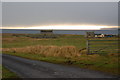
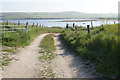
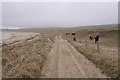
Below St. Peter's Church is a storm beach of large stones of all shapes. Even above the shore there are many, increasing in frequency as you progress to Kirk Ness.
You think of standing stones being quarried and shaped but here they are, like an open-cast mine for megaliths of all shapes and sizes. Perhaps this is why the Sorquoy Stone is so big, not importance, purely material to hand. Such an abundance marks this area as surely of importance. Near the beginning a relative few stones are upright, including some about a depression in a rise. This, RCAHMS NMRS record no. ND49SE 16, is a heavily quarried cairn 17x10m with an upright slab 0.9x0.6m orientated NE/SW within, but not a burial place they say. There are two slabs on the west margin of which one is fairly recent. . Shows signs of re-use, most likely as a kelp-kiln.
You may be viewing yesterday's version of this page. To see the most up to date information please register for a free account.
")
Do not use the above information on other web sites or publications without permission of the contributor.
Nearby Images from Geograph Britain and Ireland:
©2008(licence)
©2019(licence)
©2018(licence)
©2013(licence)
©2018(licence)
The above images may not be of the site on this page, they are loaded from Geograph.
Please Submit an Image of this site or go out and take one for us!
Click here to see more info for this site
Nearby sites
Key: Red: member's photo, Blue: 3rd party photo, Yellow: other image, Green: no photo - please go there and take one, Grey: site destroyed
Download sites to:
KML (Google Earth)
GPX (GPS waypoints)
CSV (Garmin/Navman)
CSV (Excel)
To unlock full downloads you need to sign up as a Contributory Member. Otherwise downloads are limited to 50 sites.
Turn off the page maps and other distractions
Nearby sites listing. In the following links * = Image available
465m NE 54° Kirk Ness* Round Cairn (ND47389117)
499m NE 52° Kirk Ness Dyke* Ancient Village or Settlement (ND474912)
509m NNW 348° Eastside* Standing Stone (Menhir) (ND469914)
2.0km SSW 194° Stews* Standing Stone (Menhir) (ND465890)
3.7km WSW 248° Clouduhall Stone* Standing Stone (Menhir) (ND43538957)
3.7km WSW 249° Clouduhall Cairn* Round Cairn (ND43498958)
3.7km WNW 294° Oyce of Quindry* Standing Stone (Menhir) (ND436925)
3.8km SSW 198° The Cairns Windwick Bay* Broch or Nuraghe (ND4578987256)
4.1km WSW 240° Weems Castle Broch or Nuraghe (ND434889)
4.5km NW 304° The Wart* Chambered Cairn (ND433935)
4.6km NNE 18° Kyelittle* Broch or Nuraghe (ND485953)
5.4km W 264° Harra Brough* Broch or Nuraghe (ND41579038)
5.4km NW 304° Howe of Hoxa* Broch or Nuraghe (ND425940)
5.5km WNW 304° Little Howe of Hoxa* Ancient Village or Settlement (ND4243694026)
5.5km WNW 304° Little Howe of Hoxa* Ancient Village or Settlement (ND42439403)
5.9km NNE 21° St Lawrence's Church* Broch or Nuraghe (ND4917896425)
6.4km S 179° Isbister: Tomb Of The Eagles* Chambered Cairn (ND47048449)
6.6km S 180° Duni Geo* Long Barrow (ND46958425)
6.7km S 184° Liddel 2 Burnt Mound Ancient Village or Settlement (ND46498416)
6.8km S 184° Isbister: Bronze Age House* Ancient Village or Settlement (ND46468411)
7.1km S 186° Tomb of the Eagles Museum Museum (ND4619783807)
7.3km SSW 204° Ladykirk Stone* Rock Art (ND44008428)
7.6km S 188° Banks Chambered Tomb* Chambered Cairn (ND45808339)
8.1km NNE 13° Northfield Broch* Broch or Nuraghe (ND489988)
9.5km NNE 33° Rose Ness* Chambered Cairn (ND5228698813)
View more nearby sites and additional images


 We would like to know more about this location. Please feel free to add a brief description and any relevant information in your own language.
 Wir möchten mehr über diese Stätte erfahren. Bitte zögern Sie nicht, eine kurze Beschreibung und relevante Informationen in Deutsch hinzuzufügen.
 Nous aimerions en savoir encore un peu sur les lieux. S'il vous plaît n'hesitez pas à ajouter une courte description et tous les renseignements pertinents dans votre propre langue.
 Quisieramos informarnos un poco más de las lugares. No dude en añadir una breve descripción y otros datos relevantes en su propio idioma.