


<< Our Photo Pages >> The Cairns Windwick Bay - Broch or Nuraghe in Scotland in Orkney
Submitted by Runemage on Tuesday, 07 December 2021 Page Views: 10732
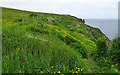
Neolithic and Bronze AgeSite Name: The Cairns Windwick BayCountry: Scotland County: Orkney Type: Broch or Nuraghe
Nearest Town: South Ronaldsay Island
Map Ref: ND4578987256
Latitude: 58.769486N Longitude: 2.93904W
Condition:
| 5 | Perfect |
| 4 | Almost Perfect |
| 3 | Reasonable but with some damage |
| 2 | Ruined but still recognisable as an ancient site |
| 1 | Pretty much destroyed, possibly visible as crop marks |
| 0 | No data. |
| -1 | Completely destroyed |
| 5 | Superb |
| 4 | Good |
| 3 | Ordinary |
| 2 | Not Good |
| 1 | Awful |
| 0 | No data. |
| 5 | Can be driven to, probably with disabled access |
| 4 | Short walk on a footpath |
| 3 | Requiring a bit more of a walk |
| 2 | A long walk |
| 1 | In the middle of nowhere, a nightmare to find |
| 0 | No data. |
| 5 | co-ordinates taken by GPS or official recorded co-ordinates |
| 4 | co-ordinates scaled from a detailed map |
| 3 | co-ordinates scaled from a bad map |
| 2 | co-ordinates of the nearest village |
| 1 | co-ordinates of the nearest town |
| 0 | no data |
Internal Links:
External Links:
I have visited· I would like to visit
whese001 would like to visit
")
As ever, with every find comes a series of questions that will only be answered by painstaking excavation and interpretation. That could take quite some time. One of the more unusual pieces unearthed was the small carved Cairns Head, thought to have been placed during a ritual closure of the site
Photo credit: Martin Carruthers
See the comments below for links to daily updates from past excavations at The Cairns excavations, also with video.
Note: UHI Archaeology Institute’s Brochtoberfest talks are available to watch online. More in the comments on our page
You may be viewing yesterday's version of this page. To see the most up to date information please register for a free account.
")
")
")
Do not use the above information on other web sites or publications without permission of the contributor.
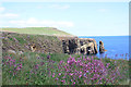
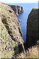
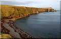
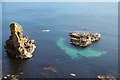
Nearby Images from Geograph Britain and Ireland:
©2013(licence)
©2012(licence)
©2015(licence)
©2012(licence)
©2018(licence)
The above images may not be of the site on this page, they are loaded from Geograph.
Please Submit an Image of this site or go out and take one for us!
Click here to see more info for this site
Nearby sites
Key: Red: member's photo, Blue: 3rd party photo, Yellow: other image, Green: no photo - please go there and take one, Grey: site destroyed
Download sites to:
KML (Google Earth)
GPX (GPS waypoints)
CSV (Garmin/Navman)
CSV (Excel)
To unlock full downloads you need to sign up as a Contributory Member. Otherwise downloads are limited to 50 sites.
Turn off the page maps and other distractions
Nearby sites listing. In the following links * = Image available
1.9km NNE 21° Stews* Standing Stone (Menhir) (ND465890)
2.9km NW 304° Weems Castle Broch or Nuraghe (ND434889)
3.0km SSE 155° Isbister: Tomb Of The Eagles* Chambered Cairn (ND47048449)
3.2km SSE 166° Liddel 2 Burnt Mound Ancient Village or Settlement (ND46498416)
3.2km SSE 167° Isbister: Bronze Age House* Ancient Village or Settlement (ND46468411)
3.2km SSE 158° Duni Geo* Long Barrow (ND46958425)
3.2km NW 315° Clouduhall Stone* Standing Stone (Menhir) (ND43538957)
3.3km NW 315° Clouduhall Cairn* Round Cairn (ND43498958)
3.5km SSW 210° Ladykirk Stone* Rock Art (ND44008428)
3.5km S 172° Tomb of the Eagles Museum Museum (ND4619783807)
3.8km NNE 18° Kirkhouse* Round Cairn (ND470909)
3.9km S 179° Banks Chambered Tomb* Chambered Cairn (ND45808339)
4.2km NNE 21° Kirk Ness* Round Cairn (ND47389117)
4.3km NNE 21° Kirk Ness Dyke* Ancient Village or Settlement (ND474912)
4.3km NNE 14° Eastside* Standing Stone (Menhir) (ND469914)
5.2km NW 306° Harra Brough* Broch or Nuraghe (ND41579038)
5.7km NNW 337° Oyce of Quindry* Standing Stone (Menhir) (ND436925)
6.7km NNW 337° The Wart* Chambered Cairn (ND433935)
7.5km NNW 333° Howe of Hoxa* Broch or Nuraghe (ND425940)
7.5km NNW 333° Little Howe of Hoxa* Ancient Village or Settlement (ND4243694026)
7.5km NNW 333° Little Howe of Hoxa* Ancient Village or Settlement (ND42439403)
8.5km NNE 18° Kyelittle* Broch or Nuraghe (ND485953)
9.8km NNE 19° St Lawrence's Church* Broch or Nuraghe (ND4917896425)
11.6km W 279° Cantick Head Bowl Barrow Round Barrow(s) (ND34318915)
11.7km W 281° Outer Green Hill Broch Chambered Cairn (ND34258958)
View more nearby sites and additional images


 We would like to know more about this location. Please feel free to add a brief description and any relevant information in your own language.
 Wir möchten mehr über diese Stätte erfahren. Bitte zögern Sie nicht, eine kurze Beschreibung und relevante Informationen in Deutsch hinzuzufügen.
 Nous aimerions en savoir encore un peu sur les lieux. S'il vous plaît n'hesitez pas à ajouter une courte description et tous les renseignements pertinents dans votre propre langue.
 Quisieramos informarnos un poco más de las lugares. No dude en añadir una breve descripción y otros datos relevantes en su propio idioma.