<< Text Pages >> Lewesdon Hillfort - Hillfort in England in Dorset
Submitted by coldrum on Wednesday, 17 February 2010 Page Views: 4551
Iron Age and Later PrehistorySite Name: Lewesdon HillfortCountry: England County: Dorset Type: Hillfort
Map Ref: ST437012
Latitude: 50.807604N Longitude: 2.800391W
Condition:
| 5 | Perfect |
| 4 | Almost Perfect |
| 3 | Reasonable but with some damage |
| 2 | Ruined but still recognisable as an ancient site |
| 1 | Pretty much destroyed, possibly visible as crop marks |
| 0 | No data. |
| -1 | Completely destroyed |
| 5 | Superb |
| 4 | Good |
| 3 | Ordinary |
| 2 | Not Good |
| 1 | Awful |
| 0 | No data. |
| 5 | Can be driven to, probably with disabled access |
| 4 | Short walk on a footpath |
| 3 | Requiring a bit more of a walk |
| 2 | A long walk |
| 1 | In the middle of nowhere, a nightmare to find |
| 0 | No data. |
| 5 | co-ordinates taken by GPS or official recorded co-ordinates |
| 4 | co-ordinates scaled from a detailed map |
| 3 | co-ordinates scaled from a bad map |
| 2 | co-ordinates of the nearest village |
| 1 | co-ordinates of the nearest town |
| 0 | no data |
Internal Links:
External Links:
Hillfort in Dorset
Details from Pastscape:
"A large univallate hillfort on the top of a narrow hill. The hillfort is defended on its south western and south eastern sides by a precipitous scarp. Along the northern side where the slope is less steep there are traces of an infilled ditch about 7 metres below the level of the interior which covers an area of about 1.2ha. At the western and southern end the hillfort is approached across narrow ridges which create natural causeways. At the western end, crossing the ridge, there is a slight ditch, 2.5 metres wide and 0.5 metres deep, with traces of an outer bank, 4 metres wide and up to 0.5 metres high. Inside the enclosure there are traces of a bank, up to 0.5 metres high, running along the edge of the scarp which may be the remains of an inner rampart. Similarly at the southern end the slope levels off suggesting an infilled ditch with a counterscarp bank which crosses the ridge. The line of the ditch continues as a ledge along the south western scarp for about 80 metres. There is a possible internal rampart cutting across the ridge 4 metres wide and up to 0.8 metres high at this end. The interior of the hillfort has been disturbed by gravel digging and timber removal. Scheduled."
Source: Pastscape
You may be viewing yesterday's version of this page. To see the most up to date information please register for a free account.
Do not use the above information on other web sites or publications without permission of the contributor.
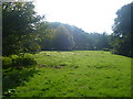
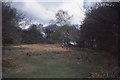
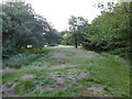
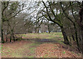
Nearby Images from Geograph Britain and Ireland:
©2013(licence)
©2014(licence)
©2021(licence)
©2011(licence)
©2013(licence)
The above images may not be of the site on this page, they are loaded from Geograph.
Please Submit an Image of this site or go out and take one for us!
Click here to see more info for this site
Nearby sites
Key: Red: member's photo, Blue: 3rd party photo, Yellow: other image, Green: no photo - please go there and take one, Grey: site destroyed
Download sites to:
KML (Google Earth)
GPX (GPS waypoints)
CSV (Garmin/Navman)
CSV (Excel)
To unlock full downloads you need to sign up as a Contributory Member. Otherwise downloads are limited to 50 sites.
Turn off the page maps and other distractions
Nearby sites listing. In the following links * = Image available
1.6km NNW 345° St Dunstan's Well* Holy Well or Sacred Spring (ST433028)
2.4km W 272° Pilsdon Pen* Hillfort (ST413013)
3.4km WSW 258° Bettiscombe Stone Natural Stone / Erratic / Other Natural Feature (ST4036800561)
5.2km NE 40° Pickett Farm Neolithic Site Misc. Earthwork (ST47100519)
6.8km WSW 251° Lambert's Castle* Hillfort (SY372991)
7.0km SW 214° St Candida & Holy Cross (Whitchurch Canonicorum)* Early Christian Sculptured Stone (SY3967895432)
7.5km WSW 240° Coney's Castle* Hillfort (SY372975)
7.8km ENE 63° Higher Ground Meadow Modern Burial Mound* Artificial Mound (ST5066904650)
8.3km SSW 206° St Candida's Well* Holy Well or Sacred Spring (SY3995193753)
8.4km ENE 74° Hore Stones* Standing Stones (ST5178603403)
8.5km ENE 64° Corscombe* Standing Stones (ST514048)
8.7km N 1° Pople's Well* Holy Well or Sacred Spring (ST4387909886)
9.6km SSW 198° Golden Cap Barrows* Barrow Cemetery (SY40569211)
9.7km S 183° Doghouse Hill* Ancient Village or Settlement (SY430915)
11.5km SE 142° Shipton Hill* Hillfort (SY507921)
12.0km E 92° Wraxall Cromlech Burial Chamber or Dolmen (ST557006)
12.2km ESE 121° Eggardon Hill* Hillfort (SY54129472)
12.8km ESE 120° Eggardon earthwork* Henge (SY54689460)
12.8km ESE 104° Toller Porcorum* Standing Stones (SY561979)
13.1km SE 134° Chilcombe Hill* Hillfort (SY530920)
13.1km SW 226° Leper's Well (Lyme Regis)* Holy Well or Sacred Spring (SY3411292224)
13.2km SE 136° Chilcombe Hill Barrows* Round Barrow(s) (SY528916)
13.6km SSE 155° Bind Barrow* Round Barrow(s) (SY494888)
13.9km ENE 75° St John's Well (Evershot)* Holy Well or Sacred Spring (ST5721304596)
13.9km ESE 122° Two Gates (Dorset)* Burial Chamber or Dolmen (SY5548593770)
View more nearby sites and additional images


 We would like to know more about this location. Please feel free to add a brief description and any relevant information in your own language.
 Wir möchten mehr über diese Stätte erfahren. Bitte zögern Sie nicht, eine kurze Beschreibung und relevante Informationen in Deutsch hinzuzufügen.
 Nous aimerions en savoir encore un peu sur les lieux. S'il vous plaît n'hesitez pas à ajouter une courte description et tous les renseignements pertinents dans votre propre langue.
 Quisieramos informarnos un poco más de las lugares. No dude en añadir una breve descripción y otros datos relevantes en su propio idioma.