<< Text Pages >> Arradoul Stone Circle - Stone Circle in Scotland in Moray
Submitted by Anonymous on Wednesday, 28 August 2024 Page Views: 999
Neolithic and Bronze AgeSite Name: Arradoul Stone CircleCountry: Scotland
NOTE: This site is 3.3 km away from the location you searched for.
County: Moray Type: Stone Circle
Nearest Town: Buckie Nearest Village: Arradoul
Map Ref: NJ415635
Latitude: 57.657580N Longitude: 2.982006W
Condition:
| 5 | Perfect |
| 4 | Almost Perfect |
| 3 | Reasonable but with some damage |
| 2 | Ruined but still recognisable as an ancient site |
| 1 | Pretty much destroyed, possibly visible as crop marks |
| 0 | No data. |
| -1 | Completely destroyed |
| 5 | Superb |
| 4 | Good |
| 3 | Ordinary |
| 2 | Not Good |
| 1 | Awful |
| 0 | No data. |
| 5 | Can be driven to, probably with disabled access |
| 4 | Short walk on a footpath |
| 3 | Requiring a bit more of a walk |
| 2 | A long walk |
| 1 | In the middle of nowhere, a nightmare to find |
| 0 | No data. |
| 5 | co-ordinates taken by GPS or official recorded co-ordinates |
| 4 | co-ordinates scaled from a detailed map |
| 3 | co-ordinates scaled from a bad map |
| 2 | co-ordinates of the nearest village |
| 1 | co-ordinates of the nearest town |
| 0 | no data |
Internal Links:
External Links:
I have visited· I would like to visit
stolinskie would like to visit
maps.nls.uk/view/228776761
Nothing visible from ground on active farm.
Neolithic pottery found nearby farm on descent towards beach.
www.britishmuseum.org/collection/term/x43078
You may be viewing yesterday's version of this page. To see the most up to date information please register for a free account.
Do not use the above information on other web sites or publications without permission of the contributor.
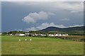
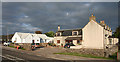
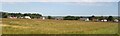
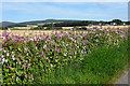
Nearby Images from Geograph Britain and Ireland:
©2007(licence)
©2013(licence)
©2006(licence)
©2020(licence)
©2021(licence)
The above images may not be of the site on this page, they are loaded from Geograph.
Please Submit an Image of this site or go out and take one for us!
Click here to see more info for this site
Nearby sites
Key: Red: member's photo, Blue: 3rd party photo, Yellow: other image, Green: no photo - please go there and take one, Grey: site destroyed
Download sites to:
KML (Google Earth)
GPX (GPS waypoints)
CSV (Garmin/Navman)
CSV (Excel)
To unlock full downloads you need to sign up as a Contributory Member. Otherwise downloads are limited to 50 sites.
Turn off the page maps and other distractions
Nearby sites listing. In the following links * = Image available
4.4km W 264° Cowiemuir* Stone Circle (NJ37096310)
7.0km SW 232° Bellie Round Barrow(s) (NJ359592)
7.7km W 278° Browland* Stone Circle (NJ339647)
8.3km E 83° Davie's Castle* Hillfort (NJ49816435)
9.1km NE 53° Green Castle (Portknockie) Promontory Fort / Cliff Castle (NJ4889768809)
9.3km ENE 59° Jenny's Well* Holy Well or Sacred Spring (NJ495682)
11.4km W 278° Binn Hill* Round Cairn (NJ30166532)
12.0km E 87° Gaul Cross* Stone Circle (NJ53506387)
12.4km SW 227° St Mary's Well (Inchberry)* Holy Well or Sacred Spring (NJ323552)
12.5km W 272° Innesmill* Stone Circle (NJ28956407)
14.3km WSW 258° Bogton Mill* Stone Circle (NJ2743060765)
14.6km E 81° Sandend Bay A Stone Circle (NJ560657)
14.6km E 80° Sandend Bay B Cairn (NJ56016571)
15.0km WSW 255° Errol circle Stone Circle (NJ26905984)
15.0km W 273° Urquart Stones* Stone Circle (NJ26456450)
15.4km SE 125° Knock Hill Stone Circle* Stone Circle (NJ54005442)
16.0km S 175° Tobar na Cailleach Holy Well or Sacred Spring (NJ4265947528)
17.7km E 82° St Comb's Well (Portsoy)* Holy Well or Sacred Spring (NJ591657)
18.7km ESE 116° Thorax* Stone Circle (NJ58225495)
19.2km WSW 242° Netherglen* Standing Stone (Menhir) (NJ24315476)
19.3km W 268° Elgin symbol stone* Class II Pictish Symbol Stone (NJ2219263057)
19.3km E 96° St. Brandan's Stanes* Stone Circle (NJ60756105)
19.6km S 191° St Fumac's Well* Holy Well or Sacred Spring (NJ376443)
19.7km W 267° Elgin Museum* Museum (NJ218628)
20.0km SE 144° Tillytarmont 2* Class I Pictish Symbol Stone (NJ52974705)
View more nearby sites and additional images


 We would like to know more about this location. Please feel free to add a brief description and any relevant information in your own language.
 Wir möchten mehr über diese Stätte erfahren. Bitte zögern Sie nicht, eine kurze Beschreibung und relevante Informationen in Deutsch hinzuzufügen.
 Nous aimerions en savoir encore un peu sur les lieux. S'il vous plaît n'hesitez pas à ajouter une courte description et tous les renseignements pertinents dans votre propre langue.
 Quisieramos informarnos un poco más de las lugares. No dude en añadir una breve descripción y otros datos relevantes en su propio idioma.