 with our Megalithic Portal iPhone app")


<< Our Photo Pages >> St Fumac's Well - Holy Well or Sacred Spring in Scotland in Moray
Submitted by KiwiBetsy on Tuesday, 10 October 2006 Page Views: 8924
Springs and Holy WellsSite Name: St Fumac's WellCountry: Scotland County: Moray Type: Holy Well or Sacred Spring
Nearest Town: Dufftown Nearest Village: Drummuir
Map Ref: NJ376443
Latitude: 57.484623N Longitude: 3.042409W
Condition:
| 5 | Perfect |
| 4 | Almost Perfect |
| 3 | Reasonable but with some damage |
| 2 | Ruined but still recognisable as an ancient site |
| 1 | Pretty much destroyed, possibly visible as crop marks |
| 0 | No data. |
| -1 | Completely destroyed |
| 5 | Superb |
| 4 | Good |
| 3 | Ordinary |
| 2 | Not Good |
| 1 | Awful |
| 0 | No data. |
| 5 | Can be driven to, probably with disabled access |
| 4 | Short walk on a footpath |
| 3 | Requiring a bit more of a walk |
| 2 | A long walk |
| 1 | In the middle of nowhere, a nightmare to find |
| 0 | No data. |
| 5 | co-ordinates taken by GPS or official recorded co-ordinates |
| 4 | co-ordinates scaled from a detailed map |
| 3 | co-ordinates scaled from a bad map |
| 2 | co-ordinates of the nearest village |
| 1 | co-ordinates of the nearest town |
| 0 | no data |
Internal Links:
External Links:
I have visited· I would like to visit
SolarMegalith would like to visit
")
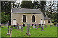
This is a 6th century circular, stone lined well named after the first Christian missionary in this part of Scotland. The well is said to have healing properties and at one time boasted a wooden image of St Fumac which was ceremonially washed each year on 3rd May which is the day of St Fumac’s Fair. During a flood of the nearby River Isla, the carving was washed away and found in Banff where it was burned at the stake being considered idolatrous.
You may be viewing yesterday's version of this page. To see the most up to date information please register for a free account.
")
Do not use the above information on other web sites or publications without permission of the contributor.
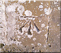
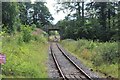
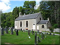
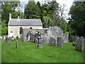
Nearby Images from Geograph Britain and Ireland:
©2019(licence)
©2020(licence)
©2019(licence)
©2019(licence)
©2019(licence)
The above images may not be of the site on this page, they are loaded from Geograph.
Please Submit an Image of this site or go out and take one for us!
Click here to see more info for this site
Nearby sites
Key: Red: member's photo, Blue: 3rd party photo, Yellow: other image, Green: no photo - please go there and take one, Grey: site destroyed
Download sites to:
KML (Google Earth)
GPX (GPS waypoints)
CSV (Garmin/Navman)
CSV (Excel)
To unlock full downloads you need to sign up as a Contributory Member. Otherwise downloads are limited to 50 sites.
Turn off the page maps and other distractions
Nearby sites listing. In the following links * = Image available
6.0km ENE 57° Tobar na Cailleach Holy Well or Sacred Spring (NJ4265947528)
7.2km SW 225° Mortlach 1* Class II Pictish Symbol Stone (NJ32413924)
7.3km SW 225° Mortlach 2* Class I Pictish Symbol Stone (NJ323392)
8.1km SE 142° Nether Dumeath* Stone Circle (NJ425378)
8.7km SW 224° Nether Cluny* Stone Circle (NJ315381)
9.0km WNW 287° Arndilly* Class I Pictish Symbol Stone (NJ29064707)
9.3km E 98° Gingomyres Stone Circle (NJ46794294)
10.9km WSW 256° Hatton Circle (Moray)* Stone Circle (NJ270418)
11.1km WSW 258° The Fairy Knowe* Misc. Earthwork (NJ267422)
11.3km ESE 113° Bowman Hillock* Stone Circle (NJ480398)
12.1km NNW 333° St Mary's Well (Inchberry)* Holy Well or Sacred Spring (NJ323552)
15.0km N 353° Bellie Round Barrow(s) (NJ359592)
15.4km SSE 151° Wormy Hillock* Henge (NJ449307)
15.5km E 84° Arnhill* Stone Circle (NJ531456)
15.6km E 79° Tillytarmont 2* Class I Pictish Symbol Stone (NJ52974705)
15.9km ESE 105° Stannin Steens O Strathbogie* Class I Pictish Symbol Stone (NJ529399)
15.9km ESE 105° Huntly Stone Circle (NJ529399)
16.4km ESE 119° Hill Of Bucharn Stone Circle (NJ518360)
16.9km NW 307° Netherglen* Standing Stone (Menhir) (NJ24315476)
17.0km E 80° Kimmonity Stone Circle (NJ54394707)
17.1km ESE 103° Battle Hill Dolmen Cairn (NJ542401)
18.0km ENE 75° Rothiemay* Stone Circle (NJ55084872)
18.4km W 265° Drum Divan* Stone Circle (NJ192431)
18.4km SE 143° Tap o'Noth* Hillfort (NJ484293)
18.8km N 358° Cowiemuir* Stone Circle (NJ37096310)
View more nearby sites and additional images


 We would like to know more about this location. Please feel free to add a brief description and any relevant information in your own language.
 Wir möchten mehr über diese Stätte erfahren. Bitte zögern Sie nicht, eine kurze Beschreibung und relevante Informationen in Deutsch hinzuzufügen.
 Nous aimerions en savoir encore un peu sur les lieux. S'il vous plaît n'hesitez pas à ajouter une courte description et tous les renseignements pertinents dans votre propre langue.
 Quisieramos informarnos un poco más de las lugares. No dude en añadir una breve descripción y otros datos relevantes en su propio idioma.