<< Our Photo Pages >> Little Howe of Hoxa - Ancient Village or Settlement in Scotland in Orkney
Submitted by howar on Friday, 06 August 2021 Page Views: 368
Iron Age and Later PrehistorySite Name: Little Howe of Hoxa Alternative Name: Uppertown, Howe FarmCountry: Scotland County: Orkney Type: Ancient Village or Settlement
Nearest Town: St Margaret's Hope
Map Ref: ND4243694026
Latitude: 58.829840N Longitude: 2.99875W
Condition:
| 5 | Perfect |
| 4 | Almost Perfect |
| 3 | Reasonable but with some damage |
| 2 | Ruined but still recognisable as an ancient site |
| 1 | Pretty much destroyed, possibly visible as crop marks |
| 0 | No data. |
| -1 | Completely destroyed |
| 5 | Superb |
| 4 | Good |
| 3 | Ordinary |
| 2 | Not Good |
| 1 | Awful |
| 0 | No data. |
| 5 | Can be driven to, probably with disabled access |
| 4 | Short walk on a footpath |
| 3 | Requiring a bit more of a walk |
| 2 | A long walk |
| 1 | In the middle of nowhere, a nightmare to find |
| 0 | No data. |
| 5 | co-ordinates taken by GPS or official recorded co-ordinates |
| 4 | co-ordinates scaled from a detailed map |
| 3 | co-ordinates scaled from a bad map |
| 2 | co-ordinates of the nearest village |
| 1 | co-ordinates of the nearest town |
| 0 | no data |
Internal Links:
External Links:

NMRS record no.ND49SW 2
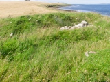
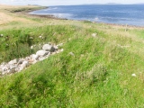
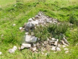
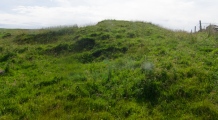
As you leave the broch take the road uphill until you see a large hut on your right, Facing this open the gate to your right and then the gate beyond that, closing both behind you. Look left to the ruined croft and the settlement mound is just in front. The pre-broch settlement or ‘homestead’ covers some 28x18m and is up to 1.5m high, and was originally at least 10m more inland than the present 15m. A modern wall crosses the site, obscuring the interior. Wide turf-covered banks up to 3m ht. surround a 13mD central structure with an uneven dished sub-circular interior where loose stones indicate a later insertion (Viking fortlet or a planticrû ?). On the S side entry to the structure is by a 3m passage though the enclosing banks. At the NNW a semi-subterranean passage or intra-mural gallery has become blocked by stones in recent decades [I know this because a fellow Brochaholic got in once]. On site it feels to me like Castle House in East Holm, where, near to the broch site at St Nicholas Church, a square building (likely Viking) has been placed within an earlier circular structure
Traditionally a passage connects the Little Howe of Hoxa to the Howe of Hoxa, but Petrie found no traces.- Wainright’s avenue is declared to be one of several linear stone clearance heaps. When Petrie investigated (through partial excavation) the already disturbed mound he found a central structure within two curvilinear concentric walls having a passage approx.. 2’ high and 12-16” wide at the base increasing a little in width at the top. The wall combo was ~21’ wide either side of the entrance then decreased to 13’ wide, and enclosed an irregular central chamber of 20’D. Inside a gallery extended behind the wall. As well as a southern ‘doorway’ cut down to the bedrock there was another passage opposite connecting to the ‘inner court’. Both entrance passage and gallery passages were lintelled.
You may be viewing yesterday's version of this page. To see the most up to date information please register for a free account.








Do not use the above information on other web sites or publications without permission of the contributor.
Click here to see more info for this site
Nearby sites
Key: Red: member's photo, Blue: 3rd party photo, Yellow: other image, Green: no photo - please go there and take one, Grey: site destroyed
Download sites to:
KML (Google Earth)
GPX (GPS waypoints)
CSV (Garmin/Navman)
CSV (Excel)
To unlock full downloads you need to sign up as a Contributory Member. Otherwise downloads are limited to 50 sites.
Turn off the page maps and other distractions
Nearby sites listing. In the following links * = Image available
7m WNW 303° Little Howe of Hoxa* Ancient Village or Settlement (ND42439403)
69m ESE 111° Howe of Hoxa* Broch or Nuraghe (ND425940)
1.0km ESE 121° The Wart* Chambered Cairn (ND433935)
1.9km SE 142° Oyce of Quindry* Standing Stone (Menhir) (ND436925)
3.7km SSW 192° Harra Brough* Broch or Nuraghe (ND41579038)
4.6km SSE 166° Clouduhall Cairn* Round Cairn (ND43498958)
4.6km SSE 165° Clouduhall Stone* Standing Stone (Menhir) (ND43538957)
5.2km ESE 120° Eastside* Standing Stone (Menhir) (ND469914)
5.2km SSE 169° Weems Castle Broch or Nuraghe (ND434889)
5.5km ESE 124° Kirkhouse* Round Cairn (ND470909)
5.7km ESE 119° Kirk Ness* Round Cairn (ND47389117)
5.7km ESE 119° Kirk Ness Dyke* Ancient Village or Settlement (ND474912)
6.2km ENE 77° Kyelittle* Broch or Nuraghe (ND485953)
6.4km SE 140° Stews* Standing Stone (Menhir) (ND465890)
7.1km ENE 70° St Lawrence's Church* Broch or Nuraghe (ND4917896425)
7.5km SSE 153° The Cairns Windwick Bay* Broch or Nuraghe (ND4578987256)
8.0km NE 53° Northfield Broch* Broch or Nuraghe (ND489988)
8.7km NNE 31° St Mary's Broch* Broch or Nuraghe (HY470014)
8.8km NE 42° Lamb Holm* Ancient Village or Settlement (HY484005)
9.3km WSW 241° Outer Green Hill Broch Chambered Cairn (ND34258958)
9.5km WSW 238° Cantick Head Bowl Barrow Round Barrow(s) (ND34318915)
9.5km WSW 244° Green Hill of Scarton Broch or Nuraghe (ND33789005)
9.9km S 170° Ladykirk Stone* Rock Art (ND44008428)
10.0km WSW 239° Green Hill of Hestigeo Broch or Nuraghe (ND33758905)
10.0km WSW 244° Burrowstone Broch or Nuraghe (ND333898)
View more nearby sites and additional images




 We would like to know more about this location. Please feel free to add a brief description and any relevant information in your own language.
 Wir möchten mehr über diese Stätte erfahren. Bitte zögern Sie nicht, eine kurze Beschreibung und relevante Informationen in Deutsch hinzuzufügen.
 Nous aimerions en savoir encore un peu sur les lieux. S'il vous plaît n'hesitez pas à ajouter une courte description et tous les renseignements pertinents dans votre propre langue.
 Quisieramos informarnos un poco más de las lugares. No dude en añadir una breve descripción y otros datos relevantes en su propio idioma.