Featured: Hare and Tabor T Shirts for discerning antiquarians

Hare and Tabor T Shirts for discerning antiquarians

Random Image


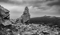
Stanton Drew SSW

Stonehenge Tea Towels - Worldwide delivery

 Stonehenge Tea Towels - Worldwide delivery

Who's Online

There are currently, 471 guests and 3 members online.

You are a guest. To join in, please register for free by clicking here

Sponsors

<< Our Photo Pages >> The Stiperstones - Cairn in England in Shropshire

Submitted by TimPrevett on Wednesday, 14 November 2018  Page Views: 20804

Neolithic and Bronze AgeSite Name: The Stiperstones
Country: England County: Shropshire Type: Cairn
Nearest Town: Church Stretton  Nearest Village: The Bog
Map Ref: SO36799880
Latitude: 52.583317N  Longitude: 2.93434W
Condition:
5Perfect
4Almost Perfect
3Reasonable but with some damage
2Ruined but still recognisable as an ancient site
1Pretty much destroyed, possibly visible as crop marks
0No data.
-1Completely destroyed
3 Ambience:
5Superb
4Good
3Ordinary
2Not Good
1Awful
0No data.
5 Access:
5Can be driven to, probably with disabled access
4Short walk on a footpath
3Requiring a bit more of a walk
2A long walk
1In the middle of nowhere, a nightmare to find
0No data.
3 Accuracy:
5co-ordinates taken by GPS or official recorded co-ordinates
4co-ordinates scaled from a detailed map
3co-ordinates scaled from a bad map
2co-ordinates of the nearest village
1co-ordinates of the nearest town
0no data
4

Internal Links:
External Links:

I have visited· I would like to visit

PAB would like to visit

w650marion visited on 24th Oct 2023 - their rating: Cond: 3 Amb: 5 Access: 3 In the clouds, with only ravens and red grouse for company - perfect!

Ogham visited on 15th Jun 1983 - their rating: Cond: 2 Amb: 4 Access: 3

hevveh TheCaptain TimPrevett Serenstar have visited here

Average ratings for this site from all visit loggers: Condition: 2.5 Ambience: 4.5 Access: 3

The Stiperstones
The Stiperstones submitted by TimPrevett : A cairn just north east of Manstone Rock. "The Stiperstones" is the name for a hill on the far west reaches of Shropshire, well into The Welsh Marches, overlooking the Welsh border. It is the second highest hill in Shropshire, affording superb views in all directions, and having several bronze age cairns along its ridge. The cairns themselves, excepting the largest, can be quite hard to loca... (Vote or comment on this photo)
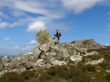
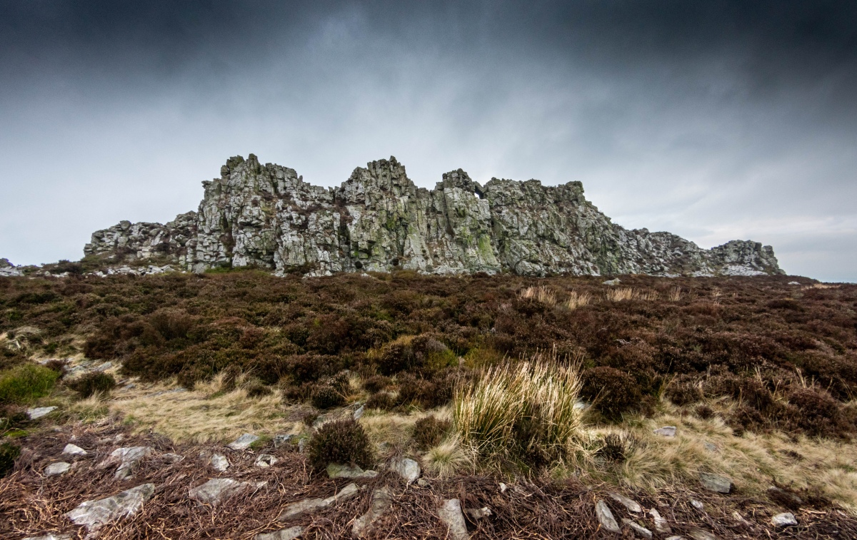
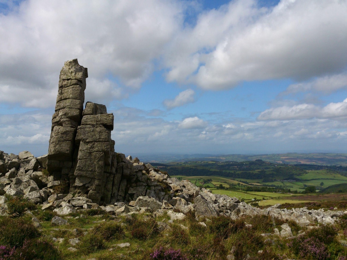
The Stiperstones is the name for a hill on the far west reaches of Shropshire, well into The Welsh Marches, overlooking the Welsh border. It is the second highest hill in Shropshire, affording superb views in all directions, and having several bronze age cairns along its ridge.

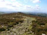
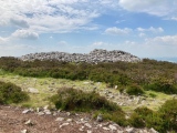
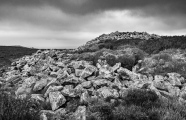
The cairns themselves, excepting the largest, can be quite hard to locate. At a very reductionist level, they are basically piles of stone amidst a whole ridge of piles of stone! The company of a 1:25000 map, a guidebook (and probably most helpful) a GPS will help locate them. The most noticeable cairns are at SO367985, SO368985, SO368988 (this last one being the biggest).

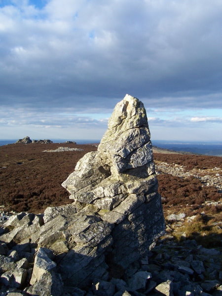
The hill is made up of quartzite rock - if you visit on a sunny day, it is impossible to miss the glistening rocks everywhere. The landscape here is blasted from the effects of projecting above the ice during the last Ice Age. Subjected to incredibly intense freezing and thawing, the otherwise strong rock was shattered, and now makes some of the toughest walking one might find in Shropshire.

Corndon Hill (the site of the Cwm Mawr neolithic axe factory) is to its southwest side, and Stapeley Hill - the ridge where Mitchell's Fold stone circle is located, is visible from The Stiperstones.

The Hoarstones stone circle, north from Mitchell's Fold also has an alignment with The Stiperstones, and the probably lost circle (or cairn) at Shelve, immediately west, is not far away at all.

To the north east, The Wrekin can be seen, and to the east Caer Caradoc's summit (Church Stretton) is noticeable, across the stretch of The Long Mynd. Stitt Hill and Ratlinghope Hill with their cross dykes and prehistoric farming features are to the immediate east.

Folklore abounds on The Stiperstones. There is The Devil's Chair, the northernmost tor, where His Infernal Majesty is claimed to take up residence at times. A thunderstorm will immediately occur should a human seek to sit in the place.

At the midwinter solstice, all the ghosts of Shropshire are also said to assemble here.

There are "The Seven Whistlers" - six birds fly together searching for the lost of their number; if found, the world will end.

Wild Edric, originally an historical figure of The Welsh Marches who made peace with William the Conqueror by 1070 haunts the Stiperstones (as well as around Church Stretton hills - here as a massive hound with fiery red eyes). As punishment for betraying the nation, he (still alive) is confined with his spectral army to the mines of the area (miners have heard tapping noises), to be released at times of National threat. Claimed sightings have happened around the times of the Napoleonic Wars, Boer War, Crimean War, and the First World War.

If similarity with King Arthur springs to mind, there is supposed to a huge magical fish which guards Edric's sword at Bomere Pool, and will only give it up to his true heir.
You may be viewing yesterday's version of this page. To see the most up to date information please register for a free account.
The Stiperstones
The Stiperstones submitted by Humbucker : The foreboding Devils Chair at the top of The Stiperstones (1 comment - Vote or comment on this photo)

The Stiperstones
The Stiperstones submitted by Antonine : 2012 (Vote or comment on this photo)

The Stiperstones
The Stiperstones submitted by simonjc : looking towards The Devil's Chair from Manstone Rock. Early evening april 10th 2006, clear skies and amazing views. (Vote or comment on this photo)

The Stiperstones
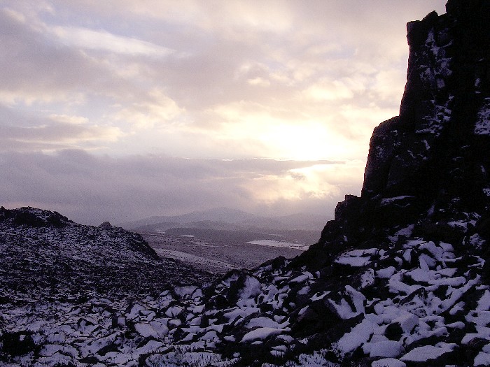
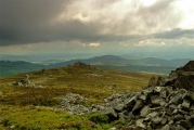
The Stiperstones submitted by TimPrevett : The Stiperstones, Midwinter Solstice Eve, 2004. Looking southwest past Manstone rock; there are numerous bronze age cairns on this ridge, some are huge, and others very difficult to spot. It is also has the worst walking conditions I have ever experienced! Even more so in the snow. However, the views and the atmosphere are euphoric. (1 comment - Vote or comment on this photo)

The Stiperstones
The Stiperstones submitted by TimPrevett : The huge bronze age cairn on The Stiperstones ridge, near sunset on Midwinter Solstice Eve, 2004. An atmospheric location whatever the weather; also the most difficult walking conditions I have ever walked upon. Even worse in the snow - albeit dramatic and thoroughly other wordly. See the main entry - click on blue text to left of picture - for more information. (2 comments - Vote or comment on this photo)

The Stiperstones
The Stiperstones submitted by TimPrevett : The largest of The Stiperstones cairns, and the most northern - about 6 feet high, and 75 feet in diameter. Situated to the west of the path. This photo is taken from the trig point atop Manstone Rock. "The Stiperstones" is the name for a hill on the far west reaches of Shropshire, well into The Welsh Marches, overlooking the Welsh border. It is the second highest hill in Shropshire, affording ... (1 comment)

The Stiperstones
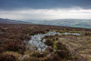
The Stiperstones submitted by w650marion : One of the 22 Bronze Age cairns recorded on the Stiperstones was being damaged by a "short cut convenience" footpath across its' side, so the archaeology group have constructed a low wall to prevent access. I hope it works. The cairn is enter top of picture with a stone upright in it.

The Stiperstones
The Stiperstones submitted by w650marion : There are 22 recorded Bronze Age cairns on the Stiperstones, 5 of which are scheduled monuments. This one is easy to find as it is so close to the trig point.

The Stiperstones
The Stiperstones submitted by Antonine : 2012

The Stiperstones
The Stiperstones submitted by Antonine

The Stiperstones
The Stiperstones submitted by Antonine

The Stiperstones
The Stiperstones submitted by w650marion : It’s huge! Close to the footpath, I wonder how tall it was originally?

The Stiperstones
The Stiperstones submitted by Humbucker : The large cairn up close on The Stiperstones

The Stiperstones
The Stiperstones submitted by Humbucker : Large cairn in the middle distance between Manstone Rock & The Devils Chair on the horizon.

The Stiperstones
The Stiperstones submitted by Humbucker : I'm sure this is a modern walkers cairn on The Stiperstones - approaching Manstone Rock

The Stiperstones
The Stiperstones submitted by Humbucker : The remains of a ring cairn on The Stiperstones.

The Stiperstones
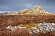
The Stiperstones submitted by Humbucker : A burst of sunshine on The Stiperstones with what may be the remains of a cairn in the foreground. Hard to tell without a GPS - a pile of stones among many piles of stones!

The Stiperstones
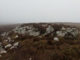
The Stiperstones submitted by TheCaptain : One of the Stiperstones cairns, near the summit of Manstone Rock. Its over 500m above sealevel, and we were in the clouds on this November day.

The Stiperstones
The Stiperstones submitted by TheCaptain : The large cairn on the top of the Stiperstones ridge, between Manstone Rock and the Devil's Chair. Its over 500m above sealevel, and we were in the clouds on this November day. (2 comments)

The Stiperstones
The Stiperstones submitted by TheCaptain

The Stiperstones
The Stiperstones submitted by stevep : The stiperstones ridge looking towards Manstone rock,the summit and second highest point in shropshire. (1 comment)

The Stiperstones
The Stiperstones submitted by stevep : the stiperstones ridge looking deep into south shropshire.Tthis national nature reserve is a wild , rugged, almost primeval place, it certainly inspired local author Mary webb who spent much time up here and weaved it into her books of myth, romance and country folklore.

The Stiperstones
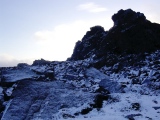
The Stiperstones submitted by TimPrevett : The Devil's Chair, The Stiperstones, Midwinter Solstice Eve, 2004. The Devil and every evil spirit in Shropshire are alleged to gather here on the longest night of the year to chose the chief of their diabolical order. This was less than an hour before sunset. I was cold, tired, and I did not hang around to find if there was any truth in the folklore! There are numerous bronze age cairns on this...

The Stiperstones
The Stiperstones submitted by TimPrevett : A profile of the Stiperstones from the west. Click on the blue text link to the left of the picture for further information. (1 comment)

These are just the first 25 photos of The Stiperstones. If you log in with a free user account you will be able to see our entire collection.

Do not use the above information on other web sites or publications without permission of the contributor.
Click here to see more info for this site

Nearby sites

Click here to view sites on an interactive OS map

Key: Red: member's photo, Blue: 3rd party photo, Yellow: other image, Green: no photo - please go there and take one, Grey: site destroyed

Download sites to:
KML (Google Earth)
GPX (GPS waypoints)
CSV (Garmin/Navman)
CSV (Excel)

To unlock full downloads you need to sign up as a Contributory Member. Otherwise downloads are limited to 50 sites.


Turn off the page maps and other distractions

Nearby sites listing. In the following links * = Image available
 1.6km NW 309° Pennerley Circle* Stone Circle (SO356998)
 1.9km WNW 284° Pennerley Barrows* Round Barrow(s) (SO349993)
 2.2km N 10° Castle Ring (Stiperstones)* Hillfort (SJ372010)
 2.6km WSW 243° Ritton Castle* Hillfort (SO34449765)
 2.6km NNE 29° The Paddocks Stone Row / Alignment (SJ38100107)
 3.0km W 281° Shelve* Stone Circle (SO338994)
 3.4km S 189° Linley Hill Camp* Misc. Earthwork (SO362954)
 3.8km ESE 104° Castle Ring (Stitt Hill)* Hillfort (SO405978)
 4.1km ENE 77° Leasowes Barrow* Round Barrow(s) (SO408997)
 4.2km ESE 110° Ratlinghope Hill Camp* Hillfort (SO407973)
 4.4km E 97° Ratlinghope Hill Bowl Barrow* Round Barrow(s) (SO41179817)
 4.5km WNW 283° Hoarstones* Stone Circle (SO32419990)
 4.7km NW 313° Lord's Stone* Standing Stone (Menhir) (SJ33400200)
 5.1km SSE 159° Norton Stones* Misc. Earthwork (SO386940)
 5.1km W 274° Giant's Grave (Shropshire)* Burial Chamber or Dolmen (SO31659925)
 5.4km WNW 284° Holywell Brook (Rorrington)* Holy Well or Sacred Spring (SJ316002)
 5.5km W 272° Stapeley Hill Cairn* Cairn (SO31279904)
 5.5km SW 218° Heath Mynd Bronze Age Homestead* Misc. Earthwork (SO33369447)
 5.5km WNW 287° Castle Ring (Rorrington)* Hillfort (SJ315005)
 5.6km W 269° Stapeley Hill Earthworks* Misc. Earthwork (SO312988)
 5.9km W 270° Cow Stone (Shropshire)* Standing Stone (Menhir) (SO30919888)
 6.0km ESE 110° Wildmoor Bowl Barrow* Round Barrow(s) (SO42409672)
 6.2km WSW 250° Corndon Hill 4* Cairn (SO30949680)
 6.2km NNE 15° Callow Hill Camp* Hillfort (SJ38430480)
 6.2km WSW 250° Corndon Hill 3* Cairn (SO30909676)
View more nearby sites and additional images

<< Crossall Hill (South Queensferry)

Glenquicken Cist >>

Please add your thoughts on this site

Britain's Oldest Art: The Ice Age Cave Art of Creswell Crag

Britain's Oldest Art: The Ice Age Cave Art of Creswell Crag

Sponsors

Auto-Translation (Google)

Translate from English into:

"The Stiperstones" | Login/Create an Account | 5 News and Comments
  
Go back to top of page    Comments are owned by the poster. We aren't responsible for their content.
Re: The Stiperstones by w650marion on Tuesday, 03 October 2023
(User Info | Send a Message)
An unofficial short cut is damaging the edges of an important scheduled cairn at the Stiperstones!!!
But help is at hand - Lost Cairns of the Stiperstones: community archaeological survey days
15th - 16th October 2023
From the Shropshire Hills website -
"There are thought to be several Bronze Age cairns in the undergrowth which are not recorded properly. Join Matt Williams of Fern Heritage and Archaeology to help locate, survey and record these features. Over the 2 days, we are also planning to carry out some work to encourage walkers to stay on the main public footpath, as an unofficial short cut is damaging the edges of an important scheduled cairn.
No experience is necessary to get involved, but booking is essential, and sturdy footwear and weather appropriate clothing a must. Please email Matt via info@fearnheritage.co.uk. "

www.shropshirehillsaonb.co.uk/aonb-events/lost-cairns-of-the-stiperstones-community-archaeological-survey-days


[ Reply to This ]

Re: The Stiperstones by mmike on Friday, 16 November 2018
(User Info | Send a Message)
For me the Stiperstones dont have any forces feeding the site, but to the east a short distance is a Portal site where two powerful forces from the N/W and another from the N/E meet in a huge V shape there, just on the high ground.Its at a point where a triangle shaped cropped bit of land is, and just below it to the south is where four hilltop paths meet,its age I believe when it became active was 4200 years ago, so its very ancient and must have history of things happening there.A web cam might record anything that goes on,it looks open ground, but anyone visiting should take loads of pictures, you just never know what might be seen.At this moment I dont know if its a time portal or what, things might appear from time to time, only visiting and taking pictures would offer a clue ? East of Perkins Beach. Its NOT a time Portal like the Woolwich Foot Tunnel, more like a place where past visions would occur in my opinion, the Romans Marching, or that WW2 Bomber trying to land after a mission, but failing yet again ?
[ Reply to This ]

Re: The Stiperstones by Anonymous on Thursday, 12 February 2009
As I was born and raised in Stiperstones, I have very fond memories of regarding the Stiperstones rocks as my own very large and endlessly entertaining playground. I would climb up the most challenging rock faces, alone, at the age of 9 or 10 years old, and despatch home made parachutes, made from my mothers silk headscarves.
Nowadays I tend to walk in company, with around 400 others, on the annual Long Mynd Hike, a 50 mile trek around the highest peaks in the local area, over 24 hours.
I recommend it to anyone.
[ Reply to This ]

Re: The Stiperstones by TimPrevett on Sunday, 19 December 2004
(User Info | Send a Message)
A panorama of the Devil's Chair and surrounding Stiperstones, where I hope to be for midwinter solstice eve sunset tomorrow!

http://www.bbc.co.uk/shropshire/panoramic/devils_chair/index.shtml

Tim
[ Reply to This ]

Re: The Stiperstones by Andy B on Thursday, 07 October 2004
(User Info | Send a Message)
Aerial photo and more information from BBC Shropshire:
http://www.bbc.co.uk/shropshire/history/2004/01/gallery_hill_forts.shtml
[ Reply to This ]

Your Name: Anonymous [ Register Now ]
Subject:


Add your comment or contribution to this page. Spam or offensive posts are deleted immediately, don't even bother

<<< What is five plus one as a number? (Please type the answer to this question in the little box on the left)
You can also embed videos and other things. For Youtube please copy and paste the 'embed code'.
For Google Street View please include Street View in the text.
Create a web link like this: <a href="https://www.megalithic.co.uk">This is a link</a>  

Allowed HTML is:
<p> <b> <i> <a> <img> <em> <br> <strong> <blockquote> <tt> <li> <ol> <ul> <object> <param> <embed> <iframe>

We would like to know more about this location. Please feel free to add a brief description and any relevant information in your own language.
Wir möchten mehr über diese Stätte erfahren. Bitte zögern Sie nicht, eine kurze Beschreibung und relevante Informationen in Deutsch hinzuzufügen.
Nous aimerions en savoir encore un peu sur les lieux. S'il vous plaît n'hesitez pas à ajouter une courte description et tous les renseignements pertinents dans votre propre langue.
Quisieramos informarnos un poco más de las lugares. No dude en añadir una breve descripción y otros datos relevantes en su propio idioma.