Featured: Hare and Tabor T Shirts for discerning antiquarians

Hare and Tabor T Shirts for discerning antiquarians

Random Image


Gelli Hill Circle

Great Stone Circles, Aubrey Burl

Great Stone Circles, Aubrey Burl

Who's Online

There are currently, 520 guests and 4 members online.

You are a guest. To join in, please register for free by clicking here

Sponsors

<< Our Photo Pages >> Hoarstones - Stone Circle in England in Shropshire

Submitted by Baz on Tuesday, 17 September 2002  Page Views: 23403

Neolithic and Bronze AgeSite Name: Hoarstones Alternative Name: Black Marsh
Country: England County: Shropshire Type: Stone Circle
 Nearest Village: Shelve
Map Ref: SO32419990  Landranger Map Number: 137
Latitude: 52.592676N  Longitude: 2.999199W
Condition:
5Perfect
4Almost Perfect
3Reasonable but with some damage
2Ruined but still recognisable as an ancient site
1Pretty much destroyed, possibly visible as crop marks
0No data.
-1Completely destroyed
3 Ambience:
5Superb
4Good
3Ordinary
2Not Good
1Awful
0No data.
4 Access:
5Can be driven to, probably with disabled access
4Short walk on a footpath
3Requiring a bit more of a walk
2A long walk
1In the middle of nowhere, a nightmare to find
0No data.
3 Accuracy:
5co-ordinates taken by GPS or official recorded co-ordinates
4co-ordinates scaled from a detailed map
3co-ordinates scaled from a bad map
2co-ordinates of the nearest village
1co-ordinates of the nearest town
0no data
4

Internal Links:
External Links:

I have visited· I would like to visit

BolshieBoris visited on 1st Aug 1998 - their rating: Cond: 3 Amb: 4 Access: 3

Humbucker TheWhiteRider TimPrevett have visited here
Hoarstones
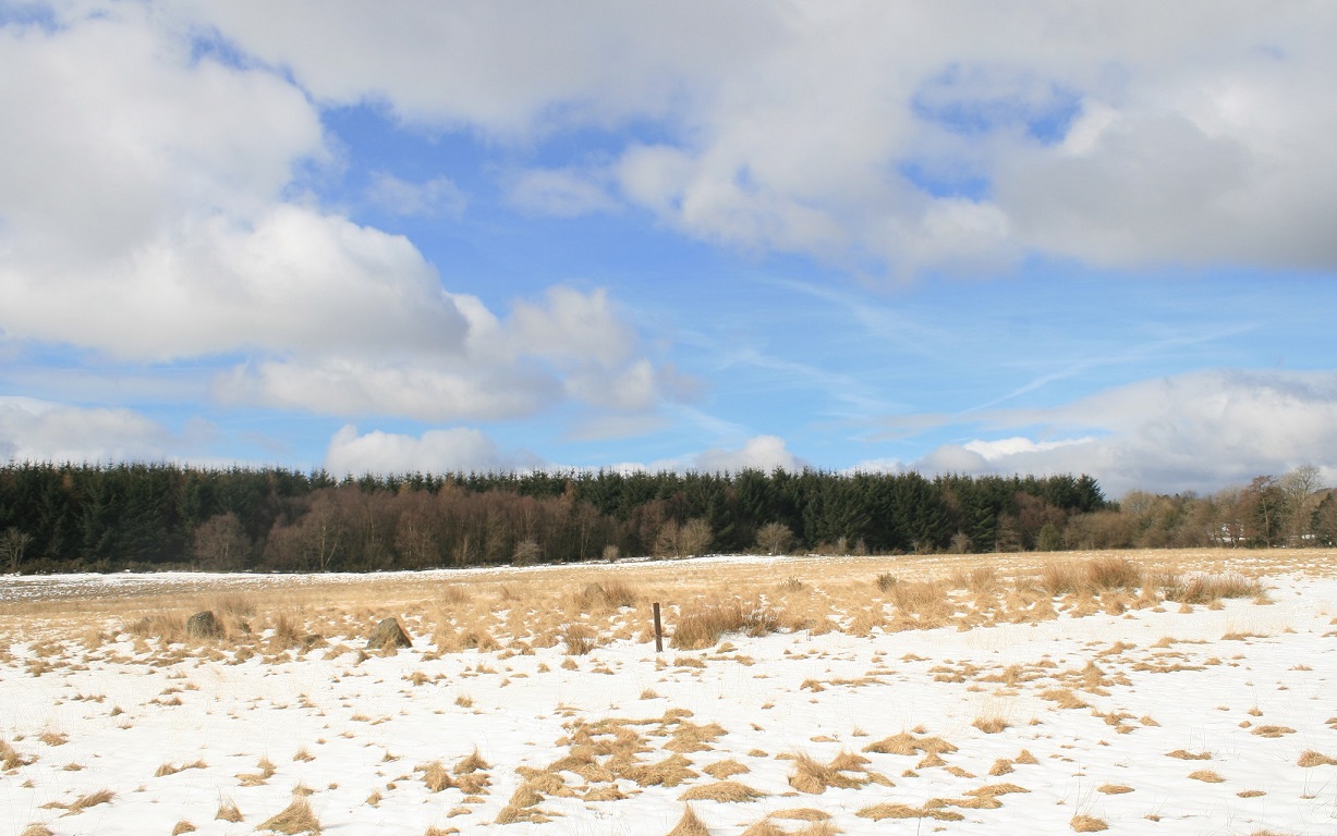
Hoarstones submitted by Postman : The sun came out at last and made the whole scene far too bright, it was almost painful to look. (Vote or comment on this photo)
Access to this stone circle is more difficult than the map suggests. I took a circuitous route and, approaching from the south-west, across the fields I saw a circular patch of hay in a recently mown meadow.

The tallest stone, at one metre, lies near the centre. The image was taken from inside the circle looking south past the central stone. Most of the other stones are hidden in the vegetation.
You may be viewing yesterday's version of this page. To see the most up to date information please register for a free account.

Hoarstones
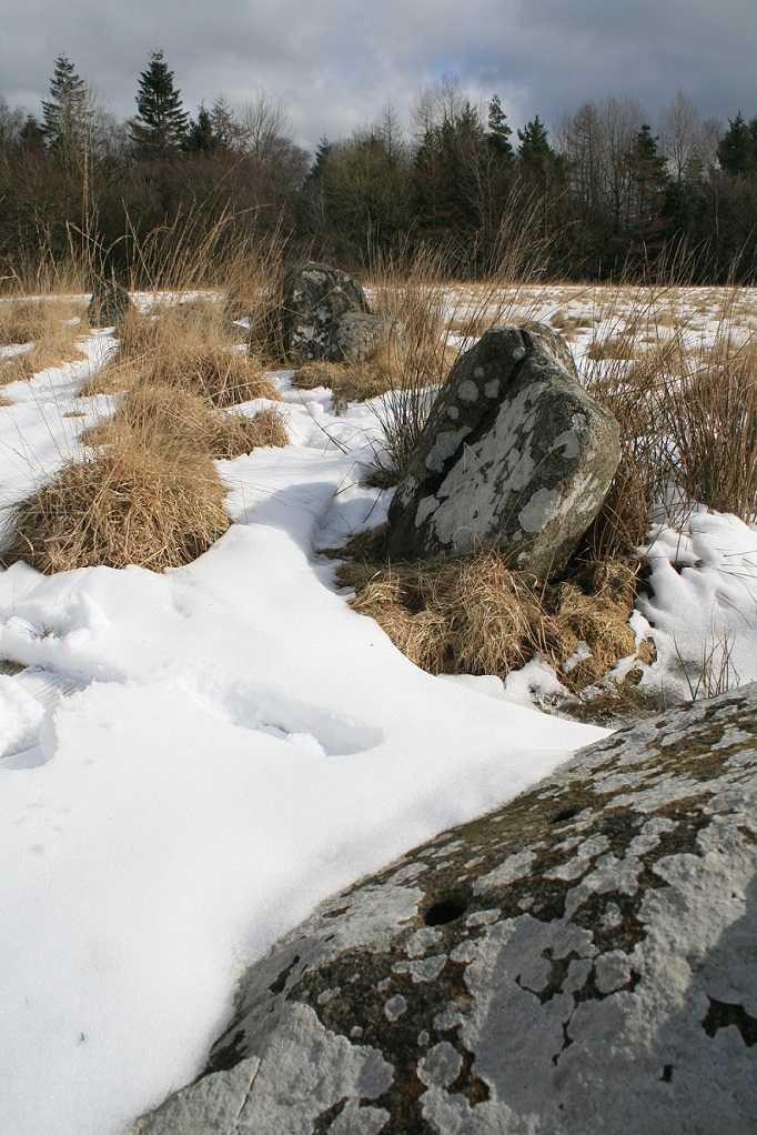
Hoarstones submitted by Postman : The stoniest part of the stone circle (Vote or comment on this photo)

Hoarstones
Hoarstones submitted by baz : The Hoarstones shot holes. Examples of the shot holes mentioned by Burl. Apparently these holes were drilled by miners and filled with gunpowder to provide home-made pyrotechnics during wedding celebrations. (2 comments - Vote or comment on this photo)

Hoarstones
Hoarstones submitted by Postman : Mostly gone are the Hoarstones, but enough is left to make sure you have to come take a look. (Vote or comment on this photo)

Hoarstones
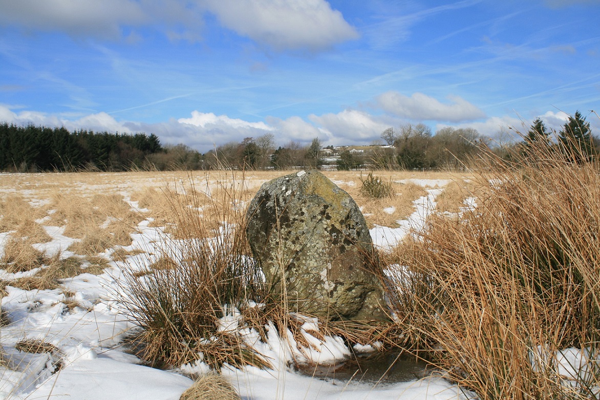
Hoarstones submitted by Postman : The central stone, and some good golly blue sky. (Vote or comment on this photo)

Hoarstones
Hoarstones submitted by Bladup : The Hoarstones [Black Marsh] Stone Circle. (Vote or comment on this photo)

Hoarstones
Hoarstones submitted by Bladup

Hoarstones
Hoarstones submitted by stevep : hoarstones panorama.

Hoarstones
Hoarstones submitted by TheWhiteRider : Corndon Hill seen from The Hoarstones. Midsummer 2005

Hoarstones
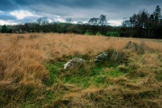
Hoarstones submitted by TimPrevett : On the Shropshire Meet 2005, the Hoarstones in a field full of buttercups. I was here six months ago in the snow on midwinter solstice eve, and it was the opposite of this picture. Leaving here was difficult.

Hoarstones
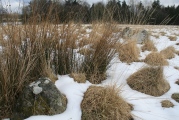
Hoarstones submitted by TimPrevett : The two cairns just to the west (two grassy rings / clumps left), and the circle of the Hoarstones, on a snowy Midwinter Solstice Eve, 2004. The circle, and cairns, have never been excavated.

Hoarstones
Hoarstones submitted by TheWhiteRider : Midsummer 2004. A stone of the Hoarstones circle near Mitchell's Fold. The blasting holes made by locals in the nineteenth century are clearly visible.

Hoarstones
Hoarstones submitted by TheWhiteRider : The Hoarstones circle, about a mile and a half North of Mitchell's Fold.

Hoarstones
Hoarstones submitted by baz : The Hoarstones Stone Circle,Black Marsh,nr Shelve,Shrops.(SO324999) Access to this stone circle is more difficult than the map suggests.I took a circuitous route and,approaching from the south-west, across the fields I saw a circular patch of hay in a recently mown meadow.The tallest stone,at one metre,lies near the centre.This image was taken from inside the circle looking south past the centr... (4 comments)

Hoarstones
Hoarstones submitted by Stubedo : A closer view of the stone and the surrounding pasture / countryside.

Hoarstones
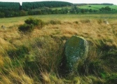
Hoarstones submitted by Stubedo : Photo of the centre stone, you can just make out the other stones surrounding it in the background. The circle itself is overgrown, yet the surrounding pasture is well grazed, perhaps the cattle know something....

Hoarstones
Hoarstones submitted by Postman : The central stone and the good surviving arc of circle stones.

Hoarstones
Hoarstones submitted by Postman : Drill holes, fireworks? yeah right.

Hoarstones
Hoarstones submitted by Postman : It should be easy to get to, but it's not.

Hoarstones
Hoarstones submitted by Humbucker : The central stone of The Black Marsh circle. A great place to visit & not many people seem to make it here - none on this bleak day in December. Although this field with the circle has some drainage ditches, it is still rather soggy during the damp weather!

Hoarstones
Hoarstones submitted by Humbucker : Part of The Black Marsh circle with Brownlow Callow tree copse on the hill in the distance. The copse is a well known local landmark.

Hoarstones
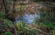
Hoarstones submitted by Humbucker : The Black Marsh itself. The remains of an ancient glacial lake. Stick to the paths, though even these can be precarious in damp weather!

Hoarstones
Hoarstones submitted by Humbucker : Visited during December when the grass is much shorter making the circle easier to spot. I followed the paths through the plantation, but a word of warning - it is called a marsh for a reason (the remains of an ancient glacial lake). I found it useful to orientate myself using the gap in the distant trees!

Hoarstones
Hoarstones submitted by Bladup : Hoarstones.

Hoarstones
Hoarstones submitted by Bladup : The Hoarstones [Black Marsh] Stone Circle.

These are just the first 25 photos of Hoarstones. If you log in with a free user account you will be able to see our entire collection.

Do not use the above information on other web sites or publications without permission of the contributor.
Click here to see more info for this site

Nearby sites

Click here to view sites on an interactive OS map

Key: Red: member's photo, Blue: 3rd party photo, Yellow: other image, Green: no photo - please go there and take one, Grey: site destroyed

Download sites to:
KML (Google Earth)
GPX (GPS waypoints)
CSV (Garmin/Navman)
CSV (Excel)

To unlock full downloads you need to sign up as a Contributory Member. Otherwise downloads are limited to 50 sites.


Turn off the page maps and other distractions

Nearby sites listing. In the following links * = Image available
 862m WNW 290° Holywell Brook (Rorrington)* Holy Well or Sacred Spring (SJ316002)
 998m SW 229° Giant's Grave (Shropshire)* Burial Chamber or Dolmen (SO31659925)
 1.1km WNW 303° Castle Ring (Rorrington)* Hillfort (SJ315005)
 1.4km SW 232° Stapeley Hill Cairn* Cairn (SO31279904)
 1.5km ESE 109° Shelve* Stone Circle (SO338994)
 1.6km SW 227° Stapeley Hill Earthworks* Misc. Earthwork (SO312988)
 1.8km SW 235° Cow Stone (Shropshire)* Standing Stone (Menhir) (SO30919888)
 2.3km NNE 24° Lord's Stone* Standing Stone (Menhir) (SJ33400200)
 2.5km SW 232° Mitchell's Fold* Stone Circle (SO30429837)
 2.5km WSW 241° Middleton Hill Round Barrow(s) (SO302987)
 2.6km ESE 103° Pennerley Barrows* Round Barrow(s) (SO349993)
 2.6km SW 230° Mitchell's Fold outlier* Standing Stone (Menhir) (SO30429828)
 2.6km SW 226° Druid's Castle* Stone Circle (SO305981)
 2.9km WSW 249° Middleton Hall* Standing Stone (Menhir) (SO297989)
 3.0km SE 137° Ritton Castle* Hillfort (SO34449765)
 3.1km SW 219° The Whetstones* Stone Circle (SO30429753)
 3.2km E 91° Pennerley Circle* Stone Circle (SO356998)
 3.4km SSW 205° Corndon Hill 4* Cairn (SO30949680)
 3.5km SSW 211° Corndon Hill 2* Cairn (SO30609693)
 3.5km SSW 205° Corndon Hill 3* Cairn (SO30909676)
 3.5km SW 222° New House Long Barrow* Long Barrow (SO300973)
 3.8km SSW 211° Corndon Hill 8* Cairn (SO304967)
 3.8km SSW 210° Corndon Hill 1* Cairn (SO30449666)
 3.9km SW 216° Corndon Hill 7* Cairn (SO301968)
 3.9km SSW 203° Corndon Hill 5* Cairn (SO30869632)
View more nearby sites and additional images

<< Ridley Common

Shelve >>

Please add your thoughts on this site

Mesolithic Britain and Ireland: New Approaches

Mesolithic Britain and Ireland: New Approaches

Sponsors

Auto-Translation (Google)

Translate from English into:

"Hoarstones" | Login/Create an Account | 6 News and Comments
  
Go back to top of page    Comments are owned by the poster. We aren't responsible for their content.
Re: Hoarstones by Stubedo on Tuesday, 05 April 2022
(User Info | Send a Message)
I went to Hoarstones on Saturday 2nd April 2022.

It was a nightmare to get to couldn't immediately get to the Hoarstones Circle, forged my own way through the wood to find a path.

The land owner had, in my opinion, made it as difficult as possible to find, no sign posts, pathways blocked by trees etc. The only reason i knew it was there is because it was on my OS Map.

When I eventually found a path to the circle the land owner had put up hand written sign on the stile saying 'Private' and 'Keep Out' reasoning that no one could lay claim to a 3000 year old site of interest, I ignored them and had a look at the circle anyway.

The land was well grazed by the cows in the field except for the stone circle. Most bizarre.

The metal gate at the other end of the field also has Private No Entry signs on it, i am not sure of the legality of that, there is a path marked on OS maps, but i am unsure if it is a public right of way.

A great shame to have a site of such interest, but no one allowed to visit it.
[ Reply to This ]

Re: Hoarstones by rogerkread on Tuesday, 16 October 2018
(User Info | Send a Message)
Thanks to Darkside for the directions - spot on except that the actual stile at the top of the field by the wood is now missing. However, if you aim for the new metal gate giving access to the footpath through the wood you will see a plank bridge over the ditch on your right. The barbs of the barbed wire fence have been removed at this point, clerly where the stile used to be, and it is easy enough to step over it.
A good site, more atmospheric than Mitchell's Fold and more stones too.
[ Reply to This ]

Re: Hoarstones by coldrum on Wednesday, 07 October 2009
(User Info | Send a Message)
Pastscape:

http://www.pastscape.org.uk/hob.aspx?hob_id=107454
[ Reply to This ]

Re: Hoarstones by coldrum on Wednesday, 01 April 2009
(User Info | Send a Message)
Link:

http://www.shropshiretourism.co.uk/south-shropshire/mitchell_fold/
[ Reply to This ]

Re: Hoarstones by TimPrevett on Friday, 04 February 2005
(User Info | Send a Message)
Another picture here in the BBC Shropshire Gallery

http://www.bbc.co.uk/shropshire/weather/gallery/winter_gallery_christmas_2004_22.shtml
[ Reply to This ]

Re: Hoarstones by Darkside on Thursday, 26 June 2003
(User Info | Send a Message)
This is a wonderful Site. There is nothing particularly remarkable about its form, but as you approach it across the fields it seem perfectly placed and wonderfully detached considering its close proximity to a road and houses. The best way of accessing the site if not walking over Black Marsh, is by parking up on the minor road which intersects the A488 in grid 32/99; this is the crossroads to Shelve etc.

Directions: - If heading north on A488 turn left at crossroads and park in the lay-by on the right 10 metres down the hill. From here, walk back up to the main road, turn right, take the track on the near immediate right up to a gate, go over this and then proceed to the style to the top right of the field. From there follow the Right of Way across the top of the field keeping your eyes right. in the summer the grass obscures the circle, but it is possible to make out an outline. The circle lies near the bottom of second (i think!) field along. This is a slightly convoluted way of accessing the site, but it sticks, as much as possible, to Rights of Way.

Rhys Davies.
[ Reply to This ]

Your Name: Anonymous [ Register Now ]
Subject:


Add your comment or contribution to this page. Spam or offensive posts are deleted immediately, don't even bother

<<< What is five plus one as a number? (Please type the answer to this question in the little box on the left)
You can also embed videos and other things. For Youtube please copy and paste the 'embed code'.
For Google Street View please include Street View in the text.
Create a web link like this: <a href="https://www.megalithic.co.uk">This is a link</a>  

Allowed HTML is:
<p> <b> <i> <a> <img> <em> <br> <strong> <blockquote> <tt> <li> <ol> <ul> <object> <param> <embed> <iframe>

We would like to know more about this location. Please feel free to add a brief description and any relevant information in your own language.
Wir möchten mehr über diese Stätte erfahren. Bitte zögern Sie nicht, eine kurze Beschreibung und relevante Informationen in Deutsch hinzuzufügen.
Nous aimerions en savoir encore un peu sur les lieux. S'il vous plaît n'hesitez pas à ajouter une courte description et tous les renseignements pertinents dans votre propre langue.
Quisieramos informarnos un poco más de las lugares. No dude en añadir una breve descripción y otros datos relevantes en su propio idioma.