


<< Our Photo Pages >> Camperdown Standing Stone - Standing Stone (Menhir) in Scotland in Angus
Submitted by peigimccann on Friday, 14 August 2020 Page Views: 2479
Neolithic and Bronze AgeSite Name: Camperdown Standing StoneCountry: Scotland County: Angus Type: Standing Stone (Menhir)
Nearest Town: Dundee Nearest Village: Birkhill
Map Ref: NO3549632905
Latitude: 56.483812N Longitude: 3.048967W
Condition:
| 5 | Perfect |
| 4 | Almost Perfect |
| 3 | Reasonable but with some damage |
| 2 | Ruined but still recognisable as an ancient site |
| 1 | Pretty much destroyed, possibly visible as crop marks |
| 0 | No data. |
| -1 | Completely destroyed |
| 5 | Superb |
| 4 | Good |
| 3 | Ordinary |
| 2 | Not Good |
| 1 | Awful |
| 0 | No data. |
| 5 | Can be driven to, probably with disabled access |
| 4 | Short walk on a footpath |
| 3 | Requiring a bit more of a walk |
| 2 | A long walk |
| 1 | In the middle of nowhere, a nightmare to find |
| 0 | No data. |
| 5 | co-ordinates taken by GPS or official recorded co-ordinates |
| 4 | co-ordinates scaled from a detailed map |
| 3 | co-ordinates scaled from a bad map |
| 2 | co-ordinates of the nearest village |
| 1 | co-ordinates of the nearest town |
| 0 | no data |
Internal Links:
External Links:
I have visited· I would like to visit
hoya105 would like to visit
")
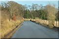
This stone is located on the Camperdown Park golf course, Dundee, not far north of the Balgarthno (Farm of Corn) stone circle
The stone measures about 1.2m tall and is oriented EW. It is at located south of the old West Gate into the park between the end of the first fairway (called "Druid") and the second tee.
You may be viewing yesterday's version of this page. To see the most up to date information please register for a free account.
")
")
Do not use the above information on other web sites or publications without permission of the contributor.
Nearby Images from Geograph Britain and Ireland:
©2014(licence)
©2022(licence)
©2014(licence)
©2008(licence)
©2013(licence)
The above images may not be of the site on this page, they are loaded from Geograph.
Please Submit an Image of this site or go out and take one for us!
Click here to see more info for this site
Nearby sites
Key: Red: member's photo, Blue: 3rd party photo, Yellow: other image, Green: no photo - please go there and take one, Grey: site destroyed
Download sites to:
KML (Google Earth)
GPX (GPS waypoints)
CSV (Garmin/Navman)
CSV (Excel)
To unlock full downloads you need to sign up as a Contributory Member. Otherwise downloads are limited to 50 sites.
Turn off the page maps and other distractions
Nearby sites listing. In the following links * = Image available
1.3km S 186° Balgarthno* Stone Circle (NO35333161)
2.0km SSE 159° Dark Stane Roundie* Round Barrow(s) (NO362310)
2.1km SSW 205° Devil's Stone (Perth & Kinross)* Standing Stone (Menhir) (NO3458131019)
2.3km W 266° Hurly Hawkins* Broch or Nuraghe (NO332328)
2.3km WNW 295° Liff and Benvie Cursus Cursus (NO33403391)
2.4km SSW 213° Longforgan Cursus Cursus (NO34163094)
2.4km SSW 214° Longforgan Cursus Cursus (NO34123090)
2.5km WNW 294° Liff and Benvie Cursus Cursus (NO33263396)
3.0km SSW 193° St Peter's Church (Invergowrie)* Early Christian Sculptured Stone (NO348300)
3.1km N 359° Templelands (Auchterhouse) Stone Circle (NO355360)
3.2km NE 44° Strathmartine 3 Class II Pictish Symbol Stone (NO378352)
3.5km SW 216° Mylnefield Stone Circle (NO334301)
5.1km NNE 22° Balluderon* Class II Pictish Symbol Stone (NO37483758)
5.3km ESE 116° McManus Galleries* Museum (NO40253047)
5.5km N 8° Balkello Standing Stone* Standing Stone (Menhir) (NO36333830)
5.5km WSW 249° Longforgan Cursus Cursus (NO30353100)
6.1km NNE 25° Balkemback* Stone Circle (NO382384)
6.3km WSW 251° Falcon Stone* Standing Stone (Menhir) (NO295309)
6.4km N 350° Auchterhouse Standing Stones (NO345392)
6.4km N 351° Witches Stone (Auchterhouse) Stone Circle (NO34603928)
6.6km WSW 251° Rossie Priory Class II Pictish Symbol Stone (NO292308)
6.6km WSW 250° Rossie Mercat Cross 1746* Ancient Cross (NO2920830732)
6.7km WSW 250° Rossie Loupin-on Stane* Standing Stone (Menhir) (NO2917630741)
7.6km NNE 27° Prieston* Rock Art (NO39023960)
7.7km NE 47° Tealing* Souterrain (Fogou, Earth House) (NO412381)
View more nearby sites and additional images


 We would like to know more about this location. Please feel free to add a brief description and any relevant information in your own language.
 Wir möchten mehr über diese Stätte erfahren. Bitte zögern Sie nicht, eine kurze Beschreibung und relevante Informationen in Deutsch hinzuzufügen.
 Nous aimerions en savoir encore un peu sur les lieux. S'il vous plaît n'hesitez pas à ajouter une courte description et tous les renseignements pertinents dans votre propre langue.
 Quisieramos informarnos un poco más de las lugares. No dude en añadir una breve descripción y otros datos relevantes en su propio idioma.