

<< Our Photo Pages >> Balluderon - Class II Pictish Symbol Stone in Scotland in Angus
Submitted by alligator on Saturday, 02 October 2004 Page Views: 15879
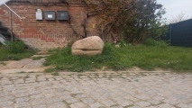
Early Medieval (Dark Age)Site Name: Balluderon Alternative Name: St. Martin's StoneCountry: Scotland County: Angus Type: Class II Pictish Symbol Stone
Map Ref: NO37483758 Landranger Map Number: 54
Latitude: 56.526073N Longitude: 3.017883W
Condition:
| 5 | Perfect |
| 4 | Almost Perfect |
| 3 | Reasonable but with some damage |
| 2 | Ruined but still recognisable as an ancient site |
| 1 | Pretty much destroyed, possibly visible as crop marks |
| 0 | No data. |
| -1 | Completely destroyed |
| 5 | Superb |
| 4 | Good |
| 3 | Ordinary |
| 2 | Not Good |
| 1 | Awful |
| 0 | No data. |
| 5 | Can be driven to, probably with disabled access |
| 4 | Short walk on a footpath |
| 3 | Requiring a bit more of a walk |
| 2 | A long walk |
| 1 | In the middle of nowhere, a nightmare to find |
| 0 | No data. |
| 5 | co-ordinates taken by GPS or official recorded co-ordinates |
| 4 | co-ordinates scaled from a detailed map |
| 3 | co-ordinates scaled from a bad map |
| 2 | co-ordinates of the nearest village |
| 1 | co-ordinates of the nearest town |
| 0 | no data |
Be the first person to rate this site - see the 'Contribute!' box in the right hand menu.
Internal Links:
External Links:
I have visited· I would like to visit
Oreo would like to visit
hamish has visited here
")
For details, visit: http://www.archaeoptics.co.uk/products/ecms/194.html
You may be viewing yesterday's version of this page. To see the most up to date information please register for a free account.
")
")
")
")
Do not use the above information on other web sites or publications without permission of the contributor.
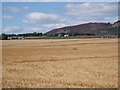
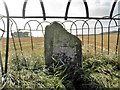
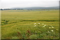
Nearby Images from Geograph Britain and Ireland:
©2012(licence)
©2016(licence)
©2014(licence)
©2014(licence)
©2020(licence)
The above images may not be of the site on this page, they are loaded from Geograph.
Please Submit an Image of this site or go out and take one for us!
Click here to see more info for this site
Nearby sites
Key: Red: member's photo, Blue: 3rd party photo, Yellow: other image, Green: no photo - please go there and take one, Grey: site destroyed
Download sites to:
KML (Google Earth)
GPX (GPS waypoints)
CSV (Garmin/Navman)
CSV (Excel)
To unlock full downloads you need to sign up as a Contributory Member. Otherwise downloads are limited to 50 sites.
Turn off the page maps and other distractions
Nearby sites listing. In the following links * = Image available
1.1km NE 40° Balkemback* Stone Circle (NO382384)
1.4km WNW 301° Balkello Standing Stone* Standing Stone (Menhir) (NO36333830)
2.4km S 172° Strathmartine 3 Class II Pictish Symbol Stone (NO378352)
2.5km SW 231° Templelands (Auchterhouse) Stone Circle (NO355360)
2.5km NE 36° Prieston* Rock Art (NO39023960)
3.2km NNE 29° Gallow Hill A* Rock Art (NO39054033)
3.3km WNW 300° Witches Stone (Auchterhouse) Stone Circle (NO34603928)
3.4km WNW 298° Auchterhouse Standing Stones (NO345392)
3.7km NNE 33° Gallow Hill B* Rock Art (NO39584066)
3.7km E 81° Tealing* Souterrain (Fogou, Earth House) (NO412381)
4.4km ENE 60° Huntingfaulds* Rock Art (NO41303974)
4.7km ENE 61° Tealing Stones* Standing Stones (NO4165139785)
5.1km SSW 202° Camperdown Standing Stone* Standing Stone (Menhir) (NO3549632905)
5.5km SW 227° Liff and Benvie Cursus Cursus (NO33403391)
5.5km SW 228° Liff and Benvie Cursus Cursus (NO33263396)
6.3km SSW 199° Balgarthno* Stone Circle (NO35333161)
6.4km SW 221° Hurly Hawkins* Broch or Nuraghe (NO332328)
6.7km S 190° Dark Stane Roundie* Round Barrow(s) (NO362310)
7.2km SSW 203° Devil's Stone (Perth & Kinross)* Standing Stone (Menhir) (NO3458131019)
7.4km SSW 206° Longforgan Cursus Cursus (NO34163094)
7.5km SSW 206° Longforgan Cursus Cursus (NO34123090)
7.6km SSE 158° McManus Galleries* Museum (NO40253047)
8.0km SSW 199° St Peter's Church (Invergowrie)* Early Christian Sculptured Stone (NO348300)
8.3km ENE 72° Carrot Hill* Rock Art (NO45454000)
8.5km SSW 208° Mylnefield Stone Circle (NO334301)
View more nearby sites and additional images


 We would like to know more about this location. Please feel free to add a brief description and any relevant information in your own language.
 Wir möchten mehr über diese Stätte erfahren. Bitte zögern Sie nicht, eine kurze Beschreibung und relevante Informationen in Deutsch hinzuzufügen.
 Nous aimerions en savoir encore un peu sur les lieux. S'il vous plaît n'hesitez pas à ajouter une courte description et tous les renseignements pertinents dans votre propre langue.
 Quisieramos informarnos un poco más de las lugares. No dude en añadir una breve descripción y otros datos relevantes en su propio idioma.