Featured: Friendly specialist tours to ancient, mystical and historical sites in the UK and beyond

Friendly specialist tours to ancient, mystical and historical sites in the UK and beyond

Random Image


stenness

Stonehenge Tea Towels - Worldwide delivery

 Stonehenge Tea Towels - Worldwide delivery

Who's Online

There are currently, 242 guests and 0 members online.

You are a guest. To join in, please register for free by clicking here

Sponsors

<< Our Photo Pages >> Keiss Broch - Broch or Nuraghe in Scotland in Caithness

Submitted by h_fenton on Thursday, 15 February 2001  Page Views: 8962

Iron Age and Later PrehistorySite Name: Keiss Broch Alternative Name: Keiss South, Keiss Harbour
Country: Scotland County: Caithness Type: Broch or Nuraghe
Nearest Town: Wick
Map Ref: ND35316108  Landranger Map Number: 12
Latitude: 58.533001N  Longitude: 3.11268W
Condition:
5Perfect
4Almost Perfect
3Reasonable but with some damage
2Ruined but still recognisable as an ancient site
1Pretty much destroyed, possibly visible as crop marks
0No data.
-1Completely destroyed
2 Ambience:
5Superb
4Good
3Ordinary
2Not Good
1Awful
0No data.
no data Access:
5Can be driven to, probably with disabled access
4Short walk on a footpath
3Requiring a bit more of a walk
2A long walk
1In the middle of nowhere, a nightmare to find
0No data.
no data Accuracy:
5co-ordinates taken by GPS or official recorded co-ordinates
4co-ordinates scaled from a detailed map
3co-ordinates scaled from a bad map
2co-ordinates of the nearest village
1co-ordinates of the nearest town
0no data
5

Internal Links:
External Links:

I have visited· I would like to visit

JCBH would like to visit

SolarMegalith visited on 15th Jul 2011 - their rating: Cond: 3 Amb: 3 Access: 4

h_fenton have visited here
Keiss Broch
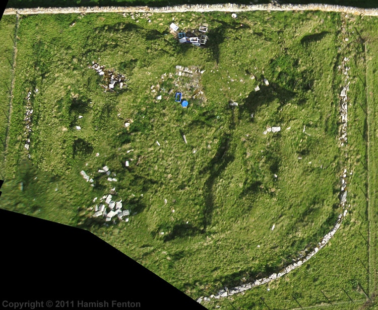
Keiss Broch submitted by h_fenton : Keiss Broch, nr Keiss, Caithness. At the time of my visit in May 2011 this broch looked a right mess full of rubbish plus old lobster pots and fish boxes, although recognisable as an ancient site, it would have been better to have backfilled this site after excavation, If you want to see a decent broch at Keiss walk c.150metres northeast to Whitegate Broch. A incomplete and badly stitched K... (Vote or comment on this photo)
Broch in Western Highlands

Remains of a broch with preserved parts of the outer walls. The site was occupied till 3rd century AD.
You may be viewing yesterday's version of this page. To see the most up to date information please register for a free account.

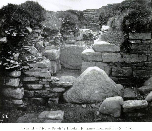
Keiss Broch
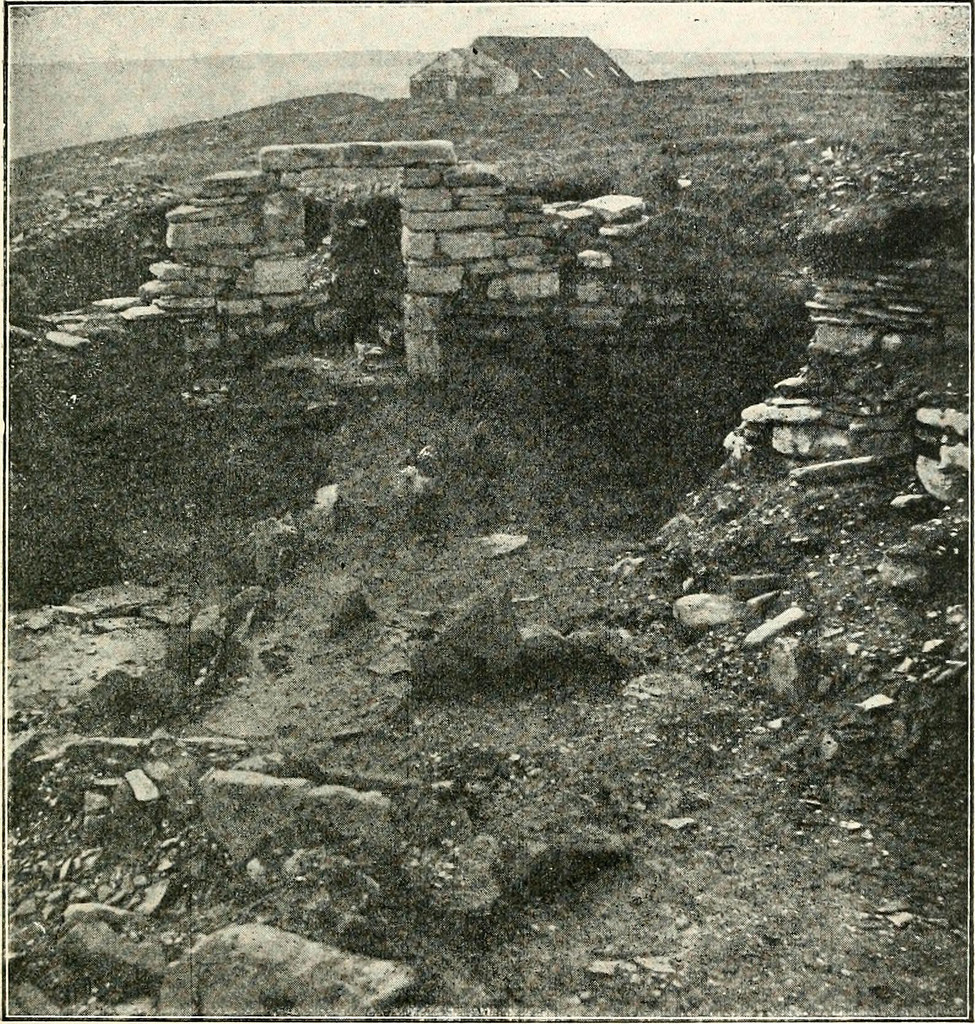
Keiss Broch submitted by Flickr : Image from page 380 of "Journal of the Royal Society of Antiquaries of Ireland" (1849) Identifier: journalofroyalso1899roya Title: Journal of the Royal Society of Antiquaries of Ireland Year: 1849 (1840s) Authors: Royal Society of Antiquaries of Ireland Royal Society of Antiquaries of Ireland. Transactions Royal Society of Antiquaries of Ireland. Proceedings and transactions Royal Society o... (Vote or comment on this photo)

Keiss Broch
Keiss Broch submitted by Flickr : Image from page 382 of "Journal of the Royal Society of Antiquaries of Ireland" (1849) Identifier: journalofroyalso1899roya Title: Journal of the Royal Society of Antiquaries of Ireland Year: 1849 (1840s) Authors: Royal Society of Antiquaries of Ireland Royal Society of Antiquaries of Ireland. Transactions Royal Society of Antiquaries of Ireland. Proceedings and transactions Royal Society o... (Vote or comment on this photo)

Keiss Broch
Keiss Broch submitted by durhamnature : Photo of the broch from "Report on inventory of Scottish Monuments...Caithness" via archive.org (Vote or comment on this photo)

Keiss Broch
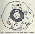
Keiss Broch submitted by durhamnature : Drawing of the broch from "Report on inventory of Scottish Monuments...Caithness" via archive.org (Vote or comment on this photo)

Keiss Broch
Keiss Broch submitted by durhamnature : Photo of "painted pebbles" from Keiss Broch from "Report on inventory of Scottish Monuments...Caithness" via archive.org

Keiss Broch
Keiss Broch submitted by durhamnature : Drawing of broch, from "Bronze Age Antiquities" via archive.org

Keiss Broch
Keiss Broch submitted by SolarMegalith : Remains of Keiss Harbour broch with tower of Keiss Castle visible in the background (photo taken on July 2011).

Keiss Broch
Keiss Broch submitted by SolarMegalith : Keiss Harbour broch - view from the NE (photo taken on July 2011).

Keiss Broch
Keiss Broch submitted by SolarMegalith : Keiss Harbour is likely to be the major among three brochs in Keiss, as the biggest number of exotic and high status goods were found in it (photo taken on July 2011).

Keiss Broch
Keiss Broch submitted by SolarMegalith : Remains of the intramural structures (possibly a staircase) in Keiss broch (photo taken on July 2011).

Keiss Broch
Keiss Broch submitted by SolarMegalith : Keiss broch (known also as Keiss South and Keiss Harbour) - view from the north (photo taken on July 2011).

Do not use the above information on other web sites or publications without permission of the contributor.
Click here to see more info for this site

Nearby sites

Click here to view sites on an interactive OS map

Key: Red: member's photo, Blue: 3rd party photo, Yellow: other image, Green: no photo - please go there and take one, Grey: site destroyed

Download sites to:
KML (Google Earth)
GPX (GPS waypoints)
CSV (Garmin/Navman)
CSV (Excel)

To unlock full downloads you need to sign up as a Contributory Member. Otherwise downloads are limited to 50 sites.


Turn off the page maps and other distractions

Nearby sites listing. In the following links * = Image available
 156m NE 39° Whitegate Broch* Broch or Nuraghe (ND35416120)
 607m NW 314° Kirk Tofts* Broch or Nuraghe (ND34886151)
 2.7km NE 39° Nybster Broch* Broch or Nuraghe (ND37026314)
 3.0km NNE 27° Caithness Broch Centre* Museum (ND367637)
 3.0km NNE 29° Watenan Class I Pictish Symbol Stone (ND36806370)
 5.4km SSW 212° Skitten Broch or Nuraghe (ND32345655)
 6.4km WNW 282° Hill of Works* Broch or Nuraghe (ND29036255)
 6.8km S 179° Ackergill Mains* Standing Stone (Menhir) (ND35285424)
 6.9km NNE 18° Freswick Links* Broch or Nuraghe (ND37616761)
 6.9km S 169° Shorelands Broch or Nuraghe (ND36475425)
 7.1km SSW 201° Norwall Broch* Broch or Nuraghe (ND32665445)
 7.4km W 276° Gunn's Hillock* Broch or Nuraghe (ND27926201)
 8.4km NNE 28° Skirza Head Broch or Nuraghe (ND39406844)
 8.5km WSW 249° Gearsay Cairn Broch or Nuraghe (ND27265819)
 8.9km N 11° Warth Hill* Stone Circle (ND37156979)
 9.2km S 181° Kettleburn Broch Broch or Nuraghe (ND34975191)
 9.2km NNW 344° Brabstermire Broch or Nuraghe (ND32856993)
 9.4km S 184° Fairy Hillock (Milton) Cairn (ND34465173)
 9.5km WSW 244° Coghill* Broch or Nuraghe (ND26705708)
 9.7km SSE 159° Cairn of Elsay* Broch or Nuraghe (ND38715198)
 9.8km SSE 161° Papigoe Broch or Nuraghe (ND38285176)
 9.9km SSE 166° The Pap* Broch or Nuraghe (ND37625140)
 10.0km SSW 211° Thuster Broch or Nuraghe (ND30045254)
 10.1km W 279° Murza Broch or Nuraghe (ND25386290)
 10.1km SW 223° North Bilbster* Standing Stone (Menhir) (ND28295381)
View more nearby sites and additional images

<< Winterbourne Stoke

Callanish 4 >>

Please add your thoughts on this site

Caithness Archaeology: Aspects of Prehistory

Caithness Archaeology: Aspects of Prehistory

Sponsors

Auto-Translation (Google)

Translate from English into:

"Keiss Broch" | Login/Create an Account | 3 News and Comments
  
Go back to top of page    Comments are owned by the poster. We aren't responsible for their content.
Digital excavation recording at Keiss Broch, Caithness by Andy B on Sunday, 28 August 2011
(User Info | Send a Message)
Digital excavation recording at Keiss Broch, Caithness

As part of the Knowledge Transfer Project, AOC Archaeology Group and The University of Nottingham have been developing laser scanning as means of creating digital terrain models. The project has focussed on producing raster and TIN digital terrain models compatible with standard desktop GIS georeferenced to ordnance survey co-ordinates. This technique has been used to record archaeological landscapes at Keiss, Caithness, resulting in a terrain model of the foreshore area containing ‘broch village’ complexes.

By integrating data collected using more traditional survey equipment, however, we have also been able to introduce ‘interpreted’ data into laser scan point clouds. During the excavation of Keiss Harbour broch in Caithness in 2006, part of the River of Stone Project, laser scanning was employed alongside traditional recording as a means of documenting the deposits and built structures encountered. Scanning was carried out at every stage where a hand-drawn plan was deemed necessary, and the resulting point-clouds registered to a common Ordnance Survey georeferenced site grid.

Each stage of the excavation could thereby be overlain on the previous scan, providing phased plans that showed the depths of removed material. By digitising the resulting point-clouds in CAD, two-dimensional plans were produced and registered in to the site survey in GIS. By recording the locations of all finds and samples retrieved during the excavation in the same georeferenced coordinate system, a GIS project was compiled recording the locations of all significant archaeological material. The result is a step towards 3D recording of archaeological excavations. Further development of the technique is planned for future seasons of excavation.

http://www.aocarchaeology.com/key-projects/survey-and-geomatics-key-projects/digital-excavation-recording-at-keiss-broch-caithness
[ Reply to This ]

Keiss Excavation Photo Gallery by Andy B on Thursday, 17 August 2006
(User Info | Send a Message)
Whitegate Broch is being excavated by a team under the leadership of Dr Andy Heald of the National Museum of Scotland with students from Nottingham university and local amateur archaeologists. The two brochs at Keiss harbour are under investigation with the larger dig being concentrated on the Whitegate broch. The project has the full support of the Caithness Archaeological Trust.

Apparently Prince Charles visited this summer, while staying at the ex-Queen Mother's place (Source: BBC)

http://www.caithness.org/atoz/brochs/whitegatebroch/index.htm
[ Reply to This ]

Re: Keiss by Andy B on Tuesday, 04 July 2006
(User Info | Send a Message)
Broch being dug this summer as part of Caithness investigations:

http://www.24hourmuseum.org.uk/nwh_gfx_en/ART38231.html
[ Reply to This ]

Your Name: Anonymous [ Register Now ]
Subject:


Add your comment or contribution to this page. Spam or offensive posts are deleted immediately, don't even bother

<<< What is five plus one as a number? (Please type the answer to this question in the little box on the left)
You can also embed videos and other things. For Youtube please copy and paste the 'embed code'.
For Google Street View please include Street View in the text.
Create a web link like this: <a href="https://www.megalithic.co.uk">This is a link</a>  

Allowed HTML is:
<p> <b> <i> <a> <img> <em> <br> <strong> <blockquote> <tt> <li> <ol> <ul> <object> <param> <embed> <iframe>

We would like to know more about this location. Please feel free to add a brief description and any relevant information in your own language.
Wir möchten mehr über diese Stätte erfahren. Bitte zögern Sie nicht, eine kurze Beschreibung und relevante Informationen in Deutsch hinzuzufügen.
Nous aimerions en savoir encore un peu sur les lieux. S'il vous plaît n'hesitez pas à ajouter une courte description et tous les renseignements pertinents dans votre propre langue.
Quisieramos informarnos un poco más de las lugares. No dude en añadir una breve descripción y otros datos relevantes en su propio idioma.