


<< Image Pages >> Gyre - Barrow Cemetery in Scotland in Orkney
Submitted by howar on Wednesday, 12 October 2005 Page Views: 3687
Neolithic and Bronze AgeSite Name: Gyre Alternative Name: GearCountry: Scotland County: Orkney Type: Barrow Cemetery
Nearest Town: Stromness Nearest Village: Orphir
Map Ref: HY340047
Latitude: 58.924467N Longitude: 3.148003W
Condition:
| 5 | Perfect |
| 4 | Almost Perfect |
| 3 | Reasonable but with some damage |
| 2 | Ruined but still recognisable as an ancient site |
| 1 | Pretty much destroyed, possibly visible as crop marks |
| 0 | No data. |
| -1 | Completely destroyed |
| 5 | Superb |
| 4 | Good |
| 3 | Ordinary |
| 2 | Not Good |
| 1 | Awful |
| 0 | No data. |
| 5 | Can be driven to, probably with disabled access |
| 4 | Short walk on a footpath |
| 3 | Requiring a bit more of a walk |
| 2 | A long walk |
| 1 | In the middle of nowhere, a nightmare to find |
| 0 | No data. |
| 5 | co-ordinates taken by GPS or official recorded co-ordinates |
| 4 | co-ordinates scaled from a detailed map |
| 3 | co-ordinates scaled from a bad map |
| 2 | co-ordinates of the nearest village |
| 1 | co-ordinates of the nearest town |
| 0 | no data |
Internal Links:
External Links:
")
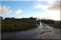
Above the stackyard of Gyre is the findspot (HY34030473) for what A.W. Johnston called 'chambered cinerary urns', which Anne Brundle of the Orkney Museum believes to have been used at the time to describe cists with divisions. Amazingly it is still unenclosed, occupying an area several metres in either direction that lies between the section of road above the stackyard and the field boundary walls. There are a few stones that appear to be the top of a short section of walling, but as the late 19th century road cuts through an older arrangement they are probably connected with that rather than the findspot.
It can be no coincidence that in 1974 a double cist HY30SW 12 was found by the stackyard the other side of the road (HY34090464). The archaeologist agrees with me that this area could therefore be the remains of a barrow cemetery. If the interpretation of Johnston's term is correct what is the reason for such a number of double cists in one location?
You may be viewing yesterday's version of this page. To see the most up to date information please register for a free account.
Do not use the above information on other web sites or publications without permission of the contributor.
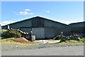
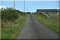
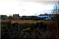
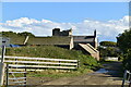
Nearby Images from Geograph Britain and Ireland:
©2024(licence)
©2024(licence)
©2008(licence)
©2024(licence)
©2008(licence)
The above images may not be of the site on this page, they are loaded from Geograph.
Please Submit an Image of this site or go out and take one for us!
Click here to see more info for this site
Nearby sites
Key: Red: member's photo, Blue: 3rd party photo, Yellow: other image, Green: no photo - please go there and take one, Grey: site destroyed
Download sites to:
KML (Google Earth)
GPX (GPS waypoints)
CSV (Garmin/Navman)
CSV (Excel)
To unlock full downloads you need to sign up as a Contributory Member. Otherwise downloads are limited to 50 sites.
Turn off the page maps and other distractions
Nearby sites listing. In the following links * = Image available
571m WSW 241° Orphir Round Church* Class I Pictish Symbol Stone (HY3349604429)
628m NE 46° Konger's Knowe* Artificial Mound (HY34460513)
988m SW 234° Harproo* Standing Stone (Menhir) (HY33190413)
1.4km ENE 73° Hillock of Breakna* Broch or Nuraghe (HY35330508)
1.4km ENE 73° The Hillock of Breakna Ancient Village or Settlement (HY35330508)
1.6km ESE 103° Toy Ness* Artificial Mound (HY35600429)
2.4km NE 44° Graystane* Standing Stone (Menhir) (HY35700638)
2.4km NE 44° Highbreck* Hillfort (HY35700640)
4.8km WNW 287° Sower Castle* Ancient Village or Settlement (HY29400620)
5.8km N 6° Summersdale* Barrow Cemetery (HY34741046)
7.1km NW 315° The Cairns* Cairn (HY29050987)
7.7km NW 314° Corn Hillock* Cairn (HY28481015)
7.9km NNW 331° Standing Stones Hotel* Chambered Cairn (HY30251165)
7.9km NNW 339° Barnhouse Stone* Standing Stone (Menhir) (HY31271217)
8.1km NW 314° Cummi Howe* Broch or Nuraghe (HY282104)
8.3km NNW 344° Maes Howe* Chambered Cairn (HY31821277)
8.4km NNE 16° Cuween Hill* Chambered Cairn (HY36421277)
8.5km NNW 336° Stenness* Stone Circle (HY30671252)
8.6km WNW 298° Quoyelsh* Ancient Village or Settlement (HY265089)
8.6km NNW 337° Barnhouse Settlement* Ancient Village or Settlement (HY30761270)
8.6km NNW 336° Watch Stone (Orkney)* Standing Stone (Menhir) (HY30551264)
8.7km NE 35° Nabban* Holy Well or Sacred Spring (HY391118)
8.8km N 2° Hill of Heddle* Round Barrow(s) (HY345135)
8.8km NNW 335° Lochview Mound* Cairn (HY304128)
8.9km NNW 335° Brodgar Farm Standing Stones* Standing Stones (HY303128)
View more nearby sites and additional images


 We would like to know more about this location. Please feel free to add a brief description and any relevant information in your own language.
 Wir möchten mehr über diese Stätte erfahren. Bitte zögern Sie nicht, eine kurze Beschreibung und relevante Informationen in Deutsch hinzuzufügen.
 Nous aimerions en savoir encore un peu sur les lieux. S'il vous plaît n'hesitez pas à ajouter une courte description et tous les renseignements pertinents dans votre propre langue.
 Quisieramos informarnos un poco más de las lugares. No dude en añadir una breve descripción y otros datos relevantes en su propio idioma.