<< Our Photo Pages >> Rockhill Iron Age Enclosure - Misc. Earthwork in England in Shropshire
Submitted by TheWhiteRider on Thursday, 01 March 2007 Page Views: 5603
Iron Age and Later PrehistorySite Name: Rockhill Iron Age EnclosureCountry: England County: Shropshire Type: Misc. Earthwork
Nearest Town: Clun
Map Ref: SO290785
Latitude: 52.399889N Longitude: 3.044957W
Condition:
| 5 | Perfect |
| 4 | Almost Perfect |
| 3 | Reasonable but with some damage |
| 2 | Ruined but still recognisable as an ancient site |
| 1 | Pretty much destroyed, possibly visible as crop marks |
| 0 | No data. |
| -1 | Completely destroyed |
| 5 | Superb |
| 4 | Good |
| 3 | Ordinary |
| 2 | Not Good |
| 1 | Awful |
| 0 | No data. |
| 5 | Can be driven to, probably with disabled access |
| 4 | Short walk on a footpath |
| 3 | Requiring a bit more of a walk |
| 2 | A long walk |
| 1 | In the middle of nowhere, a nightmare to find |
| 0 | No data. |
| 5 | co-ordinates taken by GPS or official recorded co-ordinates |
| 4 | co-ordinates scaled from a detailed map |
| 3 | co-ordinates scaled from a bad map |
| 2 | co-ordinates of the nearest village |
| 1 | co-ordinates of the nearest town |
| 0 | no data |
Internal Links:
External Links:
I have visited· I would like to visit
TheWhiteRider has visited here
")
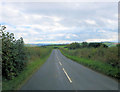
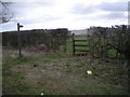
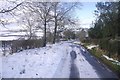
A small, roughly circular, enclosure comprising a single low bank and affording excellent views to the South.
Caer Caradoc (Chapel Lawn) is clearly visible from this location.
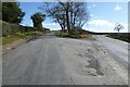
Easily accessible as a footpath runs right by it and there is ample room on the Pen-Y-Wern to Rockhill road to park up. The Pen-Y-Wern stone circle/cairn and standing stone are nearby.
You may be viewing yesterday's version of this page. To see the most up to date information please register for a free account.
")
Do not use the above information on other web sites or publications without permission of the contributor.
coldrum has found this location on Google Street View:
Nearby Images from Geograph Britain and Ireland:
©2013(licence)
©2008(licence)
©2022(licence)
©2019(licence)
©2018(licence)
The above images may not be of the site on this page, they are loaded from Geograph.
Please Submit an Image of this site or go out and take one for us!
Click here to see more info for this site
Nearby sites
Key: Red: member's photo, Blue: 3rd party photo, Yellow: other image, Green: no photo - please go there and take one, Grey: site destroyed
Download sites to:
KML (Google Earth)
GPX (GPS waypoints)
CSV (Garmin/Navman)
CSV (Excel)
To unlock full downloads you need to sign up as a Contributory Member. Otherwise downloads are limited to 50 sites.
Turn off the page maps and other distractions
Nearby sites listing. In the following links * = Image available
727m ENE 64° Clun Hill Glacial Erratic* Natural Stone / Erratic / Other Natural Feature (SO29667881)
917m ENE 75° Clun Hill Stones* Standing Stones (SO29897873)
2.3km E 82° Pen-Y-Wern Hill* Stone Circle (SO313788)
2.4km E 84° Pen-Y-Wern Conglomerate* Standing Stone (Menhir) (SO31407871)
2.4km WNW 294° Llanfair Hill East Standing Stone (Menhir) (SO26797950)
2.5km E 82° Pen-Y-Wern Outlier Standing Stone (Menhir) (SO31447880)
3.0km E 86° Fiddler's Elbow Standing Stone (Menhir) (SO32007865)
3.4km SE 143° Caer Caradoc (Chapel Lawn)* Hillfort (SO310758)
3.6km NNW 348° Oak Farm Bowl Barrow* Round Barrow(s) (SO283820)
3.6km W 271° Offa's Dyke west of Llanfair Hill Misc. Earthwork (SO25407862)
3.9km WNW 293° Llanfair Hill North Standing Stone (Menhir) (SO25428006)
4.1km NNW 340° Whitcott Keysett* Standing Stone (Menhir) (SO27648234)
4.4km NE 42° Radnor Wood Camp* Hillfort (SO320817)
5.6km ESE 108° Great Hagley* Standing Stone (Menhir) (SO343767)
5.7km NW 315° Fron Camp* Hillfort (SO250826)
6.1km S 184° Offa's Dyke Centre* Museum (SO2850172430)
6.4km NE 35° Bury Ditches (Shropshire)* Hillfort (SO327837)
6.8km S 190° Jacket's Well, The Jackets, Jackets Well* Holy Well or Sacred Spring (SO2776271836)
6.8km ESE 111° Castle Ditches (Shropshire)* Ancient Village or Settlement (SO35357594)
7.3km E 87° Hopton Castle Standing Stone (Menhir) (SO36297883)
7.4km NNW 336° St Chad's Well (nr Clun)* Holy Well or Sacred Spring (SO26068529)
8.3km E 82° Fairy Stone* Natural Stone / Erratic / Other Natural Feature (SO37237958)
8.6km SSE 168° Spaceguard Centre* Modern Stone Circle etc (SO3066970104)
9.1km ESE 123° Coxall Knoll* Hillfort (SO366734)
9.7km SE 133° Brampton Bryan Lady Well* Holy Well or Sacred Spring (SO36007172)
View more nearby sites and additional images


 We would like to know more about this location. Please feel free to add a brief description and any relevant information in your own language.
 Wir möchten mehr über diese Stätte erfahren. Bitte zögern Sie nicht, eine kurze Beschreibung und relevante Informationen in Deutsch hinzuzufügen.
 Nous aimerions en savoir encore un peu sur les lieux. S'il vous plaît n'hesitez pas à ajouter une courte description et tous les renseignements pertinents dans votre propre langue.
 Quisieramos informarnos un poco más de las lugares. No dude en añadir una breve descripción y otros datos relevantes en su propio idioma.