


<< Our Photo Pages >> Bleaberry Enclosure - Ancient Village or Settlement in England in Cumbria
Submitted by rich32 on Sunday, 14 December 2003 Page Views: 5806
Multi-periodSite Name: Bleaberry EnclosureCountry: England County: Cumbria Type: Ancient Village or Settlement
Nearest Town: Coniston Nearest Village: Torver
Map Ref: SD267950 Landranger Map Number: 96
Latitude: 54.345256N Longitude: 3.129083W
Condition:
| 5 | Perfect |
| 4 | Almost Perfect |
| 3 | Reasonable but with some damage |
| 2 | Ruined but still recognisable as an ancient site |
| 1 | Pretty much destroyed, possibly visible as crop marks |
| 0 | No data. |
| -1 | Completely destroyed |
| 5 | Superb |
| 4 | Good |
| 3 | Ordinary |
| 2 | Not Good |
| 1 | Awful |
| 0 | No data. |
| 5 | Can be driven to, probably with disabled access |
| 4 | Short walk on a footpath |
| 3 | Requiring a bit more of a walk |
| 2 | A long walk |
| 1 | In the middle of nowhere, a nightmare to find |
| 0 | No data. |
| 5 | co-ordinates taken by GPS or official recorded co-ordinates |
| 4 | co-ordinates scaled from a detailed map |
| 3 | co-ordinates scaled from a bad map |
| 2 | co-ordinates of the nearest village |
| 1 | co-ordinates of the nearest town |
| 0 | no data |
Internal Links:
External Links:
")
Have you visited this site? Please add a comment below.
You may be viewing yesterday's version of this page. To see the most up to date information please register for a free account.
")
")
Do not use the above information on other web sites or publications without permission of the contributor.
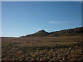
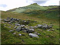
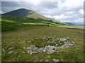
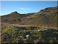
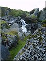
Nearby Images from Geograph Britain and Ireland:
©2018(licence)
©2009(licence)
©2009(licence)
©2018(licence)
©2009(licence)
The above images may not be of the site on this page, they are loaded from Geograph.
Please Submit an Image of this site or go out and take one for us!
Click here to see more info for this site
Nearby sites
Key: Red: member's photo, Blue: 3rd party photo, Yellow: other image, Green: no photo - please go there and take one, Grey: site destroyed
Download sites to:
KML (Google Earth)
GPX (GPS waypoints)
CSV (Garmin/Navman)
CSV (Excel)
To unlock full downloads you need to sign up as a Contributory Member. Otherwise downloads are limited to 50 sites.
Turn off the page maps and other distractions
Nearby sites listing. In the following links * = Image available
427m SW 216° Bleaberry Haws* Stone Circle (SD26449466)
1.2km NNE 19° Torver Beck Homestead* Ancient Village or Settlement (SD271961)
1.2km E 89° Hare Crags and Tranearth Beck* Artificial Mound (SD2792395001)
1.6km NE 42° Little Arrow* Stone Circle (SD278962)
2.4km NE 45° Banishead Stone Circle* Stone Circle (SD2846796700)
2.7km NE 50° Heathwaite How* Stone Circle (SD2876396672)
2.7km N 10° Old Man of Coniston and Goat Hawes* Cairn (SD272977)
3.6km NNW 338° Ring Cairn at Woody Crag, Seathwaite Tarn Ring Cairn (SD254984)
3.7km NNW 326° Ring Cairn, Lead Pike, Seathwaite Tarn Ring Cairn (SD247981)
3.7km NW 325° Ring Bank Enclosure, Lead Pike, Seathwaite Tarn Ring Cairn (SD246981)
3.7km SW 223° The Hawk Settlement* Ancient Village or Settlement (SD241923)
3.8km NW 326° Lead Pike, Seathwaite* Ring Cairn (SD246982)
4.2km NNW 345° Round Cairn at Raven Nest Howe, Seathwaite Tarn Ring Cairn (SD257991)
4.3km NNW 336° Ring Cairn, Tarn Brow, Seathwaite Tarn Ring Cairn (SD250990)
4.6km S 172° Blawith Fells and Tarn Riggs (near Beacon Tarn) Cairn (SD2725490383)
6.1km S 179° White Borran Cairn, Woodland Fell* Ring Cairn (SD2668788943)
6.1km WSW 245° Tarn Hill Cairn* Ring Cairn (SD211925)
6.7km SE 135° Bethecar Moor Round Cairn* Round Cairn (SD3142090164)
7.1km S 188° Giants Grave (Cumbria)* Ring Cairn (SD256880)
7.2km S 187° Giants Grave (Woodland)* Cairn (SD257879)
7.2km SSW 192° Heathwaite Fell Ancient Village or Settlement (SD251880)
7.6km NE 39° Holmes Fell and Uskdale Gap* Cairn (NY316008)
8.0km NW 321° Hardknott Round Cairn* Round Cairn (NY2171701328)
8.1km NW 322° Hardknott Roman Fort (MEDIOBOGDUM)* Promontory Fort / Cliff Castle (NY2184001469)
8.2km ESE 108° Stone Forest by Kimio Tsuchiya* Modern Stone Circle etc (SD34509230)
View more nearby sites and additional images


 We would like to know more about this location. Please feel free to add a brief description and any relevant information in your own language.
 Wir möchten mehr über diese Stätte erfahren. Bitte zögern Sie nicht, eine kurze Beschreibung und relevante Informationen in Deutsch hinzuzufügen.
 Nous aimerions en savoir encore un peu sur les lieux. S'il vous plaît n'hesitez pas à ajouter une courte description et tous les renseignements pertinents dans votre propre langue.
 Quisieramos informarnos un poco más de las lugares. No dude en añadir una breve descripción y otros datos relevantes en su propio idioma.