<< Text Pages >> Heathwaite Fell - Ancient Village or Settlement in England in Cumbria
Submitted by vicky on Wednesday, 18 September 2002 Page Views: 8708
Multi-periodSite Name: Heathwaite FellCountry: England County: Cumbria Type: Ancient Village or Settlement
Nearest Town: Ulverston Nearest Village: Blawith
Map Ref: SD251880 Landranger Map Number: 96
Latitude: 54.282125N Longitude: 3.151932W
Condition:
| 5 | Perfect |
| 4 | Almost Perfect |
| 3 | Reasonable but with some damage |
| 2 | Ruined but still recognisable as an ancient site |
| 1 | Pretty much destroyed, possibly visible as crop marks |
| 0 | No data. |
| -1 | Completely destroyed |
| 5 | Superb |
| 4 | Good |
| 3 | Ordinary |
| 2 | Not Good |
| 1 | Awful |
| 0 | No data. |
| 5 | Can be driven to, probably with disabled access |
| 4 | Short walk on a footpath |
| 3 | Requiring a bit more of a walk |
| 2 | A long walk |
| 1 | In the middle of nowhere, a nightmare to find |
| 0 | No data. |
| 5 | co-ordinates taken by GPS or official recorded co-ordinates |
| 4 | co-ordinates scaled from a detailed map |
| 3 | co-ordinates scaled from a bad map |
| 2 | co-ordinates of the nearest village |
| 1 | co-ordinates of the nearest town |
| 0 | no data |
Internal Links:
External Links:
Ancient Settlement in Cumbria
Have you visited this site? Please add a comment below.
You may be viewing yesterday's version of this page. To see the most up to date information please register for a free account.
Do not use the above information on other web sites or publications without permission of the contributor.
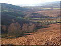
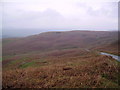
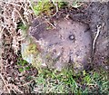
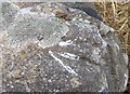
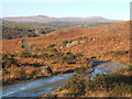
Nearby Images from Geograph Britain and Ireland:
©2009(licence)
©2006(licence)
©2020(licence)
©2018(licence)
©2008(licence)
The above images may not be of the site on this page, they are loaded from Geograph.
Please Submit an Image of this site or go out and take one for us!
Click here to see more info for this site
Nearby sites
Key: Red: member's photo, Blue: 3rd party photo, Yellow: other image, Green: no photo - please go there and take one, Grey: site destroyed
Download sites to:
KML (Google Earth)
GPX (GPS waypoints)
CSV (Garmin/Navman)
CSV (Excel)
To unlock full downloads you need to sign up as a Contributory Member. Otherwise downloads are limited to 50 sites.
Turn off the page maps and other distractions
Nearby sites listing. In the following links * = Image available
499m E 89° Giants Grave (Cumbria)* Ring Cairn (SD256880)
606m E 99° Giants Grave (Woodland)* Cairn (SD257879)
1.8km ENE 58° White Borran Cairn, Woodland Fell* Ring Cairn (SD2668788943)
1.9km SE 132° Heathwaite Settlement* Ancient Village or Settlement (SD265867)
2.7km SSE 149° Great Burney* Cairn (SD26458565)
2.8km SSE 151° Great Burney* Ring Cairn (SD2640185541)
3.2km NE 41° Blawith Fells and Tarn Riggs (near Beacon Tarn) Cairn (SD2725490383)
3.9km SSW 197° St Mary's Well (Kirkby Ireleth) Holy Well or Sacred Spring (SD2389584270)
4.4km NNW 346° The Hawk Settlement* Ancient Village or Settlement (SD241923)
4.6km SE 142° Lowick Ring Cairn (SD279843)
4.7km SSW 198° Kirkby Hall Holy Well (Kirkby Ireleth) Holy Well or Sacred Spring (SD2357083550)
4.7km SE 142° The Beacon (Cumbria)* Stone Circle (SD28008423)
5.0km S 179° Kirkby Moor Ringcairn* Round Cairn (SD25148299)
5.2km S 179° The Kirk Stone Row* Multiple Stone Rows / Avenue (SD2509182770)
5.3km S 179° The Kirk Ring Cairn* Stone Circle (SD2507082693)
5.8km W 262° Ash House* Standing Stones (SD19288729)
6.0km NW 317° Tarn Hill Cairn* Ring Cairn (SD211925)
6.7km ENE 70° Bethecar Moor Round Cairn* Round Cairn (SD3142090164)
6.8km N 10° Bleaberry Haws* Stone Circle (SD26449466)
7.1km WNW 284° Thwaites Fell* Standing Stone (Menhir) (SD1824089813)
7.2km WNW 299° Frith Hall* Ancient Village or Settlement (SD189916)
7.2km NNE 12° Bleaberry Enclosure* Ancient Village or Settlement (SD267950)
7.5km WNW 289° Beckstones and Logan Beck Bridge* Ancient Village or Settlement (SD18069051)
7.5km NNE 21° Hare Crags and Tranearth Beck* Artificial Mound (SD2792395001)
7.9km W 270° Swinside* Stone Circle (SD17168817)
View more nearby sites and additional images


 We would like to know more about this location. Please feel free to add a brief description and any relevant information in your own language.
 Wir möchten mehr über diese Stätte erfahren. Bitte zögern Sie nicht, eine kurze Beschreibung und relevante Informationen in Deutsch hinzuzufügen.
 Nous aimerions en savoir encore un peu sur les lieux. S'il vous plaît n'hesitez pas à ajouter une courte description et tous les renseignements pertinents dans votre propre langue.
 Quisieramos informarnos un poco más de las lugares. No dude en añadir una breve descripción y otros datos relevantes en su propio idioma.