


<< Our Photo Pages >> Lindal Standing Stone - Standing Stone (Menhir) in England in Cumbria
Submitted by DavidRaven on Wednesday, 25 October 2006 Page Views: 6762
Neolithic and Bronze AgeSite Name: Lindal Standing StoneCountry: England County: Cumbria Type: Standing Stone (Menhir)
Nearest Town: Dalton-in-Furness Nearest Village: Lindal in Furness
Map Ref: SD255749
Latitude: 54.164474N Longitude: 3.142534W
Condition:
| 5 | Perfect |
| 4 | Almost Perfect |
| 3 | Reasonable but with some damage |
| 2 | Ruined but still recognisable as an ancient site |
| 1 | Pretty much destroyed, possibly visible as crop marks |
| 0 | No data. |
| -1 | Completely destroyed |
| 5 | Superb |
| 4 | Good |
| 3 | Ordinary |
| 2 | Not Good |
| 1 | Awful |
| 0 | No data. |
| 5 | Can be driven to, probably with disabled access |
| 4 | Short walk on a footpath |
| 3 | Requiring a bit more of a walk |
| 2 | A long walk |
| 1 | In the middle of nowhere, a nightmare to find |
| 0 | No data. |
| 5 | co-ordinates taken by GPS or official recorded co-ordinates |
| 4 | co-ordinates scaled from a detailed map |
| 3 | co-ordinates scaled from a bad map |
| 2 | co-ordinates of the nearest village |
| 1 | co-ordinates of the nearest town |
| 0 | no data |
Internal Links:
External Links:
")
You may be viewing yesterday's version of this page. To see the most up to date information please register for a free account.
")
Do not use the above information on other web sites or publications without permission of the contributor.
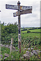
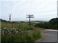
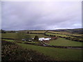
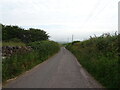
Nearby Images from Geograph Britain and Ireland:
©2019(licence)
©2021(licence)
©2006(licence)
©2021(licence)
©2015(licence)
The above images may not be of the site on this page, they are loaded from Geograph.
Please Submit an Image of this site or go out and take one for us!
Click here to see more info for this site
Nearby sites
Key: Red: member's photo, Blue: 3rd party photo, Yellow: other image, Green: no photo - please go there and take one, Grey: site destroyed
Download sites to:
KML (Google Earth)
GPX (GPS waypoints)
CSV (Garmin/Navman)
CSV (Excel)
To unlock full downloads you need to sign up as a Contributory Member. Otherwise downloads are limited to 50 sites.
Turn off the page maps and other distractions
Nearby sites listing. In the following links * = Image available
905m ESE 121° Great Urswick Burial Chamber* Burial Chamber or Dolmen (SD26277442)
942m SSE 147° Urswick Stone Walls* Ancient Village or Settlement (SD260741)
1.5km ESE 120° The Priapus Stone* Standing Stone (Menhir) (SD26757415)
1.5km ESE 116° Great Urswick Cross* Ancient Cross (SD26867422)
1.9km E 83° Great Urswick Fort* Hillfort (SD274751)
2.0km ENE 74° Great Urswick Long Barrow* Long Barrow (SD27427540)
2.8km ESE 108° Birkrigg Common Platform Cairn* Cairn (SD282740)
3.0km E 99° Birkrigg Common Round Cairn 1 Round Cairn (SD285744)
3.2km ESE 102° Birkrigg Common Cemetery* Barrow Cemetery (SD28627421)
3.3km E 94° Birkrigg Common Round Cairn 3 Round Cairn (SD288746)
3.3km E 96° Birkrigg Common Enclosures and Appleby Hill and Stone Circle Ancient Village or Settlement (SD288745)
3.3km E 95° Birkrigg Common Settlement* Ancient Village or Settlement (SD28837453)
3.4km E 99° Birkrigg Common Round Cairn 2 Round Cairn (SD289743)
3.8km ESE 103° Druids Temple (Cumbria)* Stone Circle (SD29237396)
3.9km W 280° St Helen's Well (Askam and Ireleth) Holy Well or Sacred Spring (SD2161075640)
4.1km S 176° St Michael's Well (Gleaston) Holy Well or Sacred Spring (SD2572070820)
5.6km NE 43° Hoad Hill* Cairn (SD294790)
7.8km N 356° The Kirk Ring Cairn* Stone Circle (SD2507082693)
7.9km N 356° The Kirk Stone Row* Multiple Stone Rows / Avenue (SD2509182770)
8.1km N 357° Kirkby Moor Ringcairn* Round Cairn (SD25148299)
8.9km NNW 347° Kirkby Hall Holy Well (Kirkby Ireleth) Holy Well or Sacred Spring (SD2357083550)
9.4km NE 39° Sheriff's Well (Greenodd) Holy Well or Sacred Spring (SD3150082130)
9.5km N 349° St Mary's Well (Kirkby Ireleth) Holy Well or Sacred Spring (SD2389584270)
9.7km NNE 14° The Beacon (Cumbria)* Stone Circle (SD28008423)
9.7km NNE 13° Lowick Ring Cairn (SD279843)
View more nearby sites and additional images


 We would like to know more about this location. Please feel free to add a brief description and any relevant information in your own language.
 Wir möchten mehr über diese Stätte erfahren. Bitte zögern Sie nicht, eine kurze Beschreibung und relevante Informationen in Deutsch hinzuzufügen.
 Nous aimerions en savoir encore un peu sur les lieux. S'il vous plaît n'hesitez pas à ajouter une courte description et tous les renseignements pertinents dans votre propre langue.
 Quisieramos informarnos un poco más de las lugares. No dude en añadir una breve descripción y otros datos relevantes en su propio idioma.