<< Our Photo Pages >> Skara Brae - Ancient Village or Settlement in Scotland in Orkney
Submitted by Andy B on Tuesday, 07 January 2020 Page Views: 96296
Multi-periodSite Name: Skara BraeCountry: Scotland County: Orkney Type: Ancient Village or Settlement
Nearest Town: Stromness Nearest Village: Sandwick
Map Ref: HY2312518745 Landranger Map Number: 6
Latitude: 59.048748N Longitude: 3.341718W
Condition:
| 5 | Perfect |
| 4 | Almost Perfect |
| 3 | Reasonable but with some damage |
| 2 | Ruined but still recognisable as an ancient site |
| 1 | Pretty much destroyed, possibly visible as crop marks |
| 0 | No data. |
| -1 | Completely destroyed |
| 5 | Superb |
| 4 | Good |
| 3 | Ordinary |
| 2 | Not Good |
| 1 | Awful |
| 0 | No data. |
| 5 | Can be driven to, probably with disabled access |
| 4 | Short walk on a footpath |
| 3 | Requiring a bit more of a walk |
| 2 | A long walk |
| 1 | In the middle of nowhere, a nightmare to find |
| 0 | No data. |
| 5 | co-ordinates taken by GPS or official recorded co-ordinates |
| 4 | co-ordinates scaled from a detailed map |
| 3 | co-ordinates scaled from a bad map |
| 2 | co-ordinates of the nearest village |
| 1 | co-ordinates of the nearest town |
| 0 | no data |
Internal Links:
External Links:
I have visited· I would like to visit
SteveC sharipdx church-grim coin whese001 would like to visit
drolaf visited on 15th Jun 2022 - their rating: Cond: 3 Amb: 5 Access: 4
Wazza12 visited on 13th Jul 2021 - their rating: Cond: 4 Amb: 4 Access: 5
hidebasket visited on 1st Oct 2019 - their rating: Cond: 5 Amb: 5 Access: 5
Catrinm visited on 28th Aug 2019 - their rating: Cond: 4 Amb: 4 Access: 4 Incredible architecture
Suzipam1 visited on 1st Jan 2019 - their rating: Cond: 4 Amb: 5 Access: 4 Its illuminating what my ancestors could do. Made me very proud
sba_dk visited on 18th Jul 2018 - their rating: Cond: 5 Amb: 5 Access: 4
bishop_pam visited on 19th Apr 2018 - their rating: Cond: 5 Amb: 5 Access: 5
RedKite1985 visited on 14th Sep 2016 - their rating: Cond: 5 Amb: 5 Access: 5 A truly fascinating location.
wildtalents visited on 15th Jul 2015 - their rating: Cond: 5 Amb: 5 Access: 4 Absolutely stunningly preserved settlement, down to the stone dressers, hearths, sleeping quarters . . . a shame one of the houses is sealed off but there's enough to keep you occupied for an hour. It can get very busy though.
TwinFlamesKiss visited on 1st Apr 2014 - their rating: Cond: 5 Amb: 5 Access: 5
Jansold visited on 4th Jun 2013 - their rating: Cond: 4 Amb: 5 Access: 4
ModernExplorers visited on 5th Mar 2013 - their rating: Cond: 3 Amb: 5 Access: 5 Fascinating settlement and well worth a visit to see how our ancestors lived
43559959 visited on 26th Nov 2011 - their rating: Cond: 5 Amb: 4 Access: 4
crystalskull84 visited on 13th Aug 2011 - their rating: Cond: 5 Amb: 5 Access: 4
megalithicmatt visited on 1st Jun 2011 - their rating: Cond: 4 Amb: 4 Access: 5 Nice, but the tourist focus and access detracts from the experience.
Richard13 visited on 1st Jul 1999 - their rating: Cond: 5 Amb: 5 Access: 5
FrothNinja visited on 1st Nov 1986 - their rating: Cond: 3 Amb: 5 Access: 5
Megalithic89 visited on 1st Sep 1986 - their rating: Cond: 5 Amb: 5 Access: 5
smparry123 visited - their rating: Cond: 5 Amb: 5 Access: 4
smparry123 visited - their rating: Cond: 5 Amb: 5 Access: 4
crystalskull84 visited - their rating: Cond: 5 Amb: 5 Access: 4
RockHugger visited - their rating: Cond: 5 Amb: 5 Access: 4
Chappers60 visited - their rating: Cond: 5 Amb: 5 Access: 5
Izozo PAB Tonnox Orcinus rrmoser SandyG DrewParsons jeffrep AngieLake TimPrevett Andy B davidmorgan MegalithJunkie NickyD Redfun mrcrow Pallando have visited here
Average ratings for this site from all visit loggers: Condition: 4.52 Ambience: 4.83 Access: 4.48
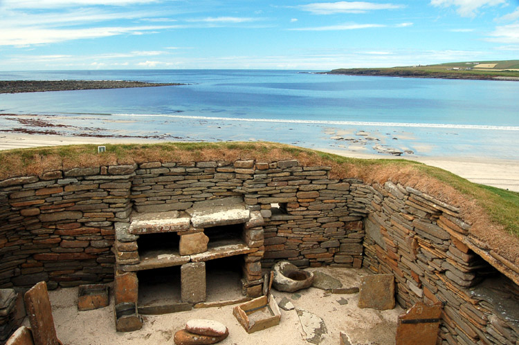
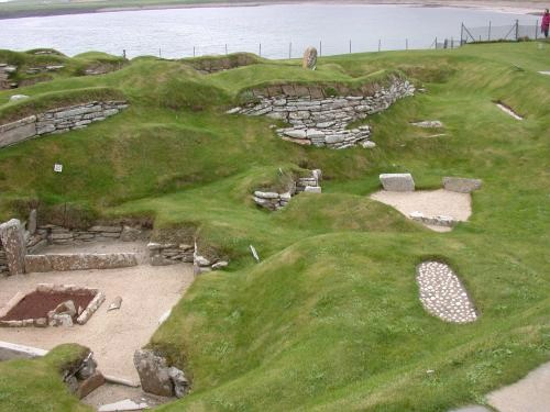
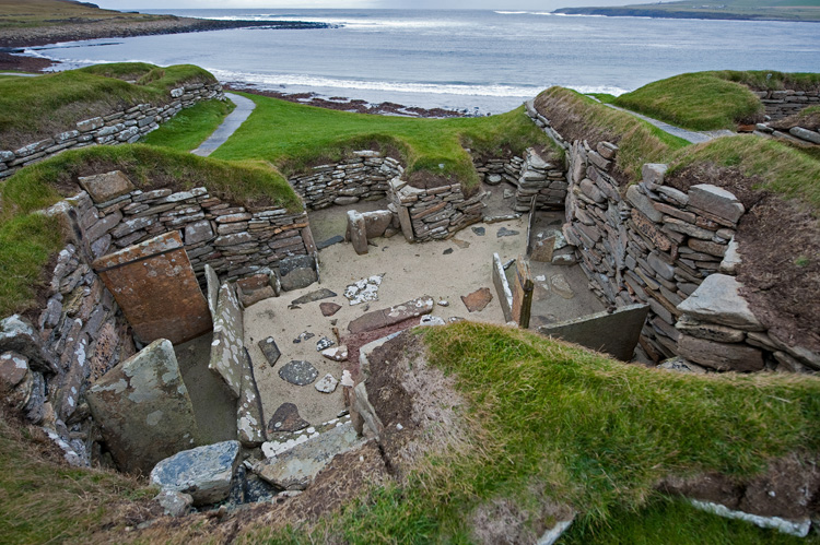
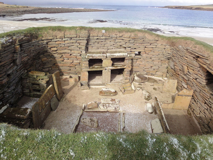
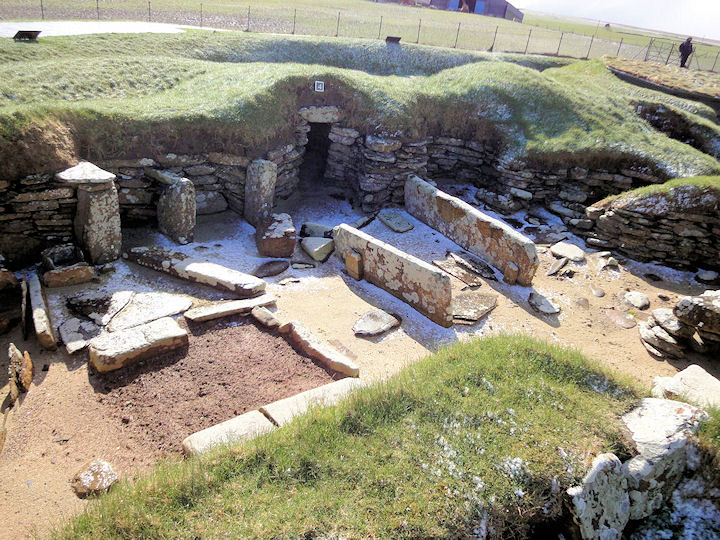
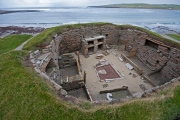
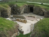
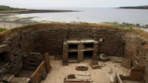
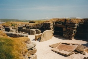
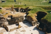
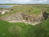
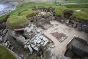
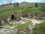
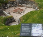
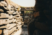
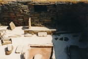
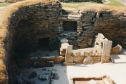
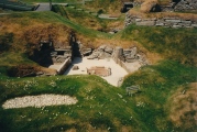
The village consists of ten clustered houses, which were sunk into the ground -- into midden, the decomposition of organic matter, shells, bones, and other matter -- to act as insulation against harsh weather. Intricate passageways connect most of the dwellings with each other.
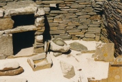
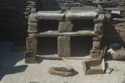
The typical dwelling contains a large square room containing a large hearth for heating and cooking, ingenious drainage, and a number of stone-built pieces of furniture, including cupboards, dressers, seats, storage boxes, and sleeping areas that would have probably used straw or sheep skins to make it as comfortable as possible.
The remains of Skara Brae that one sees today -- except for two earlier dwellings -- are from the second phase of it occupation, as they sit above an earlier settlement. The second phase took place about half-way through it occupation.
After nearly 600 years of occupation, around 2500 B.C, it appears that the settlement was abandoned. One theory suggests that the weather changed drastically, causing the inhabitants to leave. Another theory claims that it was abandoned because of changes in the nature of Neolithic society from tight-knit communities to a more dispersed one.
Original text by Vicky Morgan
See below for a beautifully made 3D model of a Neolithic House at Skara Brae by Hugo Anderson-Whymark, go to the latest comment on our page to give it a spin and click on his name for many more models from Ness of Brodgar and other sites
Note: Composer Erland Cooper and Poet John Burnside visit some of Orkney's Neolithic sites for BBC Radio 4. And also below in the comments on our page are links to archive photos from V Gordon Childe's dig from the 1920s
You may be viewing yesterday's version of this page. To see the most up to date information please register for a free account.


These are just the first 25 photos of Skara Brae. If you log in with a free user account you will be able to see our entire collection.
Do not use the above information on other web sites or publications without permission of the contributor.
Click here to see more info for this site
Nearby sites
Key: Red: member's photo, Blue: 3rd party photo, Yellow: other image, Green: no photo - please go there and take one, Grey: site destroyed
Download sites to:
KML (Google Earth)
GPX (GPS waypoints)
CSV (Garmin/Navman)
CSV (Excel)
To unlock full downloads you need to sign up as a Contributory Member. Otherwise downloads are limited to 50 sites.
Turn off the page maps and other distractions
Nearby sites listing. In the following links * = Image available
878m SSW 199° Knowe of Geoso* Chambered Cairn (HY22821792)
1.1km N 357° Knowe of Verron* Broch or Nuraghe (HY231198)
1.2km S 177° Knowe of Nebigarth* Barrow Cemetery (HY23161750)
1.4km N 6° Linnahowe* Ancient Village or Settlement (HY233201)
1.6km SSE 165° Knowe of Angerow* Round Barrow(s) (HY235172)
1.8km N 5° Upper Garson* Standing Stones (HY233205)
2.1km SSW 199° Broch of Borwick* Broch or Nuraghe (HY2241416777)
2.2km NE 49° Russel Howe* Cairn (HY24842016)
2.4km S 172° South Seatter Round Barrow(s) (HY23391637)
2.5km ESE 113° Hurkisgarth* Round Barrow(s) (HY25451770)
3.2km NNE 15° Vestra Fiold Chambered Cairn (HY240218)
3.3km SSW 201° Brough of Bigging* Hillfort (HY219157)
3.4km NNE 31° Holy Kirk Stones Chambered Cairn (HY249216)
3.4km NNE 15° Vestrafiold* Ancient Mine, Quarry or other Industry (HY241220)
3.8km SE 133° Via Barrow* Round Barrow(s) (HY25841609)
3.9km SE 136° Fiddlerhouse* Standing Stones (HY25771588)
4.0km SE 133° Stones of Via* Ancient Village or Settlement (HY260160)
4.0km SE 133° Via Mound* Round Cairn (HY26011598)
4.4km SSE 148° Voy.* Ancient Village or Settlement (HY25351497)
4.5km NE 48° Knowes of Howana Barrow Cemetery (HY26542169)
4.6km E 81° Hackland* Standing Stone (Menhir) (HY27691936)
4.9km SE 141° Voy Crannogs* Crannog (HY261149)
5.3km SE 132° Burroughston 2* Broch or Nuraghe (HY270151)
5.4km SE 131° Stackrue-Lyking Mound* Misc. Earthwork (HY27121514)
5.4km SE 131° Stackrue* Broch or Nuraghe (HY271151)
View more nearby sites and additional images


 We would like to know more about this location. Please feel free to add a brief description and any relevant information in your own language.
 Wir möchten mehr über diese Stätte erfahren. Bitte zögern Sie nicht, eine kurze Beschreibung und relevante Informationen in Deutsch hinzuzufügen.
 Nous aimerions en savoir encore un peu sur les lieux. S'il vous plaît n'hesitez pas à ajouter une courte description et tous les renseignements pertinents dans votre propre langue.
 Quisieramos informarnos un poco más de las lugares. No dude en añadir una breve descripción y otros datos relevantes en su propio idioma.