<< Our Photo Pages >> Sarn-y-Bryn-Caled - Timber Circle in Wales in Powys
Submitted by vicky on Sunday, 22 December 2002 Page Views: 13912
Neolithic and Bronze AgeSite Name: Sarn-y-Bryn-CaledCountry: Wales
NOTE: This site is 1.194 km away from the location you searched for.
County: Powys Type: Timber Circle
Map Ref: SJ219049 Landranger Map Number: 126
Latitude: 52.636205N Longitude: 3.155499W
Condition:
| 5 | Perfect |
| 4 | Almost Perfect |
| 3 | Reasonable but with some damage |
| 2 | Ruined but still recognisable as an ancient site |
| 1 | Pretty much destroyed, possibly visible as crop marks |
| 0 | No data. |
| -1 | Completely destroyed |
| 5 | Superb |
| 4 | Good |
| 3 | Ordinary |
| 2 | Not Good |
| 1 | Awful |
| 0 | No data. |
| 5 | Can be driven to, probably with disabled access |
| 4 | Short walk on a footpath |
| 3 | Requiring a bit more of a walk |
| 2 | A long walk |
| 1 | In the middle of nowhere, a nightmare to find |
| 0 | No data. |
| 5 | co-ordinates taken by GPS or official recorded co-ordinates |
| 4 | co-ordinates scaled from a detailed map |
| 3 | co-ordinates scaled from a bad map |
| 2 | co-ordinates of the nearest village |
| 1 | co-ordinates of the nearest town |
| 0 | no data |
Internal Links:
External Links:
")
A Reconstruction of the Early Bronze Age timber circle is shown on this CPAT page. The site is south of Welshpool, built about 2100 BC. The circle was formed of massive postholes — twenty in the outer circle and six in the inner circle — which originally held timbers about half a metre in diameter. The reconstruction, modelled on the famous contemporary stone circle at Stonehenge, was undertaken with assistance from Powis Castle Estates. Source: CPAT
You may be viewing yesterday's version of this page. To see the most up to date information please register for a free account.
Do not use the above information on other web sites or publications without permission of the contributor.
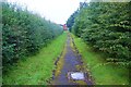
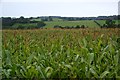
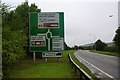
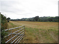
Nearby Images from Geograph Britain and Ireland:
©2012(licence)
©2012(licence)
©2012(licence)
©2009(licence)
©2012(licence)
The above images may not be of the site on this page, they are loaded from Geograph.
Please Submit an Image of this site or go out and take one for us!
Click here to see more info for this site
Nearby sites
Key: Red: member's photo, Blue: 3rd party photo, Yellow: other image, Green: no photo - please go there and take one, Grey: site destroyed
Download sites to:
KML (Google Earth)
GPX (GPS waypoints)
CSV (Garmin/Navman)
CSV (Excel)
To unlock full downloads you need to sign up as a Contributory Member. Otherwise downloads are limited to 50 sites.
Turn off the page maps and other distractions
Nearby sites listing. In the following links * = Image available
106m NW 310° Welshpool A Cursus Cursus (SJ21820497)
165m NNW 334° Sarn-y-bryn-caled II Cursus Cursus (SJ21830505)
278m WSW 248° Welshpool A Cursus Cursus (SJ21640480)
337m N 11° Sarn-y-bryn-caled II Cursus Cursus (SJ21970523)
2.5km NNE 15° Powysland Museum* Museum (SJ226073)
2.5km NNE 21° Welshpool Eisteddfod Circle* Modern Stone Circle etc (SJ2286307263)
2.8km NNE 12° Maen Llog* Standing Stone (Menhir) (SJ225076)
3.8km SSW 202° Dyffryn Lane, Berriew* Henge (SJ2044101409)
3.9km SSW 203° Maen Beuno* Standing Stone (Menhir) (SJ2029201303)
4.7km ENE 78° Beacon Ring* Hillfort (SJ265058)
5.1km SW 216° St Beuno (Berriew)* Natural Stone / Erratic / Other Natural Feature (SJ18780082)
5.6km ENE 58° Trinity Well, Cletterwood Holy Well or Sacred Spring (SJ26650780)
7.3km SSE 152° Chirbury* Henge (SO25189838)
8.0km S 181° Ffridd Faldwyn* Hillfort (SO217969)
8.1km N 359° Trinity Well, Guilsfield Holy Well or Sacred Spring (SJ21881297)
8.1km N 2° Gaer Fawr (Guilsfield)* Hillfort (SJ223130)
8.2km E 83° Walton Camp* Hillfort (SJ301057)
8.9km NW 311° Ffynnon y Clawdd Llesg* Holy Well or Sacred Spring (SJ153109)
9.8km SE 127° Middleton Hall* Standing Stone (Menhir) (SO297989)
10.0km NE 42° Trinity Well (Trewern) Holy Well or Sacred Spring (SJ287123)
10.3km SE 126° Middleton Hill Round Barrow(s) (SO302987)
10.5km NW 322° Meifod* Ancient Cross (SJ155132)
10.5km SSE 148° Calcot Camp* Hillfort (SO273959)
10.5km ESE 114° Castle Ring (Rorrington)* Hillfort (SJ315005)
10.7km SE 127° Mitchell's Fold* Stone Circle (SO30429837)
View more nearby sites and additional images


 We would like to know more about this location. Please feel free to add a brief description and any relevant information in your own language.
 Wir möchten mehr über diese Stätte erfahren. Bitte zögern Sie nicht, eine kurze Beschreibung und relevante Informationen in Deutsch hinzuzufügen.
 Nous aimerions en savoir encore un peu sur les lieux. S'il vous plaît n'hesitez pas à ajouter une courte description et tous les renseignements pertinents dans votre propre langue.
 Quisieramos informarnos un poco más de las lugares. No dude en añadir una breve descripción y otros datos relevantes en su propio idioma.