


<< Text Pages >> Gowk Stone - Standing Stone (Menhir) in Scotland in Midlothian
Submitted by vicky on Sunday, 22 December 2002 Page Views: 13620
Neolithic and Bronze AgeSite Name: Gowk Stone Alternative Name: Auchencorth StoneCountry: Scotland
NOTE: This site is 5.0 km away from the location you searched for.
County: Midlothian Type: Standing Stone (Menhir)
Nearest Town: Penicuik Nearest Village: Auchencorth
Map Ref: NT20425764 Landranger Map Number: 66
Latitude: 55.805456N Longitude: 3.271179W
Condition:
| 5 | Perfect |
| 4 | Almost Perfect |
| 3 | Reasonable but with some damage |
| 2 | Ruined but still recognisable as an ancient site |
| 1 | Pretty much destroyed, possibly visible as crop marks |
| 0 | No data. |
| -1 | Completely destroyed |
| 5 | Superb |
| 4 | Good |
| 3 | Ordinary |
| 2 | Not Good |
| 1 | Awful |
| 0 | No data. |
| 5 | Can be driven to, probably with disabled access |
| 4 | Short walk on a footpath |
| 3 | Requiring a bit more of a walk |
| 2 | A long walk |
| 1 | In the middle of nowhere, a nightmare to find |
| 0 | No data. |
| 5 | co-ordinates taken by GPS or official recorded co-ordinates |
| 4 | co-ordinates scaled from a detailed map |
| 3 | co-ordinates scaled from a bad map |
| 2 | co-ordinates of the nearest village |
| 1 | co-ordinates of the nearest town |
| 0 | no data |
Be the first person to rate this site - see the 'Contribute!' box in the right hand menu.
Internal Links:
External Links:
I have visited· I would like to visit
adam2112 would like to visit
For more information see Canmore site no. 51642.
This standing stone is also featured on The Ancient Stones: A Guide to Standing Stones and Stone Circles in the South of Scotland - see their entry for he Gowk Stone, Auchencorth, Penicuik, which includes a description, directions for finding this stone together with nearby parking, folklore and fieldnotes. The Ancient Stones adds that this stone "occupies a commanding position above the River North Esk … out of interest, the Cuckoo is sometimes referred to as the Gowk."
Note: Have you visited this site? Do you have any photographs or information to add?
You may be viewing yesterday's version of this page. To see the most up to date information please register for a free account.
Do not use the above information on other web sites or publications without permission of the contributor.
Nearby Images from Geograph Britain and Ireland:
©2009(licence)
©2005(licence)
©2009(licence)
©2005(licence)
©2009(licence)
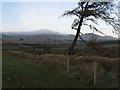
The above images may not be of the site on this page, they are loaded from Geograph.
Please Submit an Image of this site or go out and take one for us!
Click here to see more info for this site
Nearby sites
Key: Red: member's photo, Blue: 3rd party photo, Yellow: other image, Green: no photo - please go there and take one, Grey: site destroyed
Download sites to:
KML (Google Earth)
GPX (GPS waypoints)
CSV (Garmin/Navman)
CSV (Excel)
To unlock full downloads you need to sign up as a Contributory Member. Otherwise downloads are limited to 50 sites.
Turn off the page maps and other distractions
Nearby sites listing. In the following links * = Image available
2.3km NNW 329° Braidwood Fort* Hillfort (NT1928059630)
2.4km NNW 327° Camp Hill Burnt Mound South* Artificial Mound (NT19145970)
2.4km NNW 328° Camp Hill Burnt Mound North* Artificial Mound (NT19185973)
3.2km WNW 298° Monks Rig, Font Stone* Ancient Cross (NT17585919)
4.3km N 358° Carnethy Hill cairn* Cairn (NT20386192)
5.0km NNE 25° Marchwell (Glencourse) Stone Circle (NT22646211)
6.5km NE 39° Glencorse Cup and Ring Marked Stone* Rock Art (NT24676261)
6.7km NNE 21° Castle Law* Hillfort (NT2290063870)
6.9km NNE 21° Castle Knowe (Glencorse)* Ancient Village or Settlement (NT22996404)
8.7km NE 51° St Matthew's Well (Roslin)* Holy Well or Sacred Spring (NT27326298)
9.1km N 356° Clubbiedean Fort* Promontory Fort / Cliff Castle (NT19956671)
9.2km NNE 20° Caerketton Hill* Cairn (NT23706621)
9.5km NNE 24° Hillend (Loanhead)* Hillfort (NT24526620)
9.8km SSE 146° Northshield Rings* Hillfort (NT25734934)
10.3km NNW 347° St Mungo's Well (Edinburgh)* Holy Well or Sacred Spring (NT18346773)
11.4km NNE 19° Caiy Stane* Standing Stone (Menhir) (NT2424368357)
11.4km NNE 20° Fairmiliehead (Edinburgh) Cairn (NT24466828)
11.5km E 96° Yorkston Erratic Natural Stone / Erratic / Other Natural Feature (NT31875620)
11.5km NW 319° Kaimes Standing Stones (NT130665)
11.5km NW 322° Dalmahoy Hill Hillfort (NT135669)
11.7km NNE 24° Galachlaw Cairn* Cairn (NT25366831)
11.8km NNE 19° 1, West Camus Road* Modern Stone Circle etc (NT2441068763)
11.9km NNW 333° Newhouse Standing Stone Standing Stone (Menhir) (NT15296838)
12.3km NNE 18° Buck Stane* Standing Stone (Menhir) (NT24506922)
12.6km N 10° Craiglockart Hill Vitrified Fort Hillfort (NT22827006)
View more nearby sites and additional images


 We would like to know more about this location. Please feel free to add a brief description and any relevant information in your own language.
 Wir möchten mehr über diese Stätte erfahren. Bitte zögern Sie nicht, eine kurze Beschreibung und relevante Informationen in Deutsch hinzuzufügen.
 Nous aimerions en savoir encore un peu sur les lieux. S'il vous plaît n'hesitez pas à ajouter une courte description et tous les renseignements pertinents dans votre propre langue.
 Quisieramos informarnos un poco más de las lugares. No dude en añadir una breve descripción y otros datos relevantes en su propio idioma.