<< Text Pages >> Caputh Cursus - Cursus in Scotland in Perth and Kinross
Submitted by EssexMan on Wednesday, 07 April 2010 Page Views: 3013
Neolithic and Bronze AgeSite Name: Caputh CursusCountry: Scotland
NOTE: This site is 0.5 km away from the location you searched for.
County: Perth and Kinross Type: Cursus
Nearest Town: Blairgowrie Nearest Village: Caputh
Map Ref: NO17153998 Landranger Map Number: 53
Latitude: 56.544482N Longitude: 3.349028W
Condition:
| 5 | Perfect |
| 4 | Almost Perfect |
| 3 | Reasonable but with some damage |
| 2 | Ruined but still recognisable as an ancient site |
| 1 | Pretty much destroyed, possibly visible as crop marks |
| 0 | No data. |
| -1 | Completely destroyed |
| 5 | Superb |
| 4 | Good |
| 3 | Ordinary |
| 2 | Not Good |
| 1 | Awful |
| 0 | No data. |
| 5 | Can be driven to, probably with disabled access |
| 4 | Short walk on a footpath |
| 3 | Requiring a bit more of a walk |
| 2 | A long walk |
| 1 | In the middle of nowhere, a nightmare to find |
| 0 | No data. |
| 5 | co-ordinates taken by GPS or official recorded co-ordinates |
| 4 | co-ordinates scaled from a detailed map |
| 3 | co-ordinates scaled from a bad map |
| 2 | co-ordinates of the nearest village |
| 1 | co-ordinates of the nearest town |
| 0 | no data |
Internal Links:
External Links:
Major Cursus in Perthshire
Status: Certain
NMR No. NO13NE 89
Extent: 2300mx38m
Terminal type: None
1.73km of central bank and ditches still stand
Note: This location marks one terminal (end) of a cursus monument. The location of the other terminal can be found in the Nearby Site list below.
You may be viewing yesterday's version of this page. To see the most up to date information please register for a free account.
Do not use the above information on other web sites or publications without permission of the contributor.
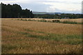
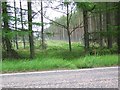
Nearby Images from Geograph Britain and Ireland:

©2022(licence)
©2009(licence)

©2007(licence)
©2008(licence)

©2007(licence)
The above images may not be of the site on this page, they are loaded from Geograph.
Please Submit an Image of this site or go out and take one for us!
Click here to see more info for this site
Nearby sites
Key: Red: member's photo, Blue: 3rd party photo, Yellow: other image, Green: no photo - please go there and take one, Grey: site destroyed
Download sites to:
KML (Google Earth)
GPX (GPS waypoints)
CSV (Garmin/Navman)
CSV (Excel)
To unlock full downloads you need to sign up as a Contributory Member. Otherwise downloads are limited to 50 sites.
Turn off the page maps and other distractions
Nearby sites listing. In the following links * = Image available
963m WNW 301° Cleaven Dyke* Cursus (NO16334049)
1.5km WSW 249° The Tron* Modern Stone Circle etc (NO1575439489)
1.7km WNW 300° Caputh Cursus Cursus (NO15664088)
1.9km SW 217° Meikleour Natural Stone / Erratic / Other Natural Feature (NO15993849)
3.6km WNW 298° Tower of Lethendy Class III Pictish Cross Slab (NO140417)
3.9km S 184° Gallow Hill Wood* Rock Art (NO16803605)
4.0km S 184° Gallowhill Wood* Stone Row / Alignment (NO16813604)
4.1km NNW 342° Ardblair* Stone Circle (NO1598943883)
4.1km NW 316° Aikenhead Farm (Blairgowrie) Rock Art (NO143430)
4.3km SSW 192° Moonshade Standing Stones (NO16153576)
4.4km NNE 29° The Welton Stone Circle (NO1937243766)
4.4km SSW 211° Cargill Symbol Stone Class I Pictish Symbol Stone (NO14773623)
4.6km SSW 196° Hangie's Stone Standing Stone (Menhir) (NO15753557)
4.8km S 177° East Whitefield Stone Circle (NO17293514)
5.1km SSW 192° Gallowhill. Stone Circle (NO1635)
5.5km NNE 27° Rattray Cursus Cursus (NO19744479)
5.8km NNW 327° Kinloch Cairn* Cairn (NO14074485)
6.6km NNE 26° Drumend* Holy Well or Sacred Spring (NO202458)
6.6km NNE 26° Drumend* Standing Stone (Menhir) (NO20184582)
6.7km E 97° Kettins Burn* Class II Pictish Symbol Stone (NO23783906)
6.8km NNW 348° Milton of Drumlochy Round Barrow(s) (NO15834662)
7.0km WSW 257° Murthly* Stone Circle (NO10273852)
7.3km W 279° Glendelvine House Standing Stone (Menhir) (NO09954130)
7.5km SSW 197° Craigmakerran* Standing Stones (NO1477832850)
7.6km SSW 198° Wolfhill* Stone Circle (NO147328)
View more nearby sites and additional images


 We would like to know more about this location. Please feel free to add a brief description and any relevant information in your own language.
 Wir möchten mehr über diese Stätte erfahren. Bitte zögern Sie nicht, eine kurze Beschreibung und relevante Informationen in Deutsch hinzuzufügen.
 Nous aimerions en savoir encore un peu sur les lieux. S'il vous plaît n'hesitez pas à ajouter une courte description et tous les renseignements pertinents dans votre propre langue.
 Quisieramos informarnos un poco más de las lugares. No dude en añadir una breve descripción y otros datos relevantes en su propio idioma.