<< Text Pages >> Croes-llechau (Bronllys) - Long Barrow in Wales in Powys
Submitted by Anne T on Friday, 28 July 2017 Page Views: 1125
Neolithic and Bronze AgeSite Name: Croes-llechau (Bronllys) Alternative Name: CroesllechauCountry: Wales County: Powys Type: Long Barrow
Nearest Village: Bronllys / Three Cocks
Map Ref: SO169357
Latitude: 52.013482N Longitude: 3.212239W
Condition:
| 5 | Perfect |
| 4 | Almost Perfect |
| 3 | Reasonable but with some damage |
| 2 | Ruined but still recognisable as an ancient site |
| 1 | Pretty much destroyed, possibly visible as crop marks |
| 0 | No data. |
| -1 | Completely destroyed |
| 5 | Superb |
| 4 | Good |
| 3 | Ordinary |
| 2 | Not Good |
| 1 | Awful |
| 0 | No data. |
| 5 | Can be driven to, probably with disabled access |
| 4 | Short walk on a footpath |
| 3 | Requiring a bit more of a walk |
| 2 | A long walk |
| 1 | In the middle of nowhere, a nightmare to find |
| 0 | No data. |
| 5 | co-ordinates taken by GPS or official recorded co-ordinates |
| 4 | co-ordinates scaled from a detailed map |
| 3 | co-ordinates scaled from a bad map |
| 2 | co-ordinates of the nearest village |
| 1 | co-ordinates of the nearest town |
| 0 | no data |
Internal Links:
External Links:
Long Barrow in Powys
This long barrow, now destroyed, is listed on The Northern Antiquarian (TNA); see their page for Croes-llechau, Bronllys, Breconshire. TNA tell us that this tomb was first documented by Theophilus Jones more than 200 years ago, saying: “In a field called Croeslechau about two miles eastward of (Talgarth), but in the parish of Bronllys and on a farm called Bryn-y-groes, is a cromlech, not merely interesting on account of its antiquity, but from the circumstance of a white thorn growing close, and indeed under part of it, which has gradually raised the horizontal or covering-stone several inches out of its original position; it is therefore not only venerable as a relic of very ancient days, but as a natural curiosity.”
The TNA page shows a line drawing of the tomb from 1809, and gives two separate book references for it.
Note: Have you visited this site or do you have any information or historical documents related to it?
You may be viewing yesterday's version of this page. To see the most up to date information please register for a free account.
Do not use the above information on other web sites or publications without permission of the contributor.
Nearby Images from Geograph Britain and Ireland:
©2015(licence)
©2015(licence)
©2015(licence)
©2015(licence)
©2015(licence)
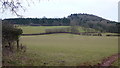
The above images may not be of the site on this page, they are loaded from Geograph.
Please Submit an Image of this site or go out and take one for us!
Click here to see more info for this site
Nearby sites
Key: Red: member's photo, Blue: 3rd party photo, Yellow: other image, Green: no photo - please go there and take one, Grey: site destroyed
Download sites to:
KML (Google Earth)
GPX (GPS waypoints)
CSV (Garmin/Navman)
CSV (Excel)
To unlock full downloads you need to sign up as a Contributory Member. Otherwise downloads are limited to 50 sites.
Turn off the page maps and other distractions
Nearby sites listing. In the following links * = Image available
1.3km SE 126° Ffostil North Chambered Long Barrow* Chambered Tomb (SO17913495)
1.3km SE 128° Ffostil South Chambered Long Barrow* Chambered Tomb (SO179349)
1.8km NNW 331° Pipton* Chambered Tomb (SO16043729)
2.0km NNE 17° Gweryfed Park* Hillfort (SO17503759)
2.2km NNW 343° Spread Eagle Cursus Cursus (SO16283784)
2.4km NNW 342° Spread Eagle Cursus Cursus (SO16203795)
2.4km N 356° Bronllys 2* Round Barrow(s) (SO16783811)
2.7km NNE 28° Little Lodge* Chambered Tomb (SO18223806)
2.9km NNE 23° Coed-y-Polyn Cairn (SO18083832)
3.4km SSW 203° Talgarth Hillfort (SO155326)
3.5km SE 134° Wern Frank Wood Cairn Cairn (SO194332)
4.3km WNW 297° Bronllys 1 Round Barrow(s) (SO131377)
4.5km SSW 203° Penywyrlod* Chambered Tomb (SO15053156)
4.6km WNW 297° Llyswen Camp Hillfort (SO128379)
5.2km SSE 161° Bwlch Bach a'r Grib cairns* Cairn (SO18503070)
5.6km N 354° Ffynnon Gynydd* Holy Well or Sacred Spring (SO1641241282)
5.7km S 169° Castell Dinas* Hillfort (SO179301)
5.7km NW 311° Boughrood Tumulus* Round Barrow(s) (SO126395)
6.0km NNE 16° Brynrhydd Common* Misc. Earthwork (SO18644145)
6.0km NW 309° Llangoed Maen Hir* Standing Stone (Menhir) (SO123396)
6.2km W 267° St Mathew's Church Well* Holy Well or Sacred Spring (SO107355)
6.3km WSW 242° Llanfilo Camp* Hillfort (SO113328)
6.4km W 260° Tre Durn Wood Fort Hillfort (SO106347)
6.4km SSE 166° Cwm Fforest Modern Stone Circle etc (SO1833029440)
6.4km NNE 20° St Maelog's Cross* Ancient Cross (SO1923941704)
View more nearby sites and additional images


 We would like to know more about this location. Please feel free to add a brief description and any relevant information in your own language.
 Wir möchten mehr über diese Stätte erfahren. Bitte zögern Sie nicht, eine kurze Beschreibung und relevante Informationen in Deutsch hinzuzufügen.
 Nous aimerions en savoir encore un peu sur les lieux. S'il vous plaît n'hesitez pas à ajouter une courte description et tous les renseignements pertinents dans votre propre langue.
 Quisieramos informarnos un poco más de las lugares. No dude en añadir una breve descripción y otros datos relevantes en su propio idioma.