<< Text Pages >> Llanerch Stone Alignment - Standing Stones in Wales in Powys
Submitted by coldrum on Thursday, 04 February 2010 Page Views: 3804
Neolithic and Bronze AgeSite Name: Llanerch Stone AlignmentCountry: Wales
NOTE: This site is 0.8 km away from the location you searched for.
County: Powys Type: Standing Stones
Map Ref: SO15775871
Latitude: 52.220135N Longitude: 3.234402W
Condition:
| 5 | Perfect |
| 4 | Almost Perfect |
| 3 | Reasonable but with some damage |
| 2 | Ruined but still recognisable as an ancient site |
| 1 | Pretty much destroyed, possibly visible as crop marks |
| 0 | No data. |
| -1 | Completely destroyed |
| 5 | Superb |
| 4 | Good |
| 3 | Ordinary |
| 2 | Not Good |
| 1 | Awful |
| 0 | No data. |
| 5 | Can be driven to, probably with disabled access |
| 4 | Short walk on a footpath |
| 3 | Requiring a bit more of a walk |
| 2 | A long walk |
| 1 | In the middle of nowhere, a nightmare to find |
| 0 | No data. |
| 5 | co-ordinates taken by GPS or official recorded co-ordinates |
| 4 | co-ordinates scaled from a detailed map |
| 3 | co-ordinates scaled from a bad map |
| 2 | co-ordinates of the nearest village |
| 1 | co-ordinates of the nearest town |
| 0 | no data |
Internal Links:
External Links:
Standing Stones in Powys
"Three irregular stones, found at 24m intervals along a common alignment, not intervisible. Possibly the remains of a field boundary."
Source: Coflein.
You may be viewing yesterday's version of this page. To see the most up to date information please register for a free account.
Do not use the above information on other web sites or publications without permission of the contributor.
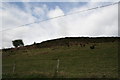
Nearby Images from Geograph Britain and Ireland:
©2008(licence)
©2008(licence)
©2008(licence)
©2008(licence)
©2008(licence)
The above images may not be of the site on this page, they are loaded from Geograph.
Please Submit an Image of this site or go out and take one for us!
Click here to see more info for this site
Nearby sites
Key: Red: member's photo, Blue: 3rd party photo, Yellow: other image, Green: no photo - please go there and take one, Grey: site destroyed
Download sites to:
KML (Google Earth)
GPX (GPS waypoints)
CSV (Garmin/Navman)
CSV (Excel)
To unlock full downloads you need to sign up as a Contributory Member. Otherwise downloads are limited to 50 sites.
Turn off the page maps and other distractions
Nearby sites listing. In the following links * = Image available
130m S 183° Llanerch Stone* Rock Art (SO15765858)
429m E 90° The Van* Round Barrow(s) (SO162587)
1.6km W 272° Cwm Maerdy* Standing Stone (Menhir) (SO14205879)
1.7km WSW 240° Rhos-Maen* Stone Circle (SO143579)
1.7km SSE 147° Bryn-y-Maen* Standing Stone (Menhir) (SO16685728)
1.9km S 182° Bryn-Y-Maen Barrow Round Barrow(s) (SO15665686)
1.9km S 184° Pedwar Maen* Stone Row / Alignment (SO156568)
2.1km ESE 102° Llanfihangel Nant Melan* Standing Stone (Menhir) (SO1783258231)
2.7km W 262° Graig Camp* Hillfort (SO131584)
3.0km NNW 327° Rhosdeglia Stone Standing Stone (Menhir) (SO1420661245)
3.7km SSE 147° Cwmceste Barrow* Round Barrow(s) (SO1775655582)
3.7km SE 132° Gilwern Brook Barrows* Round Barrow(s) (SO18515618)
4.6km SSW 200° Giant's Grave (Powys)* Round Barrow(s) (SO141544)
5.1km S 174° Wern Hill Camp* Hillfort (SO162536)
5.9km W 265° Gelli Hill Cairn A* Cairn (SO09895828)
6.1km WSW 246° Cwm Stone* Standing Stone (Menhir) (SO10185630)
6.1km NE 50° Whimble Barrow* Round Barrow(s) (SO205626)
6.3km W 265° Gelli Hill Circle* Stone Circle (SO095583)
6.3km W 266° Gelli Hill Standing Stone* Standing Stone (Menhir) (SO09425837)
6.4km NNE 15° Cwm Bwch Barrows* Round Barrow(s) (SO175649)
6.4km WSW 252° Gwernfach Cairns I,II,III & IV* Cairn (SO096568)
6.5km W 269° Gelli Hill Cairn B* Cairn (SO09305870)
6.6km NE 47° Whinyard Rocks Barrows* Round Barrow(s) (SO207631)
6.7km N 357° Shepherd's Tump* Round Barrow(s) (SO155654)
6.8km NNE 33° Black Mixen Barrows* Round Barrow(s) (SO196643)
View more nearby sites and additional images


 We would like to know more about this location. Please feel free to add a brief description and any relevant information in your own language.
 Wir möchten mehr über diese Stätte erfahren. Bitte zögern Sie nicht, eine kurze Beschreibung und relevante Informationen in Deutsch hinzuzufügen.
 Nous aimerions en savoir encore un peu sur les lieux. S'il vous plaît n'hesitez pas à ajouter une courte description et tous les renseignements pertinents dans votre propre langue.
 Quisieramos informarnos un poco más de las lugares. No dude en añadir una breve descripción y otros datos relevantes en su propio idioma.