<< Our Photo Pages >> Craigmakerran - Standing Stones in Scotland in Perth and Kinross
Submitted by vicky on Saturday, 25 September 2004 Page Views: 10328
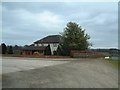
Neolithic and Bronze AgeSite Name: Craigmakerran Alternative Name: Wolfhill, Loanhead, Newlands, BlairmuirCountry: Scotland County: Perth and Kinross Type: Standing Stones
Map Ref: NO1477832850 Landranger Map Number: 53
Latitude: 56.480021N Longitude: 3.385254W
Condition:
| 5 | Perfect |
| 4 | Almost Perfect |
| 3 | Reasonable but with some damage |
| 2 | Ruined but still recognisable as an ancient site |
| 1 | Pretty much destroyed, possibly visible as crop marks |
| 0 | No data. |
| -1 | Completely destroyed |
| 5 | Superb |
| 4 | Good |
| 3 | Ordinary |
| 2 | Not Good |
| 1 | Awful |
| 0 | No data. |
| 5 | Can be driven to, probably with disabled access |
| 4 | Short walk on a footpath |
| 3 | Requiring a bit more of a walk |
| 2 | A long walk |
| 1 | In the middle of nowhere, a nightmare to find |
| 0 | No data. |
| 5 | co-ordinates taken by GPS or official recorded co-ordinates |
| 4 | co-ordinates scaled from a detailed map |
| 3 | co-ordinates scaled from a bad map |
| 2 | co-ordinates of the nearest village |
| 1 | co-ordinates of the nearest town |
| 0 | no data |
Internal Links:
External Links:
I have visited· I would like to visit
golux visited on 10th May 2010 - their rating: Cond: 3 Amb: 3 Access: 5 Easy access by the farm track between Cragmerrakin and Wolfhill which runs right next to these stones.
hamish have visited here
")
Canmore site no. 28636.
You may be viewing yesterday's version of this page. To see the most up to date information please register for a free account.
")
")
")
Do not use the above information on other web sites or publications without permission of the contributor.
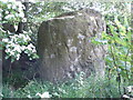
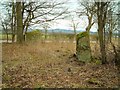
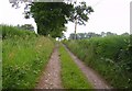
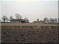
Nearby Images from Geograph Britain and Ireland:
©2008(licence)
©2006(licence)
©2009(licence)
©2006(licence)
©2006(licence)
The above images may not be of the site on this page, they are loaded from Geograph.
Please Submit an Image of this site or go out and take one for us!
Click here to see more info for this site
Nearby sites
Key: Red: member's photo, Blue: 3rd party photo, Yellow: other image, Green: no photo - please go there and take one, Grey: site destroyed
Download sites to:
KML (Google Earth)
GPX (GPS waypoints)
CSV (Garmin/Navman)
CSV (Excel)
To unlock full downloads you need to sign up as a Contributory Member. Otherwise downloads are limited to 50 sites.
Turn off the page maps and other distractions
Nearby sites listing. In the following links * = Image available
92m SW 236° Wolfhill* Stone Circle (NO147328)
1.3km SSW 208° Blackfaulds* Stone Circle (NO14133167)
1.7km SE 136° Witches' Stone, St Martins* Standing Stone (Menhir) (NO15923160)
1.8km S 191° Tammieteeth* Cairn (NO14403109)
2.0km SE 142° St. Martins* Stone Circle (NO160312)
2.1km SSW 207° Williamston Stone Circle (NO138310)
2.3km SE 145° Brownies Knowe Stone Circle (NO16063092)
2.5km NNE 28° Gallowhill. Stone Circle (NO1635)
2.8km SW 235° Druids Seat* Stone Circle (NO12483132)
2.9km NNE 18° Hangie's Stone Standing Stone (Menhir) (NO15753557)
3.2km NNE 24° Moonshade Standing Stones (NO16153576)
3.4km N 359° Cargill Symbol Stone Class I Pictish Symbol Stone (NO14773623)
3.4km NE 46° East Whitefield Stone Circle (NO17293514)
3.8km NNE 31° Gallowhill Wood* Stone Row / Alignment (NO16813604)
3.8km NNE 31° Gallow Hill Wood* Rock Art (NO16803605)
4.2km WSW 244° Colen* Stone Circle (NO110311)
5.3km W 262° Overbenchil* Standing Stone (Menhir) (NO095322)
5.6km S 171° Shianbank NW* Stone Circle (NO15552731)
5.6km S 171° Shianbank SE* Stone Circle (NO15562729)
5.7km SSW 211° Scone Cursus Cursus (NO11712803)
5.8km N 11° Meikleour Natural Stone / Erratic / Other Natural Feature (NO15993849)
5.9km SSW 212° Scone Cursus Cursus (NO11532797)
5.9km E 86° Collace Pictish Stone* Class I Pictish Symbol Stone (NO20693319)
6.3km W 265° Newmill souterrain* Souterrain (Fogou, Earth House) (NO08513239)
6.4km ESE 106° Bandirran* Stone Circle (NO20913099)
View more nearby sites and additional images


 We would like to know more about this location. Please feel free to add a brief description and any relevant information in your own language.
 Wir möchten mehr über diese Stätte erfahren. Bitte zögern Sie nicht, eine kurze Beschreibung und relevante Informationen in Deutsch hinzuzufügen.
 Nous aimerions en savoir encore un peu sur les lieux. S'il vous plaît n'hesitez pas à ajouter une courte description et tous les renseignements pertinents dans votre propre langue.
 Quisieramos informarnos un poco más de las lugares. No dude en añadir una breve descripción y otros datos relevantes en su propio idioma.