<< Our Photo Pages >> Tammieteeth - Cairn in Scotland in Perth and Kinross
Submitted by cosmic on Sunday, 06 August 2006 Page Views: 6316
Neolithic and Bronze AgeSite Name: Tammieteeth Alternative Name: Williamston, CairnbeddieCountry: Scotland
NOTE: This site is 1.3 km away from the location you searched for.
County: Perth and Kinross Type: Cairn
Nearest Town: Perth
Map Ref: NO14403109
Latitude: 56.464145N Longitude: 3.390811W
Condition:
| 5 | Perfect |
| 4 | Almost Perfect |
| 3 | Reasonable but with some damage |
| 2 | Ruined but still recognisable as an ancient site |
| 1 | Pretty much destroyed, possibly visible as crop marks |
| 0 | No data. |
| -1 | Completely destroyed |
| 5 | Superb |
| 4 | Good |
| 3 | Ordinary |
| 2 | Not Good |
| 1 | Awful |
| 0 | No data. |
| 5 | Can be driven to, probably with disabled access |
| 4 | Short walk on a footpath |
| 3 | Requiring a bit more of a walk |
| 2 | A long walk |
| 1 | In the middle of nowhere, a nightmare to find |
| 0 | No data. |
| 5 | co-ordinates taken by GPS or official recorded co-ordinates |
| 4 | co-ordinates scaled from a detailed map |
| 3 | co-ordinates scaled from a bad map |
| 2 | co-ordinates of the nearest village |
| 1 | co-ordinates of the nearest town |
| 0 | no data |
Internal Links:
External Links:
I have visited· I would like to visit
SolarMegalith visited on 10th Aug 2017 - their rating: Cond: 2 Amb: 3 Access: 4
")
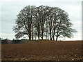
Remains of a cairn now marked by tree circle.
You may be viewing yesterday's version of this page. To see the most up to date information please register for a free account.
")
")
")
")
Do not use the above information on other web sites or publications without permission of the contributor.
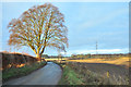
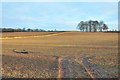
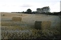
Nearby Images from Geograph Britain and Ireland:
©2006(licence)
©2012(licence)
©2012(licence)
©2016(licence)
©2021(licence)
The above images may not be of the site on this page, they are loaded from Geograph.
Please Submit an Image of this site or go out and take one for us!
Click here to see more info for this site
Nearby sites
Key: Red: member's photo, Blue: 3rd party photo, Yellow: other image, Green: no photo - please go there and take one, Grey: site destroyed
Download sites to:
KML (Google Earth)
GPX (GPS waypoints)
CSV (Garmin/Navman)
CSV (Excel)
To unlock full downloads you need to sign up as a Contributory Member. Otherwise downloads are limited to 50 sites.
Turn off the page maps and other distractions
Nearby sites listing. In the following links * = Image available
605m W 260° Williamston Stone Circle (NO138310)
639m NNW 334° Blackfaulds* Stone Circle (NO14133167)
1.6km ENE 70° Witches' Stone, St Martins* Standing Stone (Menhir) (NO15923160)
1.6km E 85° St. Martins* Stone Circle (NO160312)
1.7km E 95° Brownies Knowe Stone Circle (NO16063092)
1.7km N 9° Wolfhill* Stone Circle (NO147328)
1.8km N 11° Craigmakerran* Standing Stones (NO1477832850)
1.9km W 276° Druids Seat* Stone Circle (NO12483132)
3.4km W 269° Colen* Stone Circle (NO110311)
3.9km SSE 162° Shianbank NW* Stone Circle (NO15552731)
4.0km SSE 162° Shianbank SE* Stone Circle (NO15562729)
4.1km SW 220° Scone Cursus Cursus (NO11712803)
4.2km NNE 21° Gallowhill. Stone Circle (NO1635)
4.2km SW 221° Scone Cursus Cursus (NO11532797)
4.7km NNE 16° Hangie's Stone Standing Stone (Menhir) (NO15753557)
4.8km SSW 192° Sandy Road* Stone Circle (NO1327526463)
4.8km SSW 192° Sandy Road East Stone Circle (NO13282646)
4.9km S 169° Murrayshall* Standing Stone (Menhir) (NO1519926265)
5.0km NE 34° East Whitefield Stone Circle (NO17293514)
5.0km NNE 19° Moonshade Standing Stones (NO16153576)
5.0km WNW 282° Overbenchil* Standing Stone (Menhir) (NO095322)
5.1km N 3° Cargill Symbol Stone Class I Pictish Symbol Stone (NO14773623)
5.3km SE 145° Shien Hill* Round Cairn (NO1735926678)
5.5km WSW 238° King's Stone (Perth)* Standing Stone (Menhir) (NO09712828)
5.5km NNE 25° Gallowhill Wood* Stone Row / Alignment (NO16813604)
View more nearby sites and additional images


 We would like to know more about this location. Please feel free to add a brief description and any relevant information in your own language.
 Wir möchten mehr über diese Stätte erfahren. Bitte zögern Sie nicht, eine kurze Beschreibung und relevante Informationen in Deutsch hinzuzufügen.
 Nous aimerions en savoir encore un peu sur les lieux. S'il vous plaît n'hesitez pas à ajouter une courte description et tous les renseignements pertinents dans votre propre langue.
 Quisieramos informarnos un poco más de las lugares. No dude en añadir una breve descripción y otros datos relevantes en su propio idioma.