<< Text Pages >> Twyn Ceiliog Round Cairn - Cairn in Wales in Powys
Submitted by coldrum on Monday, 18 October 2010 Page Views: 2111
Neolithic and Bronze AgeSite Name: Twyn Ceiliog Round CairnCountry: Wales County: Powys Type: Cairn
Map Ref: SO0990813103
Latitude: 51.809277N Longitude: 3.308173W
Condition:
| 5 | Perfect |
| 4 | Almost Perfect |
| 3 | Reasonable but with some damage |
| 2 | Ruined but still recognisable as an ancient site |
| 1 | Pretty much destroyed, possibly visible as crop marks |
| 0 | No data. |
| -1 | Completely destroyed |
| 5 | Superb |
| 4 | Good |
| 3 | Ordinary |
| 2 | Not Good |
| 1 | Awful |
| 0 | No data. |
| 5 | Can be driven to, probably with disabled access |
| 4 | Short walk on a footpath |
| 3 | Requiring a bit more of a walk |
| 2 | A long walk |
| 1 | In the middle of nowhere, a nightmare to find |
| 0 | No data. |
| 5 | co-ordinates taken by GPS or official recorded co-ordinates |
| 4 | co-ordinates scaled from a detailed map |
| 3 | co-ordinates scaled from a bad map |
| 2 | co-ordinates of the nearest village |
| 1 | co-ordinates of the nearest town |
| 0 | no data |
Be the first person to rate this site - see the 'Contribute!' box in the right hand menu.
Internal Links:
External Links:
Cairn in Powys
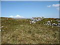
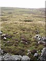
"On the crest of a limestone ridge is a large cairn; 10m diameter and 2m high. A slight central depression may be an original feature or an attempt to rob the site."
Source: Coflein
You may be viewing yesterday's version of this page. To see the most up to date information please register for a free account.
Do not use the above information on other web sites or publications without permission of the contributor.
Nearby Images from Geograph Britain and Ireland:
©2008(licence)
©2013(licence)
©2012(licence)
©2012(licence)
©2008(licence)
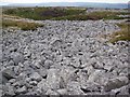
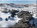
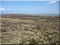
The above images may not be of the site on this page, they are loaded from Geograph.
Please Submit an Image of this site or go out and take one for us!
Click here to see more info for this site
Nearby sites
Key: Red: member's photo, Blue: 3rd party photo, Yellow: other image, Green: no photo - please go there and take one, Grey: site destroyed
Download sites to:
KML (Google Earth)
GPX (GPS waypoints)
CSV (Garmin/Navman)
CSV (Excel)
To unlock full downloads you need to sign up as a Contributory Member. Otherwise downloads are limited to 50 sites.
Turn off the page maps and other distractions
Nearby sites listing. In the following links * = Image available
591m W 274° Twyn Ceiliog Cairn 2 Cairn (SO0931813155)
1.1km NW 307° Garn Felen Enclosure 2 Ancient Village or Settlement (SO0902513791)
1.2km WNW 295° Carn-Y-Bugail Cairn (SO0880613629)
1.2km WNW 300° Garn Felen Cairn (SO0885613724)
1.3km NW 306° Garn Felen Enclosure 1 Ancient Village or Settlement (SO0889213878)
1.3km SW 224° Odyn-fach Stone Circle (SO090122)
1.3km NW 326° Cwar-Y-Hendre Ancient Village or Settlement (SO092142)
1.4km SW 215° Garn Ddu Standing Stone Standing Stone (Menhir) (SO09111200)
2.1km E 92° Trefil-Las Round Barrow(s) (SO1213)
2.5km NW 325° Gwaun Nant Ddu Ancient Village or Settlement (SO0847615214)
2.6km W 274° Cwm Criban Cairn (SO0734313320)
2.6km NW 322° Gwaun Nant Ddu Stone Standing Stone (Menhir) (SO0834815158)
2.6km W 271° Pontsticill Inscribed Stone* Early Christian Sculptured Stone (SO0726513176)
2.7km W 281° Buarth Y Caerau 2 Cairn (SO0729613638)
2.7km NNE 27° Darren Ddu Enclosures Misc. Earthwork (SO112155)
3.0km W 278° Buarth Y Caerau Hut Circles Ancient Village or Settlement (SO0695213557)
3.0km NW 320° Nany Y Ychen Misc. Earthwork (SO0804015447)
3.2km NE 49° Garn Fawr (Mynydd Llangyndir)* Cairn (SO12351514)
3.4km NNE 27° Clo Cadno 2 Cairn Cairn (SO115161)
3.4km NW 313° Nany Y Ychen Cairn Cairn (SO0745215486)
3.4km WSW 250° Abercriban Ciarn 1 Round Cairn (SO06651201)
3.4km NNE 28° Clo Cadno Cairn Cairn (SO116161)
3.5km NE 37° Blaen Cwmclaisfer Cairn Cairn (SO121159)
3.6km W 272° Waun Rydd Cairn 1 Cairn (SO0625513310)
4.1km NNE 27° Nant-y-Wern* Stone Row / Alignment (SO1184816732)
View more nearby sites and additional images


 We would like to know more about this location. Please feel free to add a brief description and any relevant information in your own language.
 Wir möchten mehr über diese Stätte erfahren. Bitte zögern Sie nicht, eine kurze Beschreibung und relevante Informationen in Deutsch hinzuzufügen.
 Nous aimerions en savoir encore un peu sur les lieux. S'il vous plaît n'hesitez pas à ajouter une courte description et tous les renseignements pertinents dans votre propre langue.
 Quisieramos informarnos un poco más de las lugares. No dude en añadir una breve descripción y otros datos relevantes en su propio idioma.