


<< Text Pages >> Tyle Clydach - Hillfort in Wales in Powys
Submitted by coldrum on Monday, 18 October 2010 Page Views: 3760
Iron Age and Later PrehistorySite Name: Tyle ClydachCountry: Wales
NOTE: This site is 1.5 km away from the location you searched for.
County: Powys Type: Hillfort
Map Ref: SO09742175
Latitude: 51.886974N Longitude: 3.312869W
Condition:
| 5 | Perfect |
| 4 | Almost Perfect |
| 3 | Reasonable but with some damage |
| 2 | Ruined but still recognisable as an ancient site |
| 1 | Pretty much destroyed, possibly visible as crop marks |
| 0 | No data. |
| -1 | Completely destroyed |
| 5 | Superb |
| 4 | Good |
| 3 | Ordinary |
| 2 | Not Good |
| 1 | Awful |
| 0 | No data. |
| 5 | Can be driven to, probably with disabled access |
| 4 | Short walk on a footpath |
| 3 | Requiring a bit more of a walk |
| 2 | A long walk |
| 1 | In the middle of nowhere, a nightmare to find |
| 0 | No data. |
| 5 | co-ordinates taken by GPS or official recorded co-ordinates |
| 4 | co-ordinates scaled from a detailed map |
| 3 | co-ordinates scaled from a bad map |
| 2 | co-ordinates of the nearest village |
| 1 | co-ordinates of the nearest town |
| 0 | no data |
Be the first person to rate this site - see the 'Contribute!' box in the right hand menu.
Internal Links:
External Links:
Hillfort in Powys
From Coflein:
"A spur-end enclosure, 120m by 75m, is defined by a bank and ditch, with natural scarps on the east."
Source: Coflein
You may be viewing yesterday's version of this page. To see the most up to date information please register for a free account.
Do not use the above information on other web sites or publications without permission of the contributor.
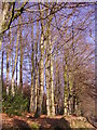
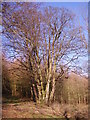
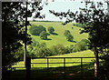
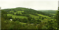
Nearby Images from Geograph Britain and Ireland:
©2008(licence)
©2008(licence)
©2022(licence)
©2022(licence)
©2022(licence)
The above images may not be of the site on this page, they are loaded from Geograph.
Please Submit an Image of this site or go out and take one for us!
Click here to see more info for this site
Nearby sites
Key: Red: member's photo, Blue: 3rd party photo, Yellow: other image, Green: no photo - please go there and take one, Grey: site destroyed
Download sites to:
KML (Google Earth)
GPX (GPS waypoints)
CSV (Garmin/Navman)
CSV (Excel)
To unlock full downloads you need to sign up as a Contributory Member. Otherwise downloads are limited to 50 sites.
Turn off the page maps and other distractions
Nearby sites listing. In the following links * = Image available
1.6km E 98° Tump Wood* Hillfort (SO113215)
1.6km ESE 118° Pen-Y-Wenallt* Hillfort (SO11162095)
2.3km SSW 195° Nant Tarthwyni Hillfort (SO09111951)
2.8km NE 43° Gileston* Standing Stone (Menhir) (SO11672374)
3.0km NNW 332° Pencelli Standing Stone* Standing Stone (Menhir) (SO0836024470)
3.2km WSW 239° Carn Pica* Cairn (SO06982015)
3.4km ESE 115° The Llanddetty Stone Ancient Cross (SO12802023)
3.5km NE 45° Allt yr Esgair 3 Hillfort (SO123242)
3.5km SSE 160° Bryn Melyn Hillfort* Hillfort (SO10881839)
3.6km NW 307° Coed y Caerau* Hillfort (SO069240)
3.8km NW 304° Coed y Brenhin Hillfort* Ancient Village or Settlement (SO06592396)
3.9km NE 47° Allt-Yr-Yscrin* Cairn (SO12612435)
4.0km NE 40° Allt yr Esgair* Hillfort (SO124248)
4.0km NE 40° Allt yr Esgair 2 Hillfort (SO124248)
4.6km NNW 330° Llanfrynach Early Christian Stone* Ancient Cross (SO07512579)
4.6km N 0° Ty Illtyd* Chambered Cairn (SO09842637)
4.7km WNW 299° Rhiwiau Well* Holy Well or Sacred Spring (SO0565224123)
4.7km N 349° The Cross of Moridic (Llanhamlach)* Ancient Cross (SO089264)
5.1km N 350° Llanhamlach Standing Stone* Standing Stone (Menhir) (SO08932675)
5.3km E 87° Bwlch Standing Stone* Standing Stone (Menhir) (SO15052195)
5.4km SSE 149° House Platforms by Y Neuadd Ancient Village or Settlement (SO124171)
5.4km SSE 156° Nant-y-Wern* Stone Row / Alignment (SO1184816732)
5.5km SE 139° Carreg Wen Fawr Y Rugos Stone Row* Stone Row / Alignment (SO1328417568)
5.5km SW 227° Craig-Y-Fan Ddu* Multiple Stone Rows / Avenue (SO05631806)
5.6km SSE 153° Pant Serthfa Cairn Cairn (SO122167)
View more nearby sites and additional images


 We would like to know more about this location. Please feel free to add a brief description and any relevant information in your own language.
 Wir möchten mehr über diese Stätte erfahren. Bitte zögern Sie nicht, eine kurze Beschreibung und relevante Informationen in Deutsch hinzuzufügen.
 Nous aimerions en savoir encore un peu sur les lieux. S'il vous plaît n'hesitez pas à ajouter une courte description et tous les renseignements pertinents dans votre propre langue.
 Quisieramos informarnos un poco más de las lugares. No dude en añadir una breve descripción y otros datos relevantes en su propio idioma.