<< Text Pages >> Nany Y Ychen - Misc. Earthwork in Wales in Powys
Submitted by coldrum on Monday, 18 October 2010 Page Views: 2519
Multi-periodSite Name: Nany Y YchenCountry: Wales
NOTE: This site is 1.6 km away from the location you searched for.
County: Powys Type: Misc. Earthwork
Map Ref: SO0804015447
Latitude: 51.830041N Longitude: 3.335883W
Condition:
| 5 | Perfect |
| 4 | Almost Perfect |
| 3 | Reasonable but with some damage |
| 2 | Ruined but still recognisable as an ancient site |
| 1 | Pretty much destroyed, possibly visible as crop marks |
| 0 | No data. |
| -1 | Completely destroyed |
| 5 | Superb |
| 4 | Good |
| 3 | Ordinary |
| 2 | Not Good |
| 1 | Awful |
| 0 | No data. |
| 5 | Can be driven to, probably with disabled access |
| 4 | Short walk on a footpath |
| 3 | Requiring a bit more of a walk |
| 2 | A long walk |
| 1 | In the middle of nowhere, a nightmare to find |
| 0 | No data. |
| 5 | co-ordinates taken by GPS or official recorded co-ordinates |
| 4 | co-ordinates scaled from a detailed map |
| 3 | co-ordinates scaled from a bad map |
| 2 | co-ordinates of the nearest village |
| 1 | co-ordinates of the nearest town |
| 0 | no data |
Be the first person to rate this site - see the 'Contribute!' box in the right hand menu.
Internal Links:
External Links:
Misc. Earthwork in Powys
From Coflein:
"A mound approx 4m square and 1m high, located on a short steep slope. The front (facing downslope) is formed by a revetment wall of coursed stone. Loose stone is strewn around the site. Near the head of the Nant yr Ychen, just S of long-distance track (NPRN293076). Purpose and date of the structure unclear."
Source: Coflein
You may be viewing yesterday's version of this page. To see the most up to date information please register for a free account.
Do not use the above information on other web sites or publications without permission of the contributor.
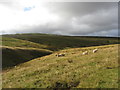
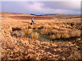
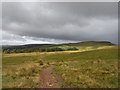
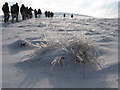
Nearby Images from Geograph Britain and Ireland:
©2014(licence)
©2005(licence)
©2014(licence)
©2010(licence)
©2017(licence)
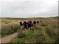
The above images may not be of the site on this page, they are loaded from Geograph.
Please Submit an Image of this site or go out and take one for us!
Click here to see more info for this site
Nearby sites
Key: Red: member's photo, Blue: 3rd party photo, Yellow: other image, Green: no photo - please go there and take one, Grey: site destroyed
Download sites to:
KML (Google Earth)
GPX (GPS waypoints)
CSV (Garmin/Navman)
CSV (Excel)
To unlock full downloads you need to sign up as a Contributory Member. Otherwise downloads are limited to 50 sites.
Turn off the page maps and other distractions
Nearby sites listing. In the following links * = Image available
422m SE 132° Gwaun Nant Ddu Stone Standing Stone (Menhir) (SO0834815158)
493m ESE 117° Gwaun Nant Ddu Ancient Village or Settlement (SO0847615214)
588m W 273° Nany Y Ychen Cairn Cairn (SO0745215486)
1.7km SE 136° Cwar-Y-Hendre Ancient Village or Settlement (SO092142)
1.8km SSE 151° Garn Felen Enclosure 1 Ancient Village or Settlement (SO0889213878)
1.9km SSE 154° Garn Felen Cairn (SO0885613724)
1.9km SSE 148° Garn Felen Enclosure 2 Ancient Village or Settlement (SO0902513791)
2.0km SSW 201° Buarth Y Caerau 2 Cairn (SO0729613638)
2.0km SSE 156° Carn-Y-Bugail Cairn (SO0880613629)
2.2km SSW 209° Buarth Y Caerau Hut Circles Ancient Village or Settlement (SO0695213557)
2.2km WSW 251° Y Gaer Enclosure Hillfort (SO05931478)
2.2km WSW 252° Y Gaer (Mid Glamorgan)* Hillfort (SO059148)
2.2km SSW 197° Cwm Criban Cairn (SO0734313320)
2.4km SSW 198° Pontsticill Inscribed Stone* Early Christian Sculptured Stone (SO0726513176)
2.6km SSE 150° Twyn Ceiliog Cairn 2 Cairn (SO0931813155)
2.8km SW 219° Waun Rydd Cairn 1 Cairn (SO0625513310)
3.0km SE 140° Twyn Ceiliog Round Cairn Cairn (SO0990813103)
3.2km E 88° Darren Ddu Enclosures Misc. Earthwork (SO112155)
3.4km SSE 163° Odyn-fach Stone Circle (SO090122)
3.5km ENE 78° Clo Cadno 2 Cairn Cairn (SO115161)
3.5km NW 316° Craig-Y-Fan Ddu* Multiple Stone Rows / Avenue (SO05631806)
3.6km SSE 162° Garn Ddu Standing Stone Standing Stone (Menhir) (SO09111200)
3.6km ENE 79° Clo Cadno Cairn Cairn (SO116161)
3.7km SSW 201° Abercriban Ciarn 1 Round Cairn (SO06651201)
4.0km ENE 70° Nant-y-Wern* Stone Row / Alignment (SO1184816732)
View more nearby sites and additional images


 We would like to know more about this location. Please feel free to add a brief description and any relevant information in your own language.
 Wir möchten mehr über diese Stätte erfahren. Bitte zögern Sie nicht, eine kurze Beschreibung und relevante Informationen in Deutsch hinzuzufügen.
 Nous aimerions en savoir encore un peu sur les lieux. S'il vous plaît n'hesitez pas à ajouter une courte description et tous les renseignements pertinents dans votre propre langue.
 Quisieramos informarnos un poco más de las lugares. No dude en añadir una breve descripción y otros datos relevantes en su propio idioma.