<< Text Pages >> Pentre Camp - Hillfort in Wales in Powys
Submitted by coldrum on Wednesday, 13 October 2010 Page Views: 4457
Iron Age and Later PrehistorySite Name: Pentre Camp Alternative Name: Pen-Y-Castell, Pen-Y-GorddinCountry: Wales
NOTE: This site is 3.7 km away from the location you searched for.
County: Powys Type: Hillfort
Map Ref: SJ11730957
Latitude: 52.676615N Longitude: 3.30699W
Condition:
| 5 | Perfect |
| 4 | Almost Perfect |
| 3 | Reasonable but with some damage |
| 2 | Ruined but still recognisable as an ancient site |
| 1 | Pretty much destroyed, possibly visible as crop marks |
| 0 | No data. |
| -1 | Completely destroyed |
| 5 | Superb |
| 4 | Good |
| 3 | Ordinary |
| 2 | Not Good |
| 1 | Awful |
| 0 | No data. |
| 5 | Can be driven to, probably with disabled access |
| 4 | Short walk on a footpath |
| 3 | Requiring a bit more of a walk |
| 2 | A long walk |
| 1 | In the middle of nowhere, a nightmare to find |
| 0 | No data. |
| 5 | co-ordinates taken by GPS or official recorded co-ordinates |
| 4 | co-ordinates scaled from a detailed map |
| 3 | co-ordinates scaled from a bad map |
| 2 | co-ordinates of the nearest village |
| 1 | co-ordinates of the nearest town |
| 0 | no data |
Be the first person to rate this site - see the 'Contribute!' box in the right hand menu.
Internal Links:
External Links:
Hillfort in Powys
From Coflein:
"Pentre Camp is an oval, multivallate, contour hillfort, measuring c.74m by 48m, enclosing a mere 0.8 acres. Its defences comprise five ramparts, now largely reduced to terraces on all but the north and west, where only three ramparts appear to have been constructed. The entrance is in the east where the third and fourth ramparts are linked to form an entrance passage. There is now no evidence of any huts within the enclosure. (OS Record card entry, 1972).
A field visit by T. Driver on 14th March 2007 confirmed the above details in addition to those revealed during the original site survey:
The hillfort was carefully and expertly planned and built to achieve a final plan which is difficult to parallel in other parts of central Wales, although mulitvallate sites are common. As well as the main concentric ramparts, there are traces of discontinuous and more denuded interim ramparts on the south and west sides, suggesting more than one phase of development. The earthworks are low now, and are crossed by deeply-gouged parallel field drains. Whether they ever stood very high is uncertain; it is possible that these banks provided firm foundations for concentric timber defences.
Interesting aspects of the rampart construction are revealed on the north side, where historic field boundaries cross the line of the Iron Age outer ramparts. On the north-east side, at SJ 1179 0963, an area of eroded ground crossed by a field bank reveals a high proportion of boulders, suggesting that these made up the original rampart structure. On the north side, at approx. SJ1174 0963 there is an isolated stretch of stone walling in the present field boundary where it crosses the Iron Age rampart; again, there is the possibility that this is a fragment of the original rampart revetment.
The most significant aspect of the site's setting and topography is the very prominent spring head below the fort to the north at SJ 1168 0966. This deep, enlarged spring head which is backed by a rocky slope and is still issuing water, sits immediately at the base of the precipitous slopes which fall from the north side of the hillfort. Although enlarged and lined with brick in historic times, it is reasonable to assume that the site of this spring was important in the choice of siting of the hillfort, at least for practical reasons. There is a high probability that artefacts from the hillfort have rolled down into the spring in prehistory and may be preserved in waterlogged conditions. Whether the spring had any symbolic role in the life of the hillfort inhabitants is more speculative."
Source: Coflein
You may be viewing yesterday's version of this page. To see the most up to date information please register for a free account.
Do not use the above information on other web sites or publications without permission of the contributor.
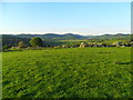
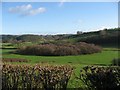
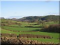
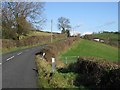
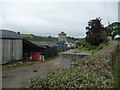
Nearby Images from Geograph Britain and Ireland:
©2012(licence)
©2007(licence)
©2007(licence)
©2007(licence)
©2012(licence)
The above images may not be of the site on this page, they are loaded from Geograph.
Please Submit an Image of this site or go out and take one for us!
Click here to see more info for this site
Nearby sites
Key: Red: member's photo, Blue: 3rd party photo, Yellow: other image, Green: no photo - please go there and take one, Grey: site destroyed
Download sites to:
KML (Google Earth)
GPX (GPS waypoints)
CSV (Garmin/Navman)
CSV (Excel)
To unlock full downloads you need to sign up as a Contributory Member. Otherwise downloads are limited to 50 sites.
Turn off the page maps and other distractions
Nearby sites listing. In the following links * = Image available
2.7km SSW 204° Tanllan Enclosure Ancient Village or Settlement (SJ10600715)
3.4km SSW 203° Ffynnon Fair (Llanfair Caereinion)* Holy Well or Sacred Spring (SJ1036106480)
3.8km ENE 68° Ffynnon y Clawdd Llesg* Holy Well or Sacred Spring (SJ153109)
5.2km NE 45° Meifod* Ancient Cross (SJ155132)
5.3km NE 38° Meifod Cursus Cursus (SJ15121367)
5.5km NE 38° Meifod Cursus Cursus (SJ15231380)
8.3km W 270° The Rustica Stone Early Christian Sculptured Stone (SJ0340809775)
10.2km NNE 11° St Myllin's Well* Holy Well or Sacred Spring (SJ1393819533)
10.7km ENE 70° Trinity Well, Guilsfield Holy Well or Sacred Spring (SJ21881297)
10.7km W 273° St Cadfan's Well* Holy Well or Sacred Spring (SJ010104)
10.9km E 99° Maen Llog* Standing Stone (Menhir) (SJ225076)
11.0km ESE 115° Welshpool A Cursus Cursus (SJ21640480)
11.0km ESE 113° Sarn-y-bryn-caled II Cursus Cursus (SJ21830505)
11.1km ESE 114° Welshpool A Cursus Cursus (SJ21820497)
11.1km E 101° Powysland Museum* Museum (SJ226073)
11.1km ENE 71° Gaer Fawr (Guilsfield)* Hillfort (SJ223130)
11.1km ESE 112° Sarn-y-bryn-caled II Cursus Cursus (SJ21970523)
11.2km ESE 114° Sarn-y-Bryn-Caled* Timber Circle (SJ219049)
11.2km SE 140° St Beuno (Berriew)* Natural Stone / Erratic / Other Natural Feature (SJ18780082)
11.3km E 101° Welshpool Eisteddfod Circle* Modern Stone Circle etc (SJ2286307263)
11.6km SW 231° Llidiardau mawr Stone Row / Alignment (SJ025025)
11.9km SE 133° Maen Beuno* Standing Stone (Menhir) (SJ2029201303)
11.9km SE 132° Dyffryn Lane, Berriew* Henge (SJ2044101409)
12.2km NE 55° Collfryn Ring Ditch Misc. Earthwork (SJ21861650)
12.7km NE 41° Long Hill Hillfort (Powys)* Hillfort (SJ2026019050)
View more nearby sites and additional images


 We would like to know more about this location. Please feel free to add a brief description and any relevant information in your own language.
 Wir möchten mehr über diese Stätte erfahren. Bitte zögern Sie nicht, eine kurze Beschreibung und relevante Informationen in Deutsch hinzuzufügen.
 Nous aimerions en savoir encore un peu sur les lieux. S'il vous plaît n'hesitez pas à ajouter une courte description et tous les renseignements pertinents dans votre propre langue.
 Quisieramos informarnos un poco más de las lugares. No dude en añadir una breve descripción y otros datos relevantes en su propio idioma.