<< Text Pages >> Rhyd y Gethin - Standing Stone (Menhir) in Wales in Denbighshire
Submitted by Andy B on Sunday, 11 February 2024 Page Views: 92
Neolithic and Bronze AgeSite Name: Rhyd y GethinCountry: Wales
NOTE: This site is 0.4 km away from the location you searched for.
County: Denbighshire Type: Standing Stone (Menhir)
Nearest Village: Llandrillo
Map Ref: SJ03303330
Latitude: 52.888429N Longitude: 3.438651W
Condition:
| 5 | Perfect |
| 4 | Almost Perfect |
| 3 | Reasonable but with some damage |
| 2 | Ruined but still recognisable as an ancient site |
| 1 | Pretty much destroyed, possibly visible as crop marks |
| 0 | No data. |
| -1 | Completely destroyed |
| 5 | Superb |
| 4 | Good |
| 3 | Ordinary |
| 2 | Not Good |
| 1 | Awful |
| 0 | No data. |
| 5 | Can be driven to, probably with disabled access |
| 4 | Short walk on a footpath |
| 3 | Requiring a bit more of a walk |
| 2 | A long walk |
| 1 | In the middle of nowhere, a nightmare to find |
| 0 | No data. |
| 5 | co-ordinates taken by GPS or official recorded co-ordinates |
| 4 | co-ordinates scaled from a detailed map |
| 3 | co-ordinates scaled from a bad map |
| 2 | co-ordinates of the nearest village |
| 1 | co-ordinates of the nearest town |
| 0 | no data |
Internal Links:
External Links:
Standing Stone in Denbighshire
Standing stone measuring 1.4m x 0.7m x 0.9m high and aligned approx E-W. Extensive sheep scour around the base has exposed possible packer stones. The field has well-preserved ridge and furrow aligned NNW-SSE and the stone lies in the east side of one of the ridges. Stone appears to be well-set and not an erratic (CPAT 2002)
Source: archwilio.org.uk/arch/query/page.php?watprn=CPAT105841
You may be viewing yesterday's version of this page. To see the most up to date information please register for a free account.
Do not use the above information on other web sites or publications without permission of the contributor.
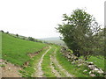
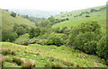
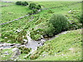
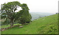
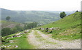
Nearby Images from Geograph Britain and Ireland:
©2007(licence)
©2007(licence)
©2007(licence)
©2007(licence)
©2007(licence)
The above images may not be of the site on this page, they are loaded from Geograph.
Please Submit an Image of this site or go out and take one for us!
Click here to see more info for this site
Nearby sites
Key: Red: member's photo, Blue: 3rd party photo, Yellow: other image, Green: no photo - please go there and take one, Grey: site destroyed
Download sites to:
KML (Google Earth)
GPX (GPS waypoints)
CSV (Garmin/Navman)
CSV (Excel)
To unlock full downloads you need to sign up as a Contributory Member. Otherwise downloads are limited to 50 sites.
Turn off the page maps and other distractions
Nearby sites listing. In the following links * = Image available
567m SSW 205° Yr Aran* Barrow Cemetery (SJ03053279)
669m ENE 62° Cefn Penagored Cairn and Ring Cairn* Cairn (SJ039336)
822m ENE 75° Cefn Penagored Ridge Cairns* Cairn (SJ041335)
1.0km N 5° Penagored Standing Stone* Standing Stone (Menhir) (SJ034343)
1.2km ESE 109° Nant Esgeiriau* Round Cairn (SJ044329)
1.4km E 82° Cwm Tywyll* Ring Cairn (SJ04683346)
1.5km E 88° Pennant* Round Cairn (SJ04823331)
3.3km NW 320° Craig yr Arian* Chambered Cairn (SJ01243584)
3.6km ESE 112° Moel Sych* Cairn (SJ066319)
3.8km WNW 299° Carnedd Wen (Llandderfel) Cairn (SJ000352)
3.8km SE 136° Cwm Rhiwiau* Stone Circle (SJ059305)
3.8km NE 41° Cerrig Bwlch Y Fedw* Stone Circle (SJ05873615)
3.9km E 98° Cadair Berwyn* Cairn (SJ072327)
4.0km ESE 101° Cader Berwyn Cairn 2* Cairn (SJ07173245)
4.0km SE 140° Rhos y Beddau (Rows)* Multiple Stone Rows / Avenue (SJ0579530205)
4.0km SE 140° Rhos Y Beddau (Circle)* Stone Circle (SJ058302)
4.5km E 88° Berwyn mountains Marker stones* Marker Stone (SJ078334)
4.5km NNE 30° Moel Ty Uchaf* Stone Circle (SJ05613717)
4.6km ENE 71° Bwrdd Arthur* Cairn (SJ077347)
4.6km E 85° Bwlch Maen Gwynedd* Cairn (SJ07953364)
4.7km NNW 332° Branas Uchaf* Chambered Cairn (SJ01123752)
5.2km SE 133° Afon Disgynfa* Cairn (SJ07042971)
5.5km N 354° Tyfos* Stone Circle (SJ02843876)
5.6km E 101° Cwm Maen Gwynedd Stone Row I Stone Row / Alignment (SJ0881132142)
5.6km E 100° Cwm Maen Gwynedd Stone Row II Stone Row / Alignment (SJ0885332238)
View more nearby sites and additional images


 We would like to know more about this location. Please feel free to add a brief description and any relevant information in your own language.
 Wir möchten mehr über diese Stätte erfahren. Bitte zögern Sie nicht, eine kurze Beschreibung und relevante Informationen in Deutsch hinzuzufügen.
 Nous aimerions en savoir encore un peu sur les lieux. S'il vous plaît n'hesitez pas à ajouter une courte description et tous les renseignements pertinents dans votre propre langue.
 Quisieramos informarnos un poco más de las lugares. No dude en añadir una breve descripción y otros datos relevantes en su propio idioma.