


<< Our Photo Pages >> Fennifach - Standing Stone (Menhir) in Wales in Powys
Submitted by NickyD on Sunday, 17 January 2016 Page Views: 7518
Neolithic and Bronze AgeSite Name: FennifachCountry: Wales
NOTE: This site is 0.5 km away from the location you searched for.
County: Powys Type: Standing Stone (Menhir)
Nearest Town: Brecon Nearest Village: Cradoc
Map Ref: SO017302 Landranger Map Number: 160
Latitude: 51.961561N Longitude: 3.432067W
Condition:
| 5 | Perfect |
| 4 | Almost Perfect |
| 3 | Reasonable but with some damage |
| 2 | Ruined but still recognisable as an ancient site |
| 1 | Pretty much destroyed, possibly visible as crop marks |
| 0 | No data. |
| -1 | Completely destroyed |
| 5 | Superb |
| 4 | Good |
| 3 | Ordinary |
| 2 | Not Good |
| 1 | Awful |
| 0 | No data. |
| 5 | Can be driven to, probably with disabled access |
| 4 | Short walk on a footpath |
| 3 | Requiring a bit more of a walk |
| 2 | A long walk |
| 1 | In the middle of nowhere, a nightmare to find |
| 0 | No data. |
| 5 | co-ordinates taken by GPS or official recorded co-ordinates |
| 4 | co-ordinates scaled from a detailed map |
| 3 | co-ordinates scaled from a bad map |
| 2 | co-ordinates of the nearest village |
| 1 | co-ordinates of the nearest town |
| 0 | no data |
Internal Links:
External Links:
I have visited· I would like to visit
SumDoood would like to visit
NickyD visited on 1st Jan 2016 - their rating: Cond: 4 Amb: 4 Access: 4
")
The stone is at least 6 ft high and 4ft wide. Unfortunately you approach the stone from the side that is covered with ivy so it would be easy to walk past it unless you turned around after and looked back. It's in a nice spot at the foot of the hillfort.
We visited in Winter so there was probably much less undergrowth making it fairly easy to spot (with an OS map though!). We came along Cradoc Road from Brecon, passed Oakfield Park on the left, followed the road left and pulled in to the entrance to Llyn Gludy, opposite Sawmill Bungalow. It was a short walk up the track until it branched off left up the old dismantled railway. We followed this for a few minutes and used the OS map to work out it was somewhere on our right. However it was actually down the little embankment of the railway and alongside the track we had started following earlier, so it's probably easier to stay on that from the start!
More at Coflein, who say that it's age is disputed.
You may be viewing yesterday's version of this page. To see the most up to date information please register for a free account.
Do not use the above information on other web sites or publications without permission of the contributor.
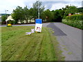
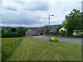
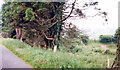
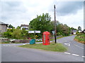
Nearby Images from Geograph Britain and Ireland:
©2012(licence)
©2012(licence)
©2014(licence)
©2012(licence)
©2012(licence)
The above images may not be of the site on this page, they are loaded from Geograph.
Please Submit an Image of this site or go out and take one for us!
Click here to see more info for this site
Nearby sites
Key: Red: member's photo, Blue: 3rd party photo, Yellow: other image, Green: no photo - please go there and take one, Grey: site destroyed
Download sites to:
KML (Google Earth)
GPX (GPS waypoints)
CSV (Garmin/Navman)
CSV (Excel)
To unlock full downloads you need to sign up as a Contributory Member. Otherwise downloads are limited to 50 sites.
Turn off the page maps and other distractions
Nearby sites listing. In the following links * = Image available
854m SSW 199° Coed Fenn-Fach* Hillfort (SO014294)
1.2km WNW 291° Battle (Powys)* Standing Stone (Menhir) (SO0062730638)
1.2km E 83° Pen-y-Crug Hillfort* Hillfort (SO02943033)
1.5km WSW 247° Y Gaer Roman Fort* Ancient Village or Settlement (SO00342965)
2.1km SSW 193° St Cattwg's Church (Llanspyddid)* Early Christian Sculptured Stone (SO01192818)
2.3km ESE 103° Maen-Du Well* Holy Well or Sacred Spring (SO03902963)
2.8km NE 36° The Cross of Briamail (Llandefaelog)* Ancient Cross (SO034324)
2.8km W 276° Aberyscir* Ring Cairn (SN98883057)
3.0km ESE 111° Priory Well (Powys)* Holy Well or Sacred Spring (SO04522906)
3.2km NNW 343° Battle Hill Cairn 1* Cairn (SO00833328)
3.2km NNW 344° Battle Hill Cairn 2* Cairn (SO00853331)
3.4km ESE 120° Brecknock Museum* Museum (SO0458528441)
3.5km SW 230° Twyn-y-Gaer (Llanspyddid)* Hillfort (SN990280)
3.8km E 80° Bishop Gower's Well* Holy Well or Sacred Spring (SO0551330776)
4.3km ESE 114° Slwch Camp* Hillfort (SO056284)
4.7km W 274° Twyn-y-Gaer (Trallong)* Hillfort (SN970306)
5.1km W 262° St David's Church (Trallong)* Early Christian Sculptured Stone (SN966296)
5.5km SW 227° Mynydd Illtud Standing Stone 1* Standing Stone (Menhir) (SN97602651)
5.6km SSE 154° Coed Mawr Hillfort* Hillfort (SO04102512)
5.7km SSE 163° Plas-y-Gaer* Hillfort (SO033247)
6.1km NNW 327° Carn y Fan* Hillfort (SN985354)
6.2km NE 35° Twyn-y-Gaer (Llaneglwys)* Hillfort (SO054352)
6.5km E 99° Twyn-Llechfaen* Hillfort (SO081291)
6.5km N 352° Gaer Fach (Merthyr Cynog)* Hillfort (SO00913663)
7.1km SW 228° Mynydd Illtud Standing Stone 2* Standing Stone (Menhir) (SN963255)
View more nearby sites and additional images


 We would like to know more about this location. Please feel free to add a brief description and any relevant information in your own language.
 Wir möchten mehr über diese Stätte erfahren. Bitte zögern Sie nicht, eine kurze Beschreibung und relevante Informationen in Deutsch hinzuzufügen.
 Nous aimerions en savoir encore un peu sur les lieux. S'il vous plaît n'hesitez pas à ajouter une courte description et tous les renseignements pertinents dans votre propre langue.
 Quisieramos informarnos un poco más de las lugares. No dude en añadir una breve descripción y otros datos relevantes en su propio idioma.