


<< Our Photo Pages >> Ty Lettice - Round Cairn in Wales in Powys
Submitted by postman on Tuesday, 13 November 2012 Page Views: 1973
Neolithic and Bronze AgeSite Name: Ty LetticeCountry: Wales County: Powys Type: Round Cairn
Nearest Town: Rhayader
Map Ref: SN99026866
Latitude: 52.306739N Longitude: 3.482492W
Condition:
| 5 | Perfect |
| 4 | Almost Perfect |
| 3 | Reasonable but with some damage |
| 2 | Ruined but still recognisable as an ancient site |
| 1 | Pretty much destroyed, possibly visible as crop marks |
| 0 | No data. |
| -1 | Completely destroyed |
| 5 | Superb |
| 4 | Good |
| 3 | Ordinary |
| 2 | Not Good |
| 1 | Awful |
| 0 | No data. |
| 5 | Can be driven to, probably with disabled access |
| 4 | Short walk on a footpath |
| 3 | Requiring a bit more of a walk |
| 2 | A long walk |
| 1 | In the middle of nowhere, a nightmare to find |
| 0 | No data. |
| 5 | co-ordinates taken by GPS or official recorded co-ordinates |
| 4 | co-ordinates scaled from a detailed map |
| 3 | co-ordinates scaled from a bad map |
| 2 | co-ordinates of the nearest village |
| 1 | co-ordinates of the nearest town |
| 0 | no data |
Internal Links:
External Links:
I have visited· I would like to visit
SolarMegalith would like to visit
")
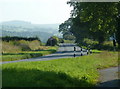
I was actually on my way somewhere else when I spotted this round cairn on the map it was so close to the road that I didn't even change out of my slippers. The cairn is about two meters high, and well over twenty across. When I first saw it at the field gate I whooped at it in splendid surprise, i wasn't expecting it to be so big. There are four largish boulders hugging the north western arc but whether they are field clearance or kerbing I couldn't say. Castle hill to the east and Gwastedyn hill to the south create a pleasing backdrop to the cairn.
You may be viewing yesterday's version of this page. To see the most up to date information please register for a free account.
")
")
")
")
Do not use the above information on other web sites or publications without permission of the contributor.
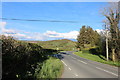
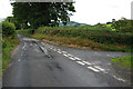
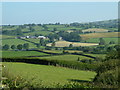
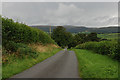
Nearby Images from Geograph Britain and Ireland:
©2019(licence)
©2008(licence)
©2011(licence)
©2008(licence)
©2011(licence)
The above images may not be of the site on this page, they are loaded from Geograph.
Please Submit an Image of this site or go out and take one for us!
Click here to see more info for this site
Nearby sites
Key: Red: member's photo, Blue: 3rd party photo, Yellow: other image, Green: no photo - please go there and take one, Grey: site destroyed
Download sites to:
KML (Google Earth)
GPX (GPS waypoints)
CSV (Garmin/Navman)
CSV (Excel)
To unlock full downloads you need to sign up as a Contributory Member. Otherwise downloads are limited to 50 sites.
Turn off the page maps and other distractions
Nearby sites listing. In the following links * = Image available
580m WSW 244° Cefn Ceidio* Cairn (SN98496842)
622m ENE 67° Ty Lettice Barrows* Round Barrow(s) (SN99606889)
2.4km NNW 333° Creggin* Round Barrow(s) (SN980708)
2.5km S 186° Carn Wen - The Druid's circle* Ring Cairn (SN98686614)
4.2km NW 313° Marteg Valley* Cairn (SN95997155)
4.7km SE 139° Dolmaengwyn* Standing Stone (Menhir) (SO02056506)
4.7km WNW 283° Maen Serth* Standing Stone (Menhir) (SN944698)
5.1km SSW 195° Llanwrthwl* Standing Stone (Menhir) (SN9757263720)
5.4km W 273° Banc Trehesglog Cairn* Cist (SN93636909)
5.4km WNW 282° Clap yr Arian* Cairn (SN937699)
5.7km E 79° Llyn Dwr Cairn* Cairn (SO04676962)
5.8km W 278° Briddell Felen B* Chambered Tomb (SN93256957)
5.8km E 80° Camlo Hill Stone* Standing Stone (Menhir) (SO048696)
5.9km W 278° Briddell Felen A* Standing Stone (Menhir) (SN93226964)
5.9km W 271° Tre Heslog Stone Row* Stone Row / Alignment (SN9310668922)
5.9km W 271° Tre Heslog Cist* Cist (SN931689)
6.1km S 190° Cae Garw Cairn* Cairn (SN97886268)
6.2km SW 229° Carn Gafallt Cairn (SN94256469)
6.3km SE 145° Gwynfan Ring Cairn* Cairn (SO02566344)
6.5km S 191° Cryn-Fryn* Ring Cairn (SN977623)
6.7km WNW 286° Maengwyngweddew* Standing Stone (Menhir) (SN926706)
6.7km SE 142° Wern Stone* Standing Stone (Menhir) (SO03076328)
7.0km W 270° Crugyn Gwyddel Cairn* Cairn (SN91976877)
7.0km WSW 247° Glog Fawr Cairn* Cist (SN92486603)
7.2km S 186° Banc Ystrdd-Wen* Ring Cairn (SN981615)
View more nearby sites and additional images


 We would like to know more about this location. Please feel free to add a brief description and any relevant information in your own language.
 Wir möchten mehr über diese Stätte erfahren. Bitte zögern Sie nicht, eine kurze Beschreibung und relevante Informationen in Deutsch hinzuzufügen.
 Nous aimerions en savoir encore un peu sur les lieux. S'il vous plaît n'hesitez pas à ajouter une courte description et tous les renseignements pertinents dans votre propre langue.
 Quisieramos informarnos un poco más de las lugares. No dude en añadir una breve descripción y otros datos relevantes en su propio idioma.