

<< Our Photo Pages >> Carn y Fan - Hillfort in Wales in Powys
Submitted by geoffstickland on Monday, 23 September 2002 Page Views: 4317
Iron Age and Later PrehistorySite Name: Carn y Fan Alternative Name: Coren y FanCountry: Wales
NOTE: This site is 1.9 km away from the location you searched for.
County: Powys Type: Hillfort
Nearest Town: Brecon Nearest Village: Pont-faen
Map Ref: SN985354 Landranger Map Number: 160
Latitude: 52.007721N Longitude: 3.480164W
Condition:
| 5 | Perfect |
| 4 | Almost Perfect |
| 3 | Reasonable but with some damage |
| 2 | Ruined but still recognisable as an ancient site |
| 1 | Pretty much destroyed, possibly visible as crop marks |
| 0 | No data. |
| -1 | Completely destroyed |
| 5 | Superb |
| 4 | Good |
| 3 | Ordinary |
| 2 | Not Good |
| 1 | Awful |
| 0 | No data. |
| 5 | Can be driven to, probably with disabled access |
| 4 | Short walk on a footpath |
| 3 | Requiring a bit more of a walk |
| 2 | A long walk |
| 1 | In the middle of nowhere, a nightmare to find |
| 0 | No data. |
| 5 | co-ordinates taken by GPS or official recorded co-ordinates |
| 4 | co-ordinates scaled from a detailed map |
| 3 | co-ordinates scaled from a bad map |
| 2 | co-ordinates of the nearest village |
| 1 | co-ordinates of the nearest town |
| 0 | no data |
Internal Links:
External Links:
I have visited· I would like to visit
geoffstickland has visited here
")
Page originally by Vicky
You may be viewing yesterday's version of this page. To see the most up to date information please register for a free account.
")
")
Do not use the above information on other web sites or publications without permission of the contributor.
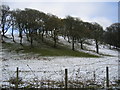
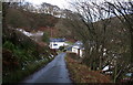
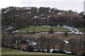
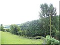
Nearby Images from Geograph Britain and Ireland:
©2007(licence)

©2025(licence)
©2007(licence)
©2018(licence)
©2010(licence)
The above images may not be of the site on this page, they are loaded from Geograph.
Please Submit an Image of this site or go out and take one for us!
Click here to see more info for this site
Nearby sites
Key: Red: member's photo, Blue: 3rd party photo, Yellow: other image, Green: no photo - please go there and take one, Grey: site destroyed
Download sites to:
KML (Google Earth)
GPX (GPS waypoints)
CSV (Garmin/Navman)
CSV (Excel)
To unlock full downloads you need to sign up as a Contributory Member. Otherwise downloads are limited to 50 sites.
Turn off the page maps and other distractions
Nearby sites listing. In the following links * = Image available
2.7km ENE 62° Gaer Fach (Merthyr Cynog)* Hillfort (SO00913663)
3.1km SE 131° Battle Hill Cairn 2* Cairn (SO00853331)
3.1km SE 131° Battle Hill Cairn 1* Cairn (SO00833328)
3.6km NNE 23° Llwyn Llwyd* Ancient Village or Settlement (SN99963869)
3.7km NNW 341° Cefn Merthyr Cynog Cairn (East)* Cairn (SN97383894)
3.8km NNW 339° Cefn Merthy Cynog Cairn (West)* Cairn (SN97223894)
3.8km NNW 342° Cefn Merthyr Cynog Mound* Cairn (SN97393902)
4.4km WNW 304° Y Crug Round Barrow(s) (SN949379)
4.4km NE 53° Gaer Fawr (Lower Chapel)* Hillfort (SO021380)
4.8km NW 309° Twyn Cerrig-Cadarn Ring Cairn (SN948385)
4.8km S 174° Aberyscir* Ring Cairn (SN98883057)
5.0km SSW 196° Twyn-y-Gaer (Trallong)* Hillfort (SN970306)
5.2km SSE 155° Battle (Powys)* Standing Stone (Menhir) (SO0062730638)
5.7km ESE 120° The Cross of Briamail (Llandefaelog)* Ancient Cross (SO034324)
6.0km NE 48° Bailey Bach* Ring Cairn (SO0304639278)
6.0km W 264° Gwar-y-Felin* Ring Cairn (SN925349)
6.0km SSE 161° Y Gaer Roman Fort* Ancient Village or Settlement (SO00342965)
6.1km SSE 147° Fennifach* Standing Stone (Menhir) (SO017302)
6.1km SSW 197° St David's Church (Trallong)* Early Christian Sculptured Stone (SN966296)
6.4km NE 45° Cefn Clawdd CairnIII* Cairn (SO03123985)
6.6km NE 41° Cornelau Uchaf Hillfort (SO029403)
6.7km SSE 153° Coed Fenn-Fach* Hillfort (SO014294)
6.7km SE 138° Pen-y-Crug Hillfort* Hillfort (SO02943033)
6.9km E 90° Twyn-y-Gaer (Llaneglwys)* Hillfort (SO054352)
6.9km NE 41° Cefn Clawdd near Twyn y Post Ring Cairn (SO032405)
View more nearby sites and additional images


 We would like to know more about this location. Please feel free to add a brief description and any relevant information in your own language.
 Wir möchten mehr über diese Stätte erfahren. Bitte zögern Sie nicht, eine kurze Beschreibung und relevante Informationen in Deutsch hinzuzufügen.
 Nous aimerions en savoir encore un peu sur les lieux. S'il vous plaît n'hesitez pas à ajouter une courte description et tous les renseignements pertinents dans votre propre langue.
 Quisieramos informarnos un poco más de las lugares. No dude en añadir una breve descripción y otros datos relevantes en su propio idioma.