<< Our Photo Pages >> Ffynnon Derfel - Holy Well or Sacred Spring in Wales in Gwynedd
Submitted by TimPrevett on Friday, 23 February 2007 Page Views: 5920
Springs and Holy WellsSite Name: Ffynnon DerfelCountry: Wales County: Gwynedd Type: Holy Well or Sacred Spring
Nearest Town: Bala Nearest Village: Llandderfel
Map Ref: SH97773723
Latitude: 52.922720N Longitude: 3.522047W
Condition:
| 5 | Perfect |
| 4 | Almost Perfect |
| 3 | Reasonable but with some damage |
| 2 | Ruined but still recognisable as an ancient site |
| 1 | Pretty much destroyed, possibly visible as crop marks |
| 0 | No data. |
| -1 | Completely destroyed |
| 5 | Superb |
| 4 | Good |
| 3 | Ordinary |
| 2 | Not Good |
| 1 | Awful |
| 0 | No data. |
| 5 | Can be driven to, probably with disabled access |
| 4 | Short walk on a footpath |
| 3 | Requiring a bit more of a walk |
| 2 | A long walk |
| 1 | In the middle of nowhere, a nightmare to find |
| 0 | No data. |
| 5 | co-ordinates taken by GPS or official recorded co-ordinates |
| 4 | co-ordinates scaled from a detailed map |
| 3 | co-ordinates scaled from a bad map |
| 2 | co-ordinates of the nearest village |
| 1 | co-ordinates of the nearest town |
| 0 | no data |
Internal Links:
External Links:
")
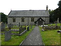
A spring to the north west of Llandderfel, attributed to the 6th Century Saint, Derfel. Derfel Gardarn (Derfel the Warrior) is reputed to have taken part in the Battle of Camlan, but had healing powers where animals were concerned, and in particular, for cattle.
You may be viewing yesterday's version of this page. To see the most up to date information please register for a free account.
")
Do not use the above information on other web sites or publications without permission of the contributor.
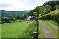
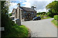
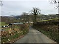
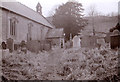
Nearby Images from Geograph Britain and Ireland:
©2010(licence)
©2010(licence)
©2022(licence)
©2018(licence)
©2018(licence)
The above images may not be of the site on this page, they are loaded from Geograph.
Please Submit an Image of this site or go out and take one for us!
Click here to see more info for this site
Nearby sites
Key: Red: member's photo, Blue: 3rd party photo, Yellow: other image, Green: no photo - please go there and take one, Grey: site destroyed
Download sites to:
KML (Google Earth)
GPX (GPS waypoints)
CSV (Garmin/Navman)
CSV (Excel)
To unlock full downloads you need to sign up as a Contributory Member. Otherwise downloads are limited to 50 sites.
Turn off the page maps and other distractions
Nearby sites listing. In the following links * = Image available
3.0km NNW 337° Coed y Bedo* Standing Stone (Menhir) (SH96664003)
3.0km SE 131° Carnedd Wen (Llandderfel) Cairn (SJ000352)
3.4km E 84° Branas Uchaf* Chambered Cairn (SJ01123752)
3.7km ESE 111° Craig yr Arian* Chambered Cairn (SJ01243584)
3.8km W 259° Pabell Llywarch Hen* Stone Circle (SH940366)
4.1km NNE 21° Cefn Caer Euni* Ring Cairn (SH993410)
4.1km S 189° Carnedd Wen (Llangywer) Cairn (SH97033315)
4.6km NNE 27° Caer Euni* Hillfort (SJ000413)
5.0km WSW 255° Bala Modern Eisteddfod Stone Circle* Modern Stone Circle etc (SH9293836035)
5.3km ENE 72° Tyfos* Stone Circle (SJ02843876)
5.8km WSW 255° Ffynnon Beuno (Bala)* Holy Well or Sacred Spring (SH92163584)
6.3km ESE 116° Penagored Standing Stone* Standing Stone (Menhir) (SJ034343)
6.8km SE 124° Rhyd y Gethin Standing Stone (Menhir) (SJ03303330)
6.9km SE 129° Yr Aran* Barrow Cemetery (SJ03053279)
7.1km ESE 119° Cefn Penagored Cairn and Ring Cairn* Cairn (SJ039336)
7.3km ESE 119° Cefn Penagored Ridge Cairns* Cairn (SJ041335)
7.4km ENE 70° Tyn y Coed* Chambered Cairn (SJ0476839603)
7.8km E 89° Moel Ty Uchaf* Stone Circle (SJ05613717)
7.9km ESE 117° Cwm Tywyll* Ring Cairn (SJ04683346)
7.9km ESE 122° Nant Esgeiriau* Round Cairn (SJ044329)
8.0km ESE 118° Pennant* Round Cairn (SJ04823331)
8.1km E 96° Cerrig Bwlch Y Fedw* Stone Circle (SJ05873615)
8.3km WSW 257° Moel Y Garnedd* Cairn (SH896355)
9.6km SW 232° Ffynnon Gower (Llangower) Holy Well or Sacred Spring (SH900315)
10.2km N 351° Pen-y-Gaer (Denbighshire) Stone Circle (SH964473)
View more nearby sites and additional images


 We would like to know more about this location. Please feel free to add a brief description and any relevant information in your own language.
 Wir möchten mehr über diese Stätte erfahren. Bitte zögern Sie nicht, eine kurze Beschreibung und relevante Informationen in Deutsch hinzuzufügen.
 Nous aimerions en savoir encore un peu sur les lieux. S'il vous plaît n'hesitez pas à ajouter une courte description et tous les renseignements pertinents dans votre propre langue.
 Quisieramos informarnos un poco más de las lugares. No dude en añadir una breve descripción y otros datos relevantes en su propio idioma.