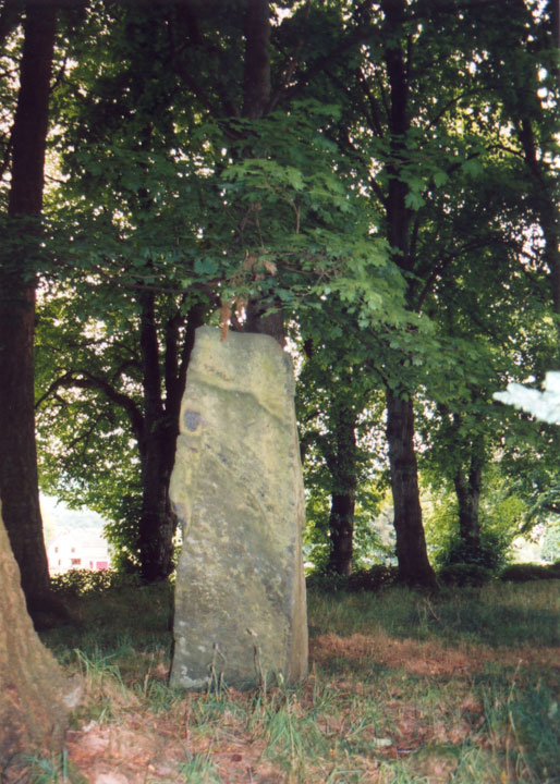
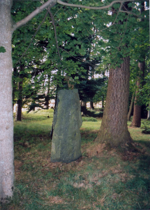
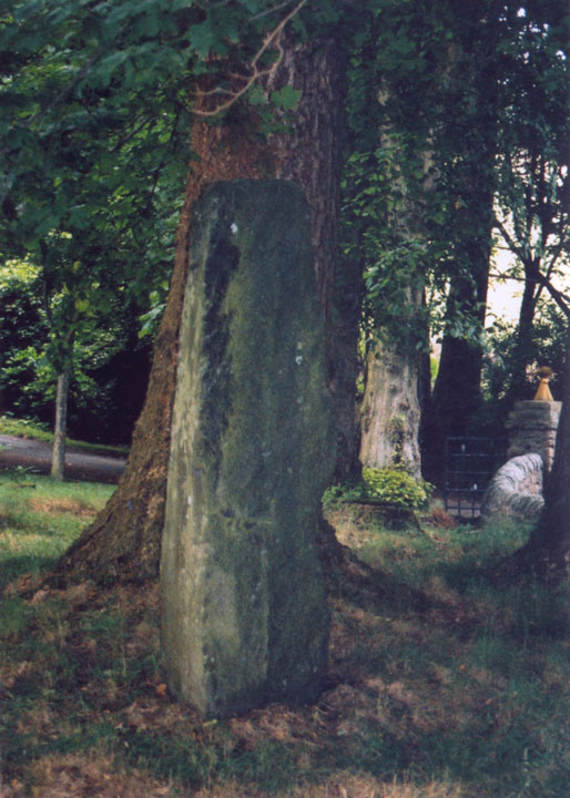
<< Our Photo Pages >> Balnakeilly - Standing Stone (Menhir) in Scotland in Perth and Kinross
Submitted by Anne T on Thursday, 15 February 2001 Page Views: 11571
Neolithic and Bronze AgeSite Name: BalnakeillyCountry: Scotland
NOTE: This site is 0.859 km away from the location you searched for.
County: Perth and Kinross Type: Standing Stone (Menhir)
Nearest Town: Pitlochry Nearest Village: Moulin
Map Ref: NN94655944 Landranger Map Number: 52
Latitude: 56.714718N Longitude: 3.722735W
Condition:
| 5 | Perfect |
| 4 | Almost Perfect |
| 3 | Reasonable but with some damage |
| 2 | Ruined but still recognisable as an ancient site |
| 1 | Pretty much destroyed, possibly visible as crop marks |
| 0 | No data. |
| -1 | Completely destroyed |
| 5 | Superb |
| 4 | Good |
| 3 | Ordinary |
| 2 | Not Good |
| 1 | Awful |
| 0 | No data. |
| 5 | Can be driven to, probably with disabled access |
| 4 | Short walk on a footpath |
| 3 | Requiring a bit more of a walk |
| 2 | A long walk |
| 1 | In the middle of nowhere, a nightmare to find |
| 0 | No data. |
| 5 | co-ordinates taken by GPS or official recorded co-ordinates |
| 4 | co-ordinates scaled from a detailed map |
| 3 | co-ordinates scaled from a bad map |
| 2 | co-ordinates of the nearest village |
| 1 | co-ordinates of the nearest town |
| 0 | no data |
Be the first person to rate this site - see the 'Contribute!' box in the right hand menu.
Internal Links:
External Links:
I have visited· I would like to visit
tom_bullock has visited here

Information on this 9 foot tall standing stone can be found on Canmore ID 26276. In their 1998 report, Canmore record:"A standing stone close to the entrance to the driveway at Balnakeilly was drawn to the attention of HS by the owner, Lt Col Stewart. A series of tool marks and the general regularity of the stone suggested that it might be of relatively modern origin, although its position, set back slightly from the road, was not as obvious as might be expected if the stone was a recent feature. Inspection of OS maps, however, indicated that although recorded on the 2nd edition map, it was absent from the 1st edition, while other nearby standing stones were marked on both. It appears that the stone was probably erected in the mid- to late 19th century to adorn the entrance to Balnakeilly."
The Northern Antiquarian's Balnakeilly Stone, Moulin, Pitlochry, Perthshire page gives directions on how to find this stone, together with photographs and the archaeology and history of the immediate area.
You may be viewing yesterday's version of this page. To see the most up to date information please register for a free account.


Do not use the above information on other web sites or publications without permission of the contributor.
Click here to see more info for this site
Nearby sites
Key: Red: member's photo, Blue: 3rd party photo, Yellow: other image, Green: no photo - please go there and take one, Grey: site destroyed
Download sites to:
KML (Google Earth)
GPX (GPS waypoints)
CSV (Garmin/Navman)
CSV (Excel)
To unlock full downloads you need to sign up as a Contributory Member. Otherwise downloads are limited to 50 sites.
Turn off the page maps and other distractions
Nearby sites listing. In the following links * = Image available
395m W 265° Dane's Stone* Standing Stone (Menhir) (NN9425559414)
836m SSW 208° Cnoc Dubh Stone Circle (NN94245871)
1.4km SSW 202° Tobar Argan* Holy Well or Sacred Spring (NN941582)
1.6km W 271° Craigiedun* Stone Circle (NN930595)
1.7km WSW 250° Faskally Cottages* Stone Circle (NN930589)
2.4km S 176° Dunfallandy Cairn* Cairn (NN94745700)
2.9km S 180° Dunfallandy stone* Class II Pictish Symbol Stone (NN946565)
4.3km SSW 209° Clachan An Diridh* Stone Circle (NN92515574)
5.0km ESE 118° Black Spout Wood Homestead Ancient Village or Settlement (NN990570)
5.3km NW 313° Claverhouse's Stone* Standing Stone (Menhir) (NN90826319)
6.2km SSW 214° Clach Na Buidseach Rock Art (NN91085435)
6.3km SSW 195° Pitnacree* Standing Stone (Menhir) (NN92875337)
6.7km SSE 152° Tigh Na Ruaich* Stone Circle (NN97625346)
6.7km WNW 300° Blair Atholl E* Stone Circle (NN88876295)
6.8km SSW 201° Haugh Of Grandtully Farm* Standing Stone (Menhir) (NN92035319)
7.2km SW 223° Findynate Farm* Standing Stones (NN89645430)
7.2km NW 308° Strathgroy Standing Stone (Menhir) (NN8964)
7.3km SW 224° Pitcastle Standing Stones (NN895543)
7.3km S 179° Clach na Croiche* Stone Row / Alignment (NN94625211)
7.3km SSW 202° Balnabeggan* Rock Art (NN917527)
7.7km SSE 163° Logierait 1 Class II Pictish Symbol Stone (NN967520)
8.0km WNW 293° Fincastle Farm* Standing Stones (NN87376274)
8.6km SW 222° Tobairandonaich* Rock Art (NN88665320)
9.1km NW 308° Clach na h' Iobairt.* Standing Stone (Menhir) (NN87626526)
9.2km SSE 154° Clach Glas* Standing Stone (Menhir) (NN98535112)
View more nearby sites and additional images


 We would like to know more about this location. Please feel free to add a brief description and any relevant information in your own language.
 Wir möchten mehr über diese Stätte erfahren. Bitte zögern Sie nicht, eine kurze Beschreibung und relevante Informationen in Deutsch hinzuzufügen.
 Nous aimerions en savoir encore un peu sur les lieux. S'il vous plaît n'hesitez pas à ajouter une courte description et tous les renseignements pertinents dans votre propre langue.
 Quisieramos informarnos un poco más de las lugares. No dude en añadir una breve descripción y otros datos relevantes en su propio idioma.