


<< Our Photo Pages >> Gurnos Ring Cairn - Cairn in Wales in Powys
Submitted by geoffstickland on Friday, 05 April 2024 Page Views: 21
Neolithic and Bronze AgeSite Name: Gurnos Ring CairnCountry: Wales
NOTE: This site is 0.4 km away from the location you searched for.
County: Powys Type: Cairn
Nearest Town: Newbridge on Wye
Map Ref: SN9229157866
Latitude: 52.208455N Longitude: 3.577699W
Condition:
| 5 | Perfect |
| 4 | Almost Perfect |
| 3 | Reasonable but with some damage |
| 2 | Ruined but still recognisable as an ancient site |
| 1 | Pretty much destroyed, possibly visible as crop marks |
| 0 | No data. |
| -1 | Completely destroyed |
| 5 | Superb |
| 4 | Good |
| 3 | Ordinary |
| 2 | Not Good |
| 1 | Awful |
| 0 | No data. |
| 5 | Can be driven to, probably with disabled access |
| 4 | Short walk on a footpath |
| 3 | Requiring a bit more of a walk |
| 2 | A long walk |
| 1 | In the middle of nowhere, a nightmare to find |
| 0 | No data. |
| 5 | co-ordinates taken by GPS or official recorded co-ordinates |
| 4 | co-ordinates scaled from a detailed map |
| 3 | co-ordinates scaled from a bad map |
| 2 | co-ordinates of the nearest village |
| 1 | co-ordinates of the nearest town |
| 0 | no data |
Internal Links:
External Links:
")
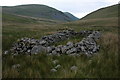
A conspicuous semicircle of loose stones, partial disturbed, situated on the open mountain side below the prominent peak of Gorllwyn.
You may be viewing yesterday's version of this page. To see the most up to date information please register for a free account.
Do not use the above information on other web sites or publications without permission of the contributor.
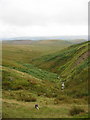
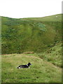
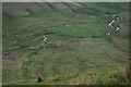
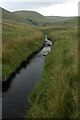
Nearby Images from Geograph Britain and Ireland:
©2009(licence)
©2009(licence)
©2008(licence)
©2008(licence)
©2008(licence)
The above images may not be of the site on this page, they are loaded from Geograph.
Please Submit an Image of this site or go out and take one for us!
Click here to see more info for this site
Nearby sites
Key: Red: member's photo, Blue: 3rd party photo, Yellow: other image, Green: no photo - please go there and take one, Grey: site destroyed
Download sites to:
KML (Google Earth)
GPX (GPS waypoints)
CSV (Garmin/Navman)
CSV (Excel)
To unlock full downloads you need to sign up as a Contributory Member. Otherwise downloads are limited to 50 sites.
Turn off the page maps and other distractions
Nearby sites listing. In the following links * = Image available
22m WSW 253° Gurnos Cairn* Cairn (SN92275786)
1.2km NW 322° Gorllwyn* Cairn (SN9159858800)
1.7km SW 221° Darren Standing Stones* Standing Stones (SN91125658)
2.4km WNW 286° Bwlch-y-Ddau-Faen Cairn* Cairn (SN90015859)
2.7km NW 325° Llwydnant Cairn 1* Cairn (SN9079860131)
2.7km NNW 329° Llwydnant Cairn II* Cairn (SN9090560238)
3.0km SSW 204° Lednant Round Barrow* Cairn (SN91045517)
3.1km SSW 202° Hen Clawdd Stones* Standing Stones (SN9106155036)
3.3km SE 127° Capel Rhos* Standing Stone (Menhir) (SN94865584)
3.5km SSW 199° Bryn Round Cairn* Cairn (SN9110554583)
3.5km ENE 71° Carn Pantmaenllwyd* Cairn (SN95675895)
3.5km SSW 197° Bryn Ring Cairn* Cairn (SN91195449)
3.6km NE 46° Saith Maen WSW* Stone Row / Alignment (SN9492160315)
3.6km ENE 62° Drum Ddu cairns* Cairn (SN95535951)
3.7km NW 317° Esgair Ceiliog* Ring Cairn (SN8977060636)
3.8km N 10° Waun Sarn Cairn* Cairn (SN93066161)
4.0km N 353° Garn Lwyd Cairn* Ring Cairn (SN919618)
4.1km NNE 28° y Gamriw 1* Ring Cairn (SN943614)
4.2km NW 309° Esgair Hafod* Ring Cairn (SN891606)
4.2km NE 48° Carnau Cefn-y-Ffordd Standing Stone* Standing Stone (Menhir) (SN955606)
4.2km N 358° Gro Hill Cairn 6* Cairn (SN922621)
4.2km N 2° Gro Hill Cairn 4* Cairn (SN925621)
4.2km NE 52° Carnau Cefn-y-Ffordd Ring Cairns* Ring Cairn (SN957604)
4.2km N 3° Gro Hill Cairn 5* Cairn (SN926621)
4.2km ENE 65° Hafen stone pair alignment* Stone Row / Alignment (SN96195958)
View more nearby sites and additional images

")
 We would like to know more about this location. Please feel free to add a brief description and any relevant information in your own language.
 Wir möchten mehr über diese Stätte erfahren. Bitte zögern Sie nicht, eine kurze Beschreibung und relevante Informationen in Deutsch hinzuzufügen.
 Nous aimerions en savoir encore un peu sur les lieux. S'il vous plaît n'hesitez pas à ajouter une courte description et tous les renseignements pertinents dans votre propre langue.
 Quisieramos informarnos un poco más de las lugares. No dude en añadir una breve descripción y otros datos relevantes en su propio idioma.