<< Our Photo Pages >> Garn Lwyd Cairn - Ring Cairn in Wales in Powys
Submitted by vicky on Monday, 23 September 2002 Page Views: 7646
Neolithic and Bronze AgeSite Name: Garn Lwyd CairnCountry: Wales
NOTE: This site is 0.5 km away from the location you searched for.
County: Powys Type: Ring Cairn
Nearest Town: Rhyader Nearest Village: Elan Village
Map Ref: SN919618 Landranger Map Number: 147
Latitude: 52.243733N Longitude: 3.584678W
Condition:
| 5 | Perfect |
| 4 | Almost Perfect |
| 3 | Reasonable but with some damage |
| 2 | Ruined but still recognisable as an ancient site |
| 1 | Pretty much destroyed, possibly visible as crop marks |
| 0 | No data. |
| -1 | Completely destroyed |
| 5 | Superb |
| 4 | Good |
| 3 | Ordinary |
| 2 | Not Good |
| 1 | Awful |
| 0 | No data. |
| 5 | Can be driven to, probably with disabled access |
| 4 | Short walk on a footpath |
| 3 | Requiring a bit more of a walk |
| 2 | A long walk |
| 1 | In the middle of nowhere, a nightmare to find |
| 0 | No data. |
| 5 | co-ordinates taken by GPS or official recorded co-ordinates |
| 4 | co-ordinates scaled from a detailed map |
| 3 | co-ordinates scaled from a bad map |
| 2 | co-ordinates of the nearest village |
| 1 | co-ordinates of the nearest town |
| 0 | no data |
Internal Links:
External Links:
")
Have you visited this site? Please add a comment below.
You may be viewing yesterday's version of this page. To see the most up to date information please register for a free account.
")
Do not use the above information on other web sites or publications without permission of the contributor.
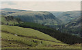
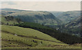
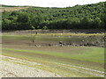
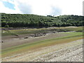
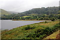
Nearby Images from Geograph Britain and Ireland:
©2010(licence)
©2007(licence)
©2022(licence)
©2022(licence)
©2012(licence)
The above images may not be of the site on this page, they are loaded from Geograph.
Please Submit an Image of this site or go out and take one for us!
Click here to see more info for this site
Nearby sites
Key: Red: member's photo, Blue: 3rd party photo, Yellow: other image, Green: no photo - please go there and take one, Grey: site destroyed
Download sites to:
KML (Google Earth)
GPX (GPS waypoints)
CSV (Garmin/Navman)
CSV (Excel)
To unlock full downloads you need to sign up as a Contributory Member. Otherwise downloads are limited to 50 sites.
Turn off the page maps and other distractions
Nearby sites listing. In the following links * = Image available
424m NE 44° Gro Hill Cairn 6* Cairn (SN922621)
499m NE 36° Gro Hill Cairn 8* Cairn (SN922622)
669m ENE 62° Gro Hill Cairn 4* Cairn (SN925621)
760m ENE 65° Gro Hill Cairn 5* Cairn (SN926621)
761m NNE 22° Gro Hill Cairn 7* Cairn (SN922625)
858m NE 53° Gro Hill Cist* Cist (SN926623)
866m NE 56° Gro Hill Cairn 2* Cairn (SN92636227)
941m ENE 57° Gro Hill Cairns* Cairn (SN927623)
1.2km E 98° Waun Sarn Cairn* Cairn (SN93066161)
1.3km ENE 60° Crugian Bach prehistoric monument complex* Barrow Cemetery (SN930624)
1.4km ENE 63° Crugian Bach Stone Circle* Stone Circle (SN9314762402)
1.8km NW 313° Rhos Y Gelynnen Cairn* Cairn (SN9062163055)
1.8km NNE 34° Ty'n Y Pant Cairn* Cairn (SN92936327)
1.8km SSW 211° Llwydnant Cairn II* Cairn (SN9090560238)
1.9km NW 312° Rhos y Gelynen Stones* Stone Row / Alignment (SN9054363085)
1.9km NE 37° Ty'n Y Pant Stone* Standing Stone (Menhir) (SN93086332)
2.0km SSW 212° Llwydnant Cairn 1* Cairn (SN9079860131)
2.1km WNW 292° Gurnos Hill Cairn* Cairn (SN89976262)
2.4km WSW 240° Esgair Ceiliog* Ring Cairn (SN8977060636)
2.4km E 98° y Gamriw 1* Ring Cairn (SN943614)
2.7km NW 308° Cefn Llanerchi* Standing Stones (SN89836350)
2.7km NW 308° Llanerchi Mound* Cairn (SN89796351)
2.9km NNE 15° Elan Valley Visitor Centre* Modern Stone Circle etc (SN9272064599)
3.0km S 184° Gorllwyn* Cairn (SN9159858800)
3.0km WSW 245° Esgair Hafod* Ring Cairn (SN891606)
View more nearby sites and additional images


 We would like to know more about this location. Please feel free to add a brief description and any relevant information in your own language.
 Wir möchten mehr über diese Stätte erfahren. Bitte zögern Sie nicht, eine kurze Beschreibung und relevante Informationen in Deutsch hinzuzufügen.
 Nous aimerions en savoir encore un peu sur les lieux. S'il vous plaît n'hesitez pas à ajouter une courte description et tous les renseignements pertinents dans votre propre langue.
 Quisieramos informarnos un poco más de las lugares. No dude en añadir una breve descripción y otros datos relevantes en su propio idioma.