

<< Our Photo Pages >> Loch Rimsdale - Multiple Stone Rows / Avenue in Scotland in Highlands
Submitted by SandyG on Tuesday, 01 October 2002 Page Views: 7442
Neolithic and Bronze AgeSite Name: Loch RimsdaleCountry: Scotland County: Highlands Type: Multiple Stone Rows / Avenue
Map Ref: NC7162034865 Landranger Map Number: 16
Latitude: 58.283603N Longitude: 4.191118W
Condition:
| 5 | Perfect |
| 4 | Almost Perfect |
| 3 | Reasonable but with some damage |
| 2 | Ruined but still recognisable as an ancient site |
| 1 | Pretty much destroyed, possibly visible as crop marks |
| 0 | No data. |
| -1 | Completely destroyed |
| 5 | Superb |
| 4 | Good |
| 3 | Ordinary |
| 2 | Not Good |
| 1 | Awful |
| 0 | No data. |
| 5 | Can be driven to, probably with disabled access |
| 4 | Short walk on a footpath |
| 3 | Requiring a bit more of a walk |
| 2 | A long walk |
| 1 | In the middle of nowhere, a nightmare to find |
| 0 | No data. |
| 5 | co-ordinates taken by GPS or official recorded co-ordinates |
| 4 | co-ordinates scaled from a detailed map |
| 3 | co-ordinates scaled from a bad map |
| 2 | co-ordinates of the nearest village |
| 1 | co-ordinates of the nearest town |
| 0 | no data |
Internal Links:
External Links:
I have visited· I would like to visit
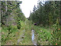
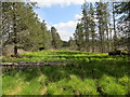
SandyG visited on 6th Sep 2016 - their rating: Cond: 2 Amb: 2 Access: 1 Car parking is available at NC 72361 39899. From here it is a very long walk to the stone row. Follow the path leading south from the parking area to NC 72471 37400. Then follow the forestry fence to NC 72559 36476. Climb the stile and then follow the forest ride. It may be best to keep to the left hand side. At NC 71904 35164 cross the forest track and follow a second ride to a forest clearing at NC 71715 34933. A standing stone close to this point is not part of the row. From here the row is about 130m to the west. Having visited the row it is a long way back and you need to allow plenty of time. Alternatively if you have access to a bicycle it may be possible to follow forest tracks from a car parking area at NC 69045 42692. Either way this is not an easy row to get to.
")
Update November 2019: This fan-shaped multiple stone row is featured on the Stone Rows of Great Britain website - see their entry for Loch Rimsdale, which includes a description, a plan of the row and its associated cairn, photographs of the rows, access information and a list of online resources for more information.
The row is also recorded as Canmore ID 6153 (Loch Rimsdale Stone Row) and as MHG10595 (Stone Rows, Loch Rimsdale) on the Highland HER.
The SRoGB asks visitors to note it is a very long walk to this stone row, so leave plenty of time. See their section on Access Information for more precise instructions on how to reach the row.
You may be viewing yesterday's version of this page. To see the most up to date information please register for a free account.
")
")
")
")
Do not use the above information on other web sites or publications without permission of the contributor.
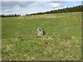
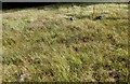
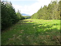
Nearby Images from Geograph Britain and Ireland:
©2014(licence)
©2018(licence)
©2014(licence)
©2014(licence)
©2014(licence)
The above images may not be of the site on this page, they are loaded from Geograph.
Please Submit an Image of this site or go out and take one for us!
Click here to see more info for this site
Nearby sites
Key: Red: member's photo, Blue: 3rd party photo, Yellow: other image, Green: no photo - please go there and take one, Grey: site destroyed
Download sites to:
KML (Google Earth)
GPX (GPS waypoints)
CSV (Garmin/Navman)
CSV (Excel)
To unlock full downloads you need to sign up as a Contributory Member. Otherwise downloads are limited to 50 sites.
![]()
Turn off the page maps and other distractions
Nearby sites listing. In the following links * = Image available
2.9km NE 54° Cnoc na h-Uide Hut Circle Ancient Village or Settlement (NC740365)
2.9km WNW 298° Cnoc na Gamhna Burnt Mound Artificial Mound (NC691363)
3.0km WNW 294° Cnoc na Gamhna Hut Circles 1 Ancient Village or Settlement (NC689362)
3.0km WNW 284° Cnoc na Gamhna Hut Circles 6 Ancient Village or Settlement (NC687357)
3.2km WNW 299° Cnoc na Gamhna Hut Circles 3 Ancient Village or Settlement (NC689365)
3.2km WNW 294° Cnoc na Gamhna Hut Circles 2 Ancient Village or Settlement (NC687363)
3.4km WNW 301° Cnoc na Gamhna Hut Circles 4 Ancient Village or Settlement (NC688367)
3.5km WNW 282° Cnoc na Gamhna Hut Circle Ancient Village or Settlement (NC682357)
3.5km NW 305° Cnoc na Gamhna Hut Circles 5 Ancient Village or Settlement (NC688370)
4.2km W 274° Coille Coire nam Feuran Cairn Cairn (NC674353)
4.2km W 274° Cnoc a Bhreac-achaidh Hut Circles Ancient Village or Settlement (NC674353)
4.8km WNW 287° Achadh an Eas Homestead Ancient Village or Settlement (NC671364)
4.9km WNW 283° Achadh an Eas Hut Circle 2 Ancient Village or Settlement (NC669361)
4.9km WNW 286° Achadh an Eas Hut Circle 1 Ancient Village or Settlement (NC669364)
5.1km W 275° Loch Coire nam Feuran Hut Circle Ancient Village or Settlement (NC665355)
5.2km W 273° Loch Coire nam Feuran Hut Circles Ancient Village or Settlement (NC664353)
5.4km W 279° Loch Coire nam Feuran Fields System Ancient Village or Settlement (NC663359)
5.4km W 274° Loch Coire nam Feuran Cairn Cairn (NC662354)
5.5km W 277° Loch Coire nam Feuran Hut Circles 2 Ancient Village or Settlement (NC662357)
5.5km NW 308° Creag Dhubh Hut Circles 2 Ancient Village or Settlement (NC674384)
5.5km W 271° Coille Coire nam Feuran Hut Circle Ancient Village or Settlement (NC661351)
5.5km WNW 298° Achadh an Eas Hut Circle 3 Ancient Village or Settlement (NC668376)
5.5km W 275° Loch Coire nam Feuran Hut Circle 2 Ancient Village or Settlement (NC661355)
5.6km NW 317° Clach an Righ* Stone Circle (NC67933903)
5.6km NW 316° Dalharrold Hut Circle* Ancient Village or Settlement (NC67883899)
View more nearby sites and additional images


 We would like to know more about this location. Please feel free to add a brief description and any relevant information in your own language.
 Wir möchten mehr über diese Stätte erfahren. Bitte zögern Sie nicht, eine kurze Beschreibung und relevante Informationen in Deutsch hinzuzufügen.
 Nous aimerions en savoir encore un peu sur les lieux. S'il vous plaît n'hesitez pas à ajouter une courte description et tous les renseignements pertinents dans votre propre langue.
 Quisieramos informarnos un poco más de las lugares. No dude en añadir una breve descripción y otros datos relevantes en su propio idioma.