

, Aubrey Burl")
<< Text Pages >> Galtway Hill - Cairn in Scotland in Dumfries and Galloway
Submitted by SolarMegalith on Friday, 15 June 2012 Page Views: 2608
Neolithic and Bronze AgeSite Name: Galtway HillCountry: Scotland
NOTE: This site is 0.3 km away from the location you searched for.
County: Dumfries and Galloway Type: Cairn
Map Ref: NX71294845
Latitude: 54.814327N Longitude: 4.004447W
Condition:
| 5 | Perfect |
| 4 | Almost Perfect |
| 3 | Reasonable but with some damage |
| 2 | Ruined but still recognisable as an ancient site |
| 1 | Pretty much destroyed, possibly visible as crop marks |
| 0 | No data. |
| -1 | Completely destroyed |
| 5 | Superb |
| 4 | Good |
| 3 | Ordinary |
| 2 | Not Good |
| 1 | Awful |
| 0 | No data. |
| 5 | Can be driven to, probably with disabled access |
| 4 | Short walk on a footpath |
| 3 | Requiring a bit more of a walk |
| 2 | A long walk |
| 1 | In the middle of nowhere, a nightmare to find |
| 0 | No data. |
| 5 | co-ordinates taken by GPS or official recorded co-ordinates |
| 4 | co-ordinates scaled from a detailed map |
| 3 | co-ordinates scaled from a bad map |
| 2 | co-ordinates of the nearest village |
| 1 | co-ordinates of the nearest town |
| 0 | no data |
Internal Links:
External Links:
Cairn in Dumfries and Galloway
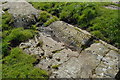
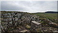
A 1.6 m high turf-covered cairn, 18.5 m in diameter.
Read More at ScotlandsPlaces.
You may be viewing yesterday's version of this page. To see the most up to date information please register for a free account.
Do not use the above information on other web sites or publications without permission of the contributor.
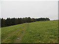
Nearby Images from Geograph Britain and Ireland:
©2016(licence)
©2008(licence)
©2018(licence)
©2008(licence)
©2022(licence)
The above images may not be of the site on this page, they are loaded from Geograph.
Please Submit an Image of this site or go out and take one for us!
Click here to see more info for this site
Nearby sites
Key: Red: member's photo, Blue: 3rd party photo, Yellow: other image, Green: no photo - please go there and take one, Grey: site destroyed
Download sites to:
KML (Google Earth)
GPX (GPS waypoints)
CSV (Garmin/Navman)
CSV (Excel)
To unlock full downloads you need to sign up as a Contributory Member. Otherwise downloads are limited to 50 sites.
Turn off the page maps and other distractions
Nearby sites listing. In the following links * = Image available
627m NW 321° High Banks Farm* Rock Art (NX70914895)
1.3km NW 313° High Banks Southern Cairn* Cairn (NX70394934)
1.3km NW 319° High Banks Northern Cairn* Cairn (NX70454947)
1.3km ENE 67° Castlecreavie Dun* Stone Fort or Dun (NX72544894)
1.3km NE 52° Castlecreavie Settlement* Ancient Village or Settlement (NX72374925)
1.4km ENE 67° Castlecreavie Rock Art* Rock Art (NX7255748944)
1.8km NNE 32° Bombie 1 Rock Art (NX72294994)
1.8km NE 40° Bombie 3* Rock Art (NX7250349821)
1.8km NE 39° Bombie 2* Rock Art (NX72504985)
1.9km NE 38° Bombie North* Rock Art (NX7249449901)
2.1km ENE 77° Newlaw Hill* Rock Art (NX73324887)
2.2km SW 228° Townhead* Rock Art (NX69644705)
2.6km WSW 248° Grange 3 (Dumfries and Galloway)* Rock Art (NX6883947526)
2.7km SW 225° Blackhill Cottage* Rock Art (NX69334663)
3.4km NW 310° Kirkcudbright Standing Stones* Standing Stones (NX6870450736)
3.5km WNW 297° Butter Well (Kirkcudbright) Holy Well or Sacred Spring (NX6821250148)
3.6km SW 223° Drummore Castle* Stone Circle (NX688459)
3.6km SW 223° Drummore* Stone Circle (NX688459)
3.6km SW 222° Drummore Hillfort* Hillfort (NX688458)
3.8km NW 308° Stewartry Museum* Museum (NX68335086)
3.8km NW 311° Soaperie Gardens Well (Kirkcudbright)* Holy Well or Sacred Spring (NX6843251039)
4.0km W 275° Monk's Well (Kirkcudbright) Holy Well or Sacred Spring (NX6730048892)
4.0km NW 306° Mercat Cross (Kirkcudbright)* Ancient Cross (NX6807650896)
4.1km N 352° Culdoach* Rock Art (NX70835250)
4.1km SW 230° Torrs 2* Rock Art (NX68054586)
View more nearby sites and additional images


 We would like to know more about this location. Please feel free to add a brief description and any relevant information in your own language.
 Wir möchten mehr über diese Stätte erfahren. Bitte zögern Sie nicht, eine kurze Beschreibung und relevante Informationen in Deutsch hinzuzufügen.
 Nous aimerions en savoir encore un peu sur les lieux. S'il vous plaît n'hesitez pas à ajouter une courte description et tous les renseignements pertinents dans votre propre langue.
 Quisieramos informarnos un poco más de las lugares. No dude en añadir una breve descripción y otros datos relevantes en su propio idioma.