<< Our Photo Pages >> Bow Henge - Henge in England in Devon
Submitted by AngieLake on Monday, 07 February 2022 Page Views: 25155
Neolithic and Bronze AgeSite Name: Bow HengeCountry: England County: Devon Type: Henge
Nearest Town: Crediton Nearest Village: Bow
Map Ref: SS70750160
Latitude: 50.799505N Longitude: 3.835449W
Condition:
| 5 | Perfect |
| 4 | Almost Perfect |
| 3 | Reasonable but with some damage |
| 2 | Ruined but still recognisable as an ancient site |
| 1 | Pretty much destroyed, possibly visible as crop marks |
| 0 | No data. |
| -1 | Completely destroyed |
| 5 | Superb |
| 4 | Good |
| 3 | Ordinary |
| 2 | Not Good |
| 1 | Awful |
| 0 | No data. |
| 5 | Can be driven to, probably with disabled access |
| 4 | Short walk on a footpath |
| 3 | Requiring a bit more of a walk |
| 2 | A long walk |
| 1 | In the middle of nowhere, a nightmare to find |
| 0 | No data. |
| 5 | co-ordinates taken by GPS or official recorded co-ordinates |
| 4 | co-ordinates scaled from a detailed map |
| 3 | co-ordinates scaled from a bad map |
| 2 | co-ordinates of the nearest village |
| 1 | co-ordinates of the nearest town |
| 0 | no data |
Internal Links:
External Links:
I have visited· I would like to visit
AngieLake has visited here

It first came to my notice while reading about the 'Nymets' around the Crediton/Bow area of mid-Devon in an article by Tracey Brown, editor of Wisht Maen, Devon Earth Mysteries magazine between 1993-97.
[Issue 4. "A Sacred Bus Journey"]. (See more of this in 'comments' under the Copplestone Cross site page on this website).
In 2007 I attended the Heritage Open Day at Totnes Castle and asked the Devon Archaeological Society representative there if one could visit the henge, but she said apparently not, as the farmer doesn't welcome visitors.
She gave me the Society's Spring magazine, and an article inside: "Dickie Dougan Remembered" (a fond obituary for the man who had flown her on so many valuable aerial reconnaissance flights) by Frances Griffith, also had a mention of her earlier discoveries, [quote]:
"The next year was 1984, one of the all-time great summers for aerial reconnaissance in Britain"........ "Literally hundreds of new sites of all sorts and periods were discovered in Devon that summer"...... "and a major ritual complex centred on a henge was found at Bow (Griffith 1985)."
NB: The site co-ordinates were given to me by Ken Taylor, who contacted me regarding my comments about Nymets on the Megalithic Portal. Because they are so precise I had no cause to disbelieve him, despite noticing that Vicky has also posted a Bow 'woodhenge' site.
My curiosity getting the better of me, I've trawled the internet for info:
1): Frances Griffith's own summary of a talk she gave at the AARG Annual Conference 2004 in Munich, 5-8 Sept 2004 'Aerial Archaeology - European Advances' - Abstracts:
'The impact of aerial reconnaissance on Neolithic studies in Devon'
"Until the 1980s, the map of Neolithic and Bronze Age ceremonial monuments in South West England coincided to a large extent to the map of the high ground - Dartmoor, Exmoor and Bodmin Moor. Since then, aerial reconnaissance in Devon has contributed to a very different picture, with a major focus of ceremonial activity - the henge at Bow with numerous surrounding monuments - in the biggest blank area on that map. Other possible henges have been identified.
A causewayed enclosure (Raddon) has been partially excavated and proved to have Neolithic and Late Bronze Age phases; a cursus monument has been found close to a previously known long enclosure, and two other major enclosures, not yet investigated on the ground, further amplify the picture. Numerous ring ditches have been discovered, and of the many simple enclosures found, some, such as that at Nymet Barton, have also produced Neolithic material on excavation. While reconnaissance in the west of Britain has many problems, this information, taken in conjunction with results from rescue excavations, has radically altered the perceived pattern of prehistoric activity, ceremonial and otherwise, over the last 25 years, and other branches of research - notably southwestern ceramic studies - have also benefited. The relationship of the 'new' material in the lowlands to the known archaeology of the moorlands is a subject of continuing study."
2): British Archaeology magazine's Issue 84 Sept/Oct 2005 ran this story:
"Some 20 years ago Frances Griffith, now county archaeologist, flew across Devon looking for new archaeological sites. North of Dartmoor, between Bow and North Tawton, she found significant prehistoric crop marks, including one of Devon's few henges and several ring ditches. All this, says Peter Green of the Den Brook Valley (Wind Turbine) Action Group is now under threat."........"A public inquiry starts in August: the initial application was turned down, partly because the company had failed to look for archaeological remains with a geophysical survey."
In Issue 92, Jan/Feb 2007 we read:
"Peter Green of Den Brook Valley (Wind Turbine) Action Group says planning consent has been refused.. with archaeological considerations. The developer appealed."
3): Tom Greeves writes [in Pulp! 1989, 43, pls]:
"The henge monument at Bow (Devon) found by air photography in 1984 lies in an area of 'Nymet' place-names deriving from 'nemeton', sacred grove. St. Boniface, well known for is attacks on pagan rites involving trees, was born a few miles from Bow...." "Moreover, this area of Devon has some of the best survivals of Green Man carvings in the churches: is there a link across the 130 generations that separate us from the henge-builders?"
[See, also, related comments under Meg P's 'Druids Temple' site page, with my reference to an extract from 'The Green Man Companion and Gazetteer' by Ronald Millar.]
**In that comment I've posted that: "I found a picture of an aerial view of a henge in cropmarks between Bow and North Tawton in 'Devon's Past: An Aerial View'. There's a 'Nichols Nymett Cross' along that straight East-West road.". Funnily enough, the Bow Henge co-ordinates show this cross to be not far at all [west] from the site of the henge. (I was unable to locate the earlier website with that picture.) Also, Broadnymett village or hamlet, with its old chapel is to the south west!**
4): Another website, for Bournemouth University, has the CV of Dr Eileen Weekes BSc, MA, PhD, MIFA, with the following comments:
"....I also serve on the Executive Committee of the Devon Archaeological Society and am currently involved in a series of surveys (geophysical and topographic) of enclosure sites in Devon, including the henge at Bow, which were identified by Devon County Council aerial reconnaissance....."
[I wasn't able to link this in with a date, so unsure when she was involved with Bow Henge.]
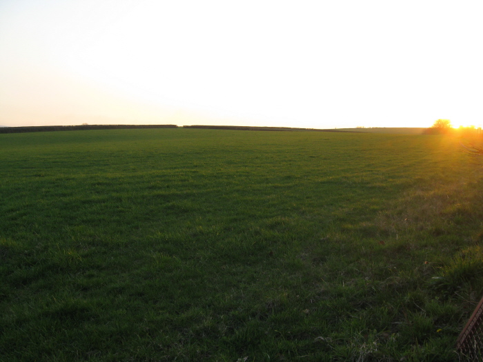
Note: Angie has added photos from the site of this henge in Devon
You may be viewing yesterday's version of this page. To see the most up to date information please register for a free account.


Do not use the above information on other web sites or publications without permission of the contributor.
Click here to see more info for this site
Nearby sites
Key: Red: member's photo, Blue: 3rd party photo, Yellow: other image, Green: no photo - please go there and take one, Grey: site destroyed
Download sites to:
KML (Google Earth)
GPX (GPS waypoints)
CSV (Garmin/Navman)
CSV (Excel)
To unlock full downloads you need to sign up as a Contributory Member. Otherwise downloads are limited to 50 sites.
Turn off the page maps and other distractions
Nearby sites listing. In the following links * = Image available
2.3km W 261° North Tawton B Cursus Cursus (SS685013)
2.5km ESE 112° Puddock's Well* Holy Well or Sacred Spring (SS731006)
3.0km N 358° Bow Timber Circle Timber Circle (SS707046)
5.8km W 270° North Tawton A Cursus Cursus (SS649017)
6.4km E 80° Copplestone Cross* Ancient Cross (SS7706802606)
6.8km SE 127° Lethen Castle Hillfort (SX761974)
8.2km SSW 204° Ringhole Copse Cross* Ancient Cross (SX6721794162)
8.3km SSW 209° Ring Hill Cross* Ancient Cross (SX66559440)
8.5km SSW 211° Oxenham Cross* Ancient Cross (SX6625194414)
8.9km SW 216° St Andrew's Cross (South Tawton)* Ancient Cross (SX65289453)
9.2km SSW 205° Addiscott Cross* Ancient Cross (SX6666993344)
9.3km SW 215° Moon's Cross* Ancient Cross (SX6525194125)
9.8km SW 214° South Zeal Cross* Ancient Cross (SX6505793594)
9.8km SSW 213° Oxenham Arms* Standing Stone (Menhir) (SX65119354)
10.1km SW 220° Sticklepath Methodist Chapel Cross* Ancient Cross (SX6404694079)
10.1km SW 221° Lady Well (Sticklepath)* Holy Well or Sacred Spring (SX6390494124)
10.1km SW 221° Sticklepath Boundary Marker* Marker Stone (SX6388694135)
10.2km SSW 212° Ramsley Stone Row / Alignment (SX651931)
10.2km SW 227° Belstone Boundary Marker* Marker Stone (SX6314994770)
10.3km SW 214° South Zeal Stone Row* Stone Row / Alignment (SX648932)
10.3km SSW 208° West Wykes Farm Tau and Latin Crosses* Ancient Cross (SX6567992638)
10.3km SSW 208° West Wyke Farm Cross* Ancient Cross (SX6564692638)
10.8km ESE 122° Higher Bury Camp Hillfort (SX79789572)
10.8km S 182° Spinsters' Rock* Burial Chamber or Dolmen (SX70109079)
10.8km S 183° Shilstone Common (DRE 1a) Cairn Circle Cairn (SX6990090800)
View more nearby sites and additional images


 We would like to know more about this location. Please feel free to add a brief description and any relevant information in your own language.
 Wir möchten mehr über diese Stätte erfahren. Bitte zögern Sie nicht, eine kurze Beschreibung und relevante Informationen in Deutsch hinzuzufügen.
 Nous aimerions en savoir encore un peu sur les lieux. S'il vous plaît n'hesitez pas à ajouter une courte description et tous les renseignements pertinents dans votre propre langue.
 Quisieramos informarnos un poco más de las lugares. No dude en añadir una breve descripción y otros datos relevantes en su propio idioma.