

<< Our Photo Pages >> Gripper's Hill Cairn Circle - Ring Cairn in England in Devon
Submitted by Anne T on Tuesday, 25 October 2016 Page Views: 1513
Neolithic and Bronze AgeSite Name: Gripper's Hill Cairn CircleCountry: England County: Devon Type: Ring Cairn
Nearest Town: Princetown Nearest Village: Shipley Bridge
Map Ref: SX68656550
Latitude: 50.474563N Longitude: 3.852428W
Condition:
| 5 | Perfect |
| 4 | Almost Perfect |
| 3 | Reasonable but with some damage |
| 2 | Ruined but still recognisable as an ancient site |
| 1 | Pretty much destroyed, possibly visible as crop marks |
| 0 | No data. |
| -1 | Completely destroyed |
| 5 | Superb |
| 4 | Good |
| 3 | Ordinary |
| 2 | Not Good |
| 1 | Awful |
| 0 | No data. |
| 5 | Can be driven to, probably with disabled access |
| 4 | Short walk on a footpath |
| 3 | Requiring a bit more of a walk |
| 2 | A long walk |
| 1 | In the middle of nowhere, a nightmare to find |
| 0 | No data. |
| 5 | co-ordinates taken by GPS or official recorded co-ordinates |
| 4 | co-ordinates scaled from a detailed map |
| 3 | co-ordinates scaled from a bad map |
| 2 | co-ordinates of the nearest village |
| 1 | co-ordinates of the nearest town |
| 0 | no data |
Be the first person to rate this site - see the 'Contribute!' box in the right hand menu.
Internal Links:
External Links:
")
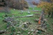
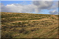
Information about the Gripper's Hill Stone Ring Cairn Circle comes from the Prehistoric Dartmoor Walks (PDW) website. Their notes say this is a "ring cairn on Gripper's Hill; stone ring 14.0 metres in diameter internally, with bank 1.2 metres wide and 0.3 metres high."
The PDW web page gives links to further information on Pastscape, Monument Number 441390, which adds that there are the remains of two cairns in the near vicinity .... both of which sit on the broad summit of Gripper's Hill at 335m above OD (sea level)."
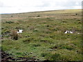
"Cairn A: A SX 68656551. A round cairn, 10.4 m diameter and 0.6 m high, is constructed of small boulders and has a flat top, the centre of which has been disturbed."
"Cairn B SX 68596551 (about 60 metres to the west of cairn A): This cairn, 16.8 m overall diameter and 0.4 m high, is constructed of small boulders and consists of a central platform 13.6 m diameter and 0.2 m high with a perimeter rim, average width 1.9 m, height 0.4 m. The rim has an east facing gap, 1.5 m wide. There is a slight central rise, about 0.1 m above the surrounding platform."
The Heritage Gateway for Devon & Dartmoor HER number MDV5225 describes cairn A as "one of a pair of cairns on Gripper's Hill. This site is on the local list of Nationally Important Dartmoor Sites." They date the ring cairns from the Early Neolithic to the Late Bronze Age (4000BC to 701BC), although they give slightly different dimensions for the cairns.
You may be viewing yesterday's version of this page. To see the most up to date information please register for a free account.
Do not use the above information on other web sites or publications without permission of the contributor.
Nearby Images from Geograph Britain and Ireland:
©2008(licence)
©2006(licence)
©2014(licence)
©2008(licence)
©2013(licence)
The above images may not be of the site on this page, they are loaded from Geograph.
Please Submit an Image of this site or go out and take one for us!
Click here to see more info for this site
Nearby sites
Key: Red: member's photo, Blue: 3rd party photo, Yellow: other image, Green: no photo - please go there and take one, Grey: site destroyed
Download sites to:
KML (Google Earth)
GPX (GPS waypoints)
CSV (Garmin/Navman)
CSV (Excel)
To unlock full downloads you need to sign up as a Contributory Member. Otherwise downloads are limited to 50 sites.
Turn off the page maps and other distractions
Nearby sites listing. In the following links * = Image available
659m SE 134° Harbourne Head A* Ring Cairn (SX6911765034)
700m SE 134° Harbourne Head B* Ring Cairn (SX6914265001)
851m SW 214° Gripper's Hill Enclosed Settlement* Ancient Village or Settlement (SX68156481)
862m WNW 282° Brockhill Ford* Cairn (SX6780965702)
889m W 265° Dean Moor Enclosed Settlement* Ancient Village or Settlement (SX67766545)
968m W 280° Brockhill Settlement* Ancient Village or Settlement (SX677657)
1.1km ESE 110° Harbourne Head Standing Stone* Standing Stone (Menhir) (SX69686509)
1.4km SSW 211° Riders Rings* Ancient Village or Settlement (SX6788964294)
1.6km SSW 202° Brent Moor House Cist (SX68026404)
1.7km ESE 105° Skerraton Down Round Cairn (SX703650)
2.1km W 259° Eastern White Barrow Cairn* Cairn (SX6653865157)
2.2km NNW 329° Inner Pupers Ring Cairn (SX67556741)
2.2km SSW 203° Black Tor SW* Multiple Stone Rows / Avenue (SX6773063494)
2.2km SSW 198° Black Tor (Avon)* Ancient Village or Settlement (SX67916338)
2.3km NW 322° Puper's Rock Ring Cairn (SX67276737)
2.4km NW 321° Outer Pupers Ring Cairn (SX672674)
2.6km WNW 299° Huntingdon Warren Plane Crash Memorial Cross Natural Stone / Erratic / Other Natural Feature (SX6642266804)
2.8km WNW 285° Huntingdon Warren Settlement* Ancient Village or Settlement (SX660663)
2.8km SE 141° Tynacombe Ring Cairn (SX70376328)
2.8km WNW 299° Huntingdon Barrow* Long Barrow (SX6621266907)
3.0km W 279° Buckland Ford* Stone Circle (SX65746604)
3.0km WSW 243° Knatta Barrow Ring Cairn (SX6595464218)
3.0km WNW 282° Huntingdon Warren Clapper Bridge* Ancient Trackway (SX65706619)
3.2km NW 326° Snowdon Cairns (Dartmoor)* Barrow Cemetery (SX669682)
3.3km W 268° Western White Barrow* Cairn (SX6535465480)
View more nearby sites and additional images


 We would like to know more about this location. Please feel free to add a brief description and any relevant information in your own language.
 Wir möchten mehr über diese Stätte erfahren. Bitte zögern Sie nicht, eine kurze Beschreibung und relevante Informationen in Deutsch hinzuzufügen.
 Nous aimerions en savoir encore un peu sur les lieux. S'il vous plaît n'hesitez pas à ajouter une courte description et tous les renseignements pertinents dans votre propre langue.
 Quisieramos informarnos un poco más de las lugares. No dude en añadir una breve descripción y otros datos relevantes en su propio idioma.